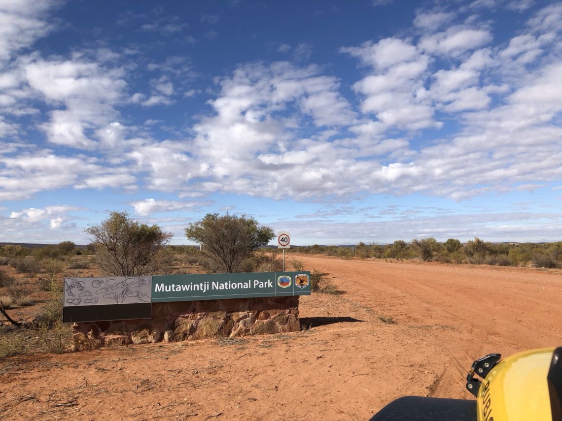
Mutawintji National Park
After two nights in Wilcannia, we were ready to keep pushing on. While it’s not super necessary to make campground bookings in the winter in outback Australia, school holidays are approaching, and so we had booked a few days each at three popular campgrounds in the Flinders Ranges in South Australia and needed to keep to some semblance of a schedule.

I use an app called WikiCamps to find campsites (thanks Holly for the recommendation!). It cost $7, and it’s a fantastic resource. It’s popular in Australia and contains user-submitted ratings, comments, prices, photos, and lists of amenities for every campground in Australia (amenities can be from as obvious as toilets and showers, to the less obvious like cell phone reception and quality of birdwatching). While I was planning our route over to the Flinders, I noticed a campground in remote NSW on WikiCamps that was rated very highly and thought we could probably detour there to check it out.

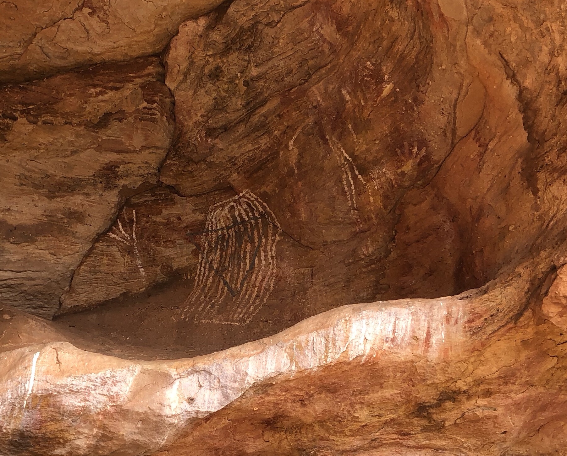
Enter Mutawintji National Park. This park in the Byngnano Range contains an important ancient gathering place for the local aboriginal people, along with many rock engravings, stencils, paintings, and remains of their day-to-day life. The best examples of these are protected within an area of the park called the Mutawintji Historic Site, which can only be accessed with an authorised guide or ranger, for a fee. The guided tour requires pre-booking, and unfortunately we weren’t able to get our act together to pre-book, and were sorry to miss seeing such an amazing place (guess we’ll have to go back!).

There are also a number of self-guided, marked bush walks (“hiking trails” for our North American friends) which pass by a few good examples of rock engravings, along with some mid-1800’s graffiti from one William Wright, leader of the support group for the doomed Burke & Wills expedition of 1860.

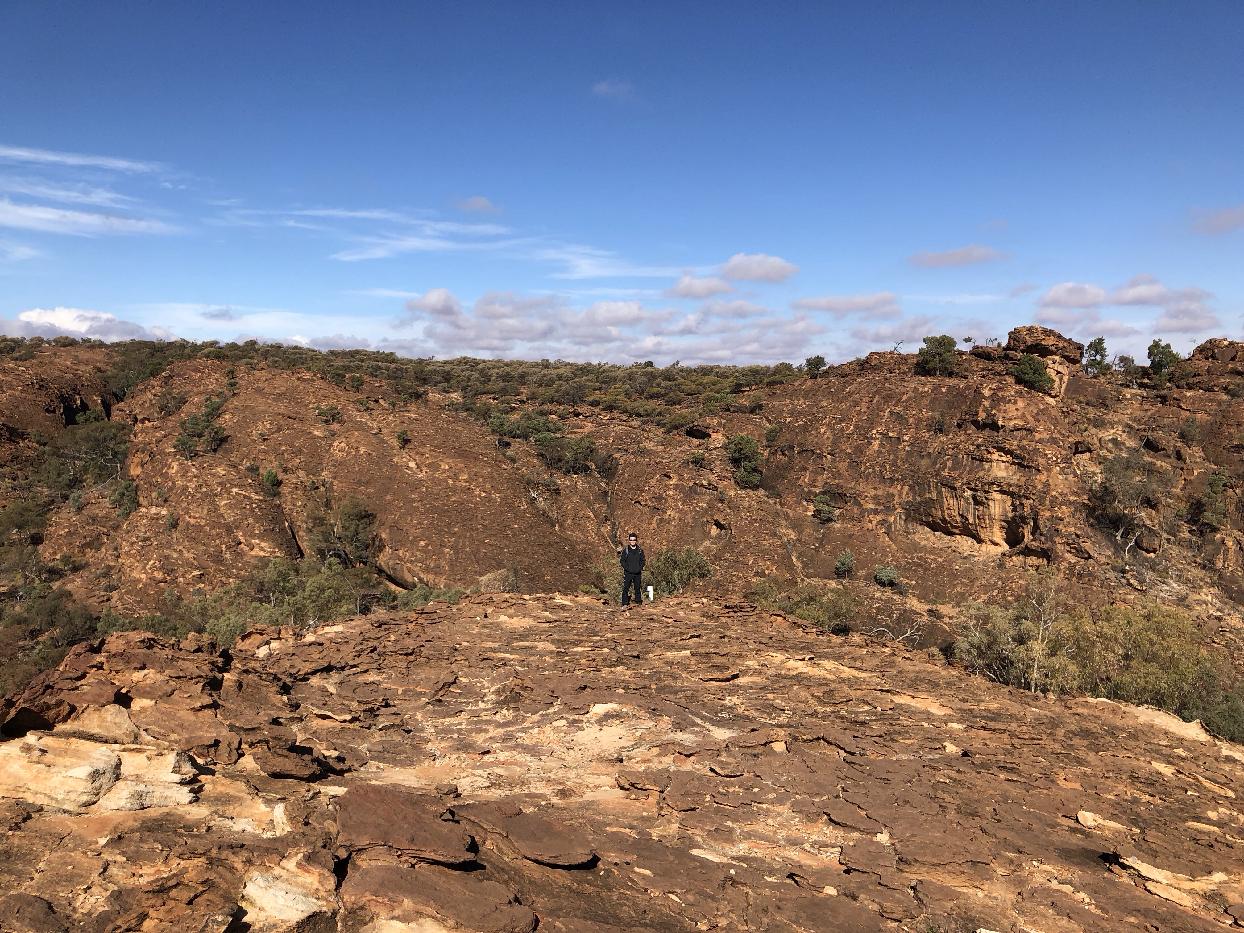
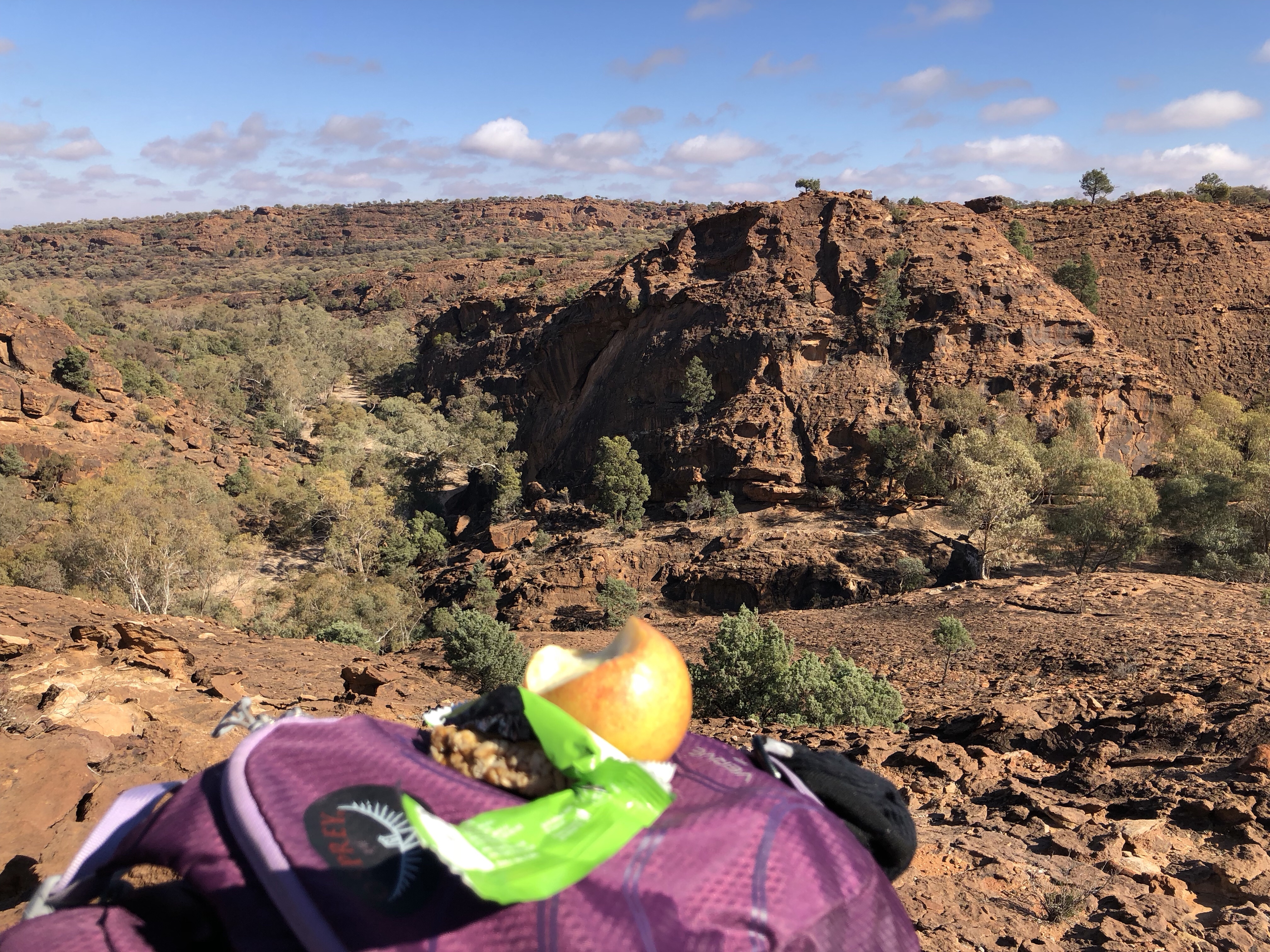
Mid-way along the route is an amazing lookout over the park, and a perfect spot to stop for lunch and take in the spectacular views.
The end of the hike is marked by a large rock pool. Part of the reason that Mutawintji was so important as a gathering place was the abundance of the rock pools in this area, which were a critical source of water in dry times. Oddly, this particular rock pool was absolutely full of dead goats. We have no idea why they all seemingly fell into or drowned in this rock pool, but goats are an invasive species here and negatively impact the local flora, so there won’t be any local tears shed over the unfortunate goat soup.

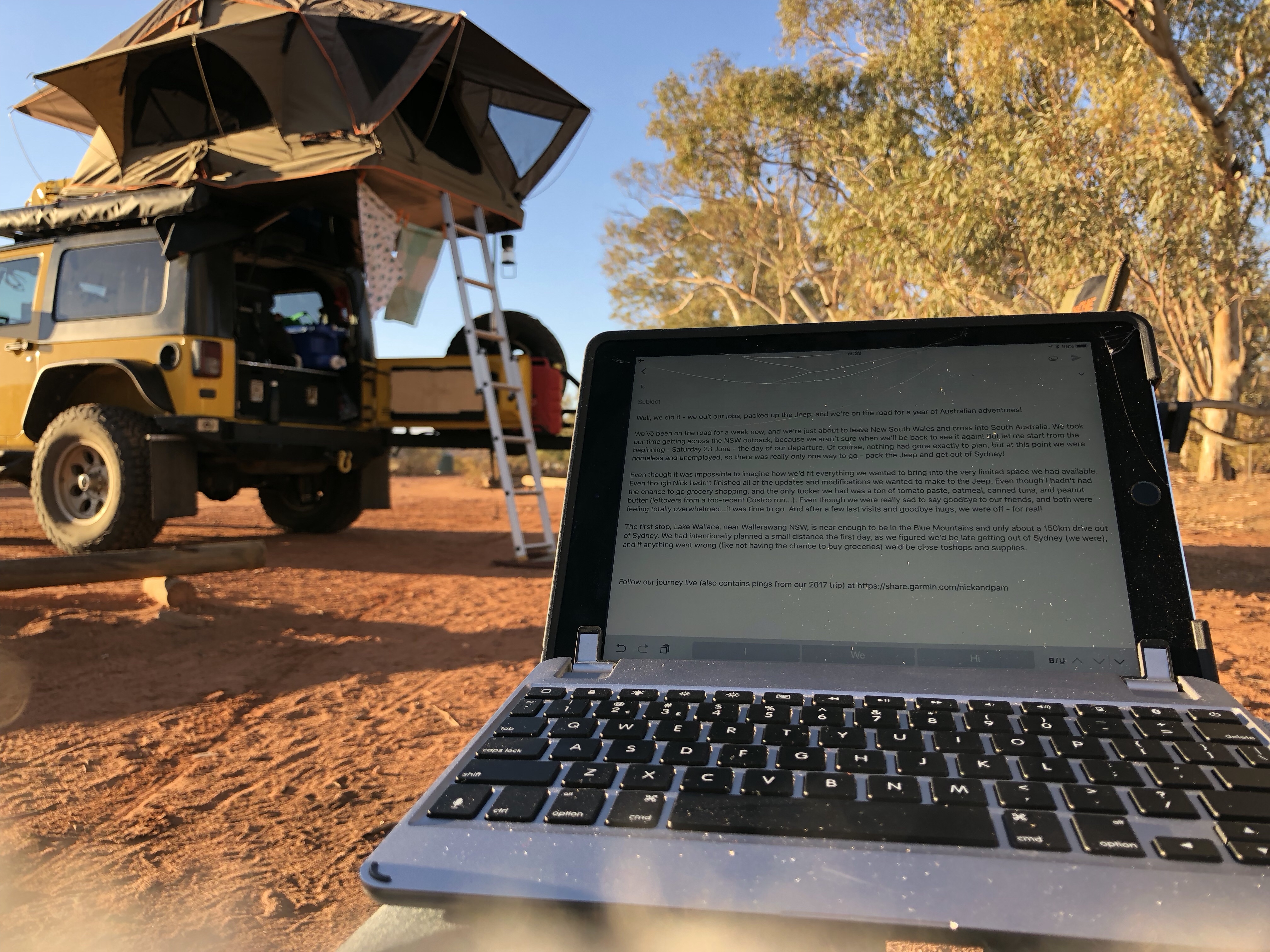
The campground at Mutawintji was pretty decent – flat sites, a few shared fire rings and picnic tables, and definitely not crowded on the cold winter day that we stayed. And, it was the perfect, peaceful environment to write a blog post!
MVP Awards:
- To Carry Enough Firewood for those Cold, Cold Nights: the Trasharoo (although minus one point for covering our license plate by default and requiring us to figure out a hack to hang the plate manually).
- For Finding Great Campsites: WikiCamps app, obvs!
Casualties So Far: two iPad screens 🙁 and the bag to hold our tent window poles.
So, Where Exactly Is This?
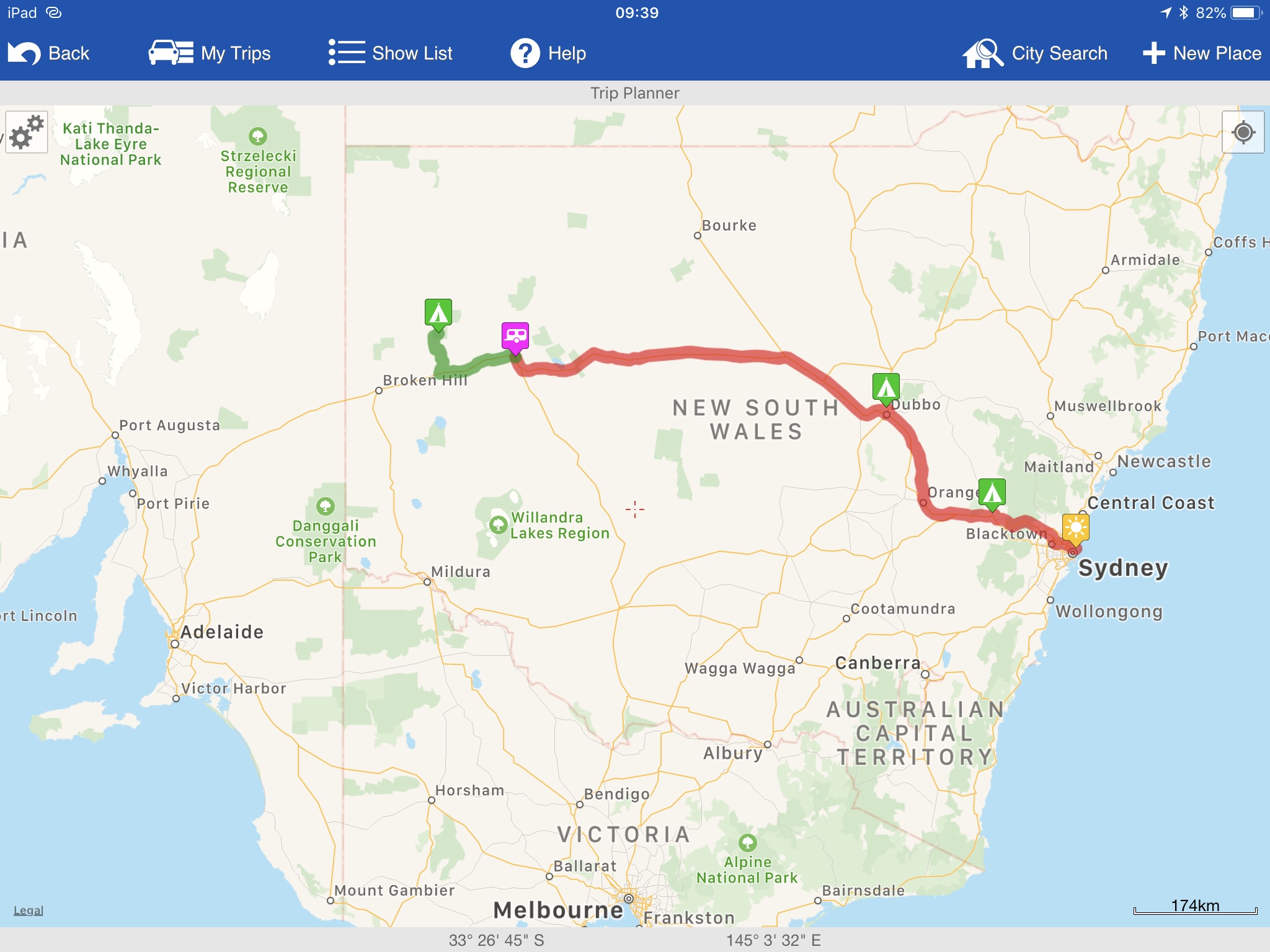
Here’s a screenshot of this leg of the journey from WikiCamps! The red is what we’ve already covered, the green is featured in the post you just read. You can also follow us live at this link – our satellite device pings this shared map about every ten minutes.