Crossing The Simpson Desert
Time now for our convoy to take on the mighty Simpson Desert, containing the world’s longest parallel sand dunes, and to tackle the mighty Big Red as the culminating “boss fight” of the desert, a massive 40 metre high sand dune at the eastern edge.
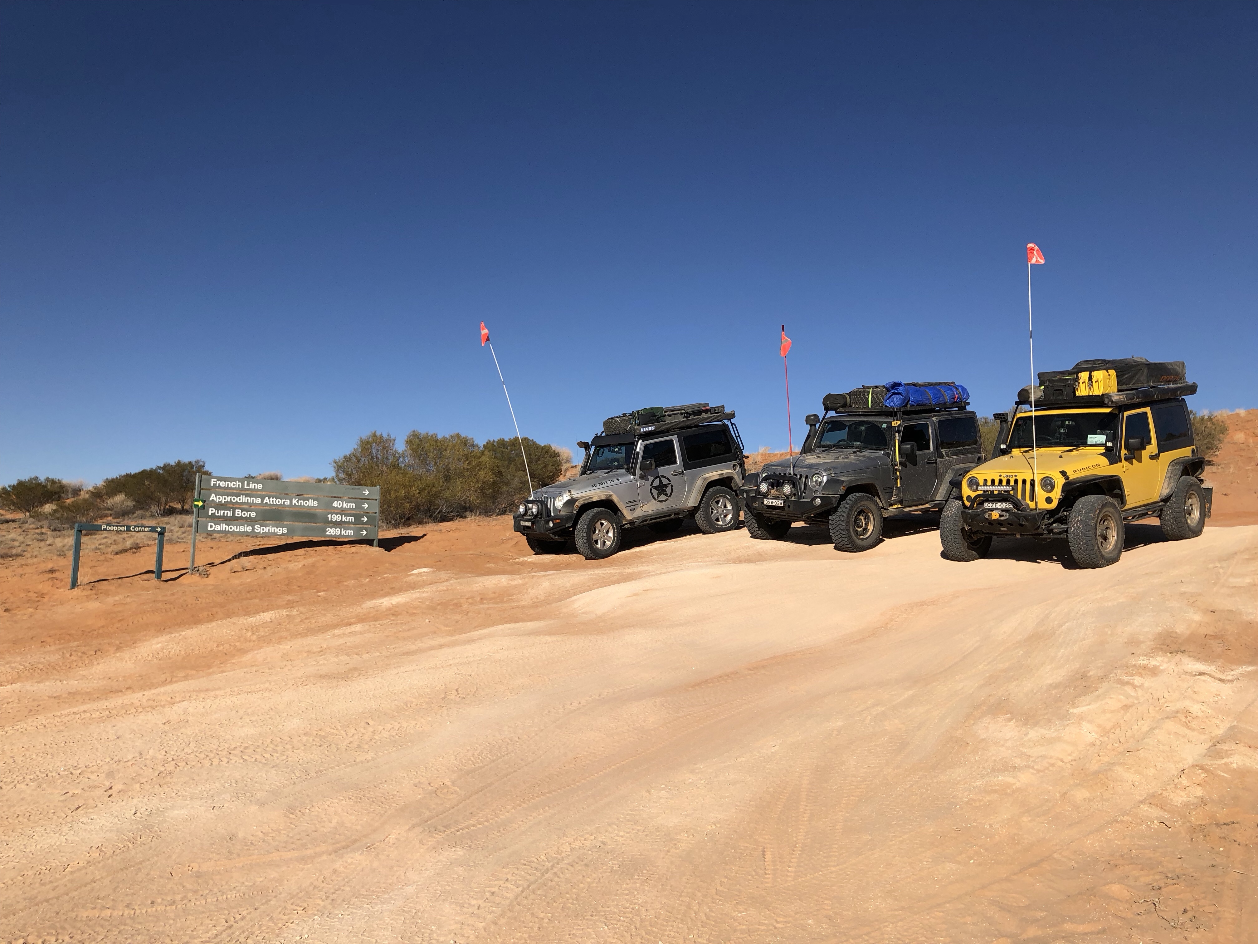
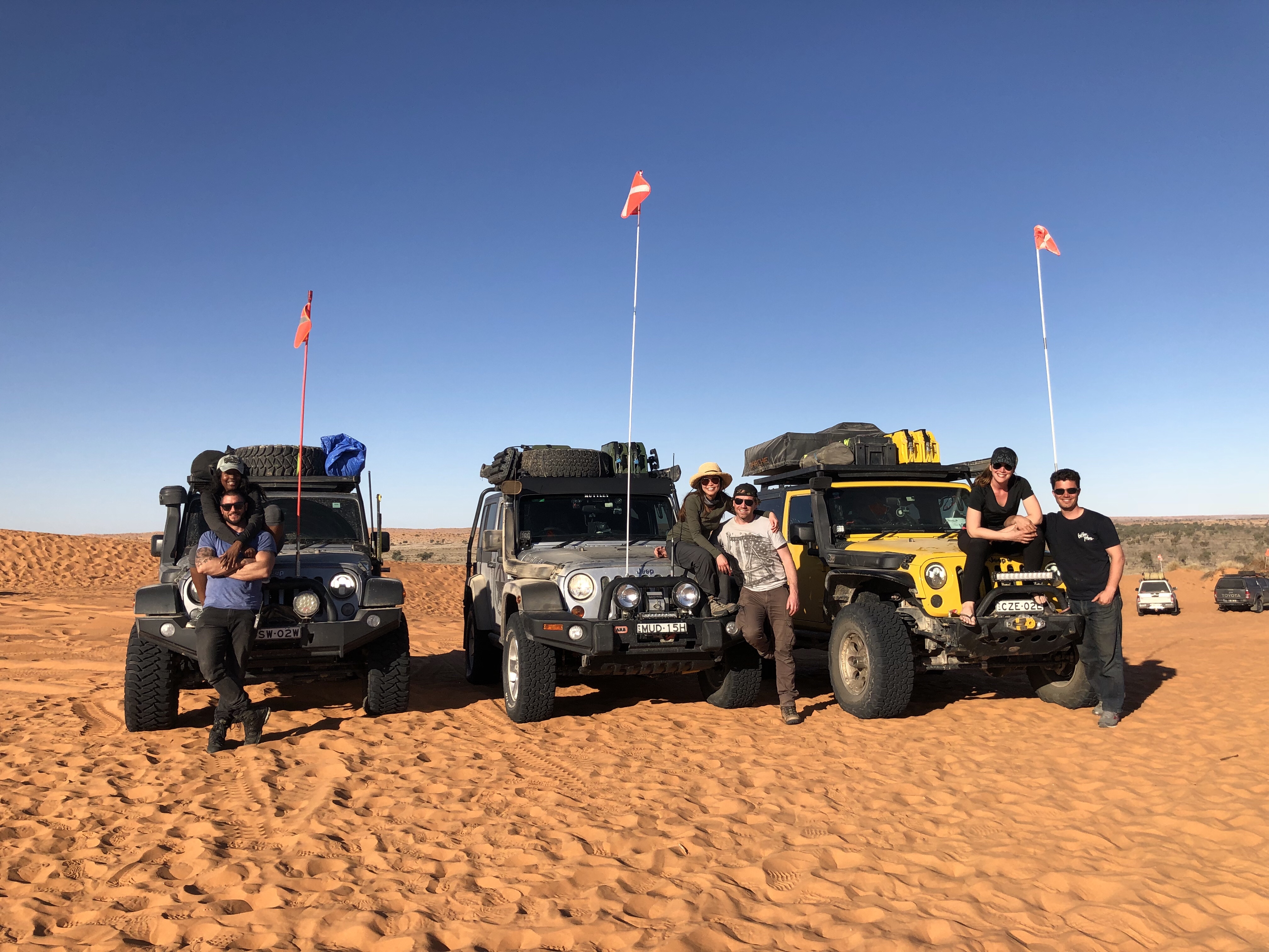
Crossing the Simpson is a very serious undertaking. You must have experience with four wheel driving, or hire a guide who has. You should travel with others for safety’s sake, and ideally never split up into groups of less than 3 vehicles. There is no fuel, food, or water for hundreds of kilometres so you must also bring your own supplies, enough for your planned trip plus a safety buffer (driving over sand dunes uses a LOT of fuel), PLUS emergency reserves (for a breakdown or worse). There is no mobile phone service so you need to have a satellite phone (or satellite communicator – phone is preferable for reasons I’ll get into later). You must have a UHF radio to communicate with your own party and with other nearby vehicles in the desert. In addition you should have mechanical knowledge and basic spares and tools to address common problems – tow trucks equipped to recover vehicles in the desert are few, far between, and callouts are costly. Oh, and of course, you need a sand flag taller than 2m above your vehicle’s roof – as it’s not exactly four lane highways out here, and oncoming vehicles need to be able to see you coming over the dunes.
All that being said – if you’re prepared, and lucky enough not to run into any issues – wow, what an experience.
The red sand, the vistas that come into view over each sand dune, the sunrises, sunsets, and clear starry skies at night…there’s just nothing else like it.
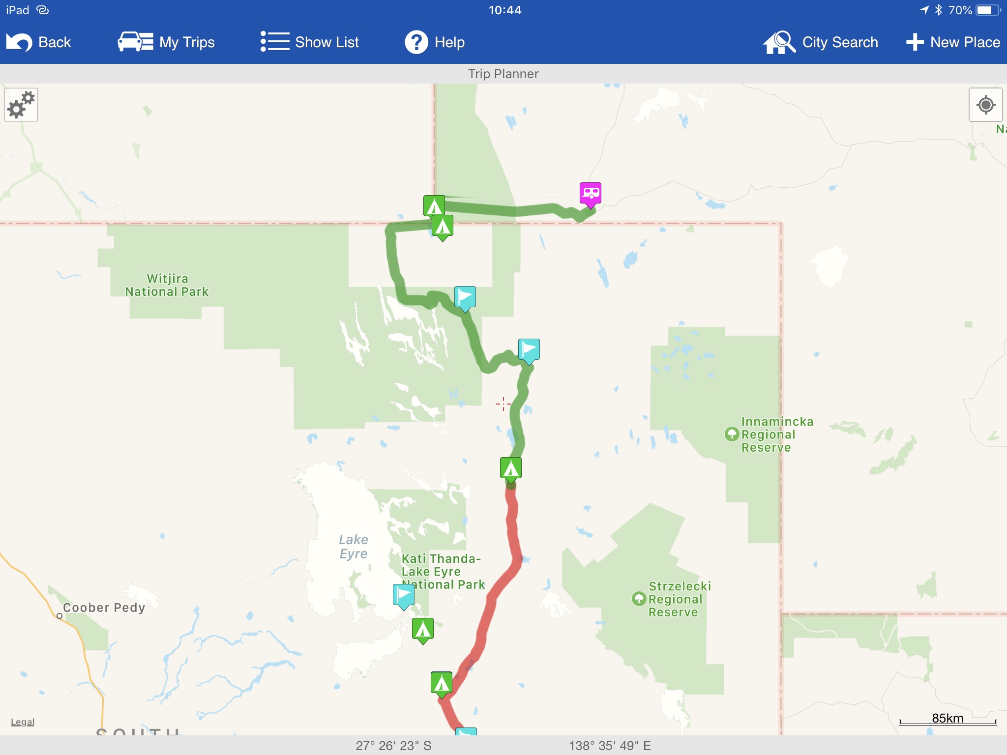
We set out early from Mungerannie for the K1 line north to Poeppel Corner (Where SA meets both QLD and the NT), planned to camp near Poeppel for the night, and then continue east on the QAA Line to Birdsville the following day. There are no maintained roads across the Simpson (or Simmo as it’s affectionately called in some circles), these “lines” are from companies who searched in the area for gas and oil (and found none).
If you’re wondering, as we were, where the “QAA” line name comes from – the name comes from the first few letters of a geological mapping system. There’s much more history here at this ExplorOZ forum thread, if you’re curious. Not sure about the K1 line though – we haven’t been able to find any history behind the name.
Unfortunately, about 60km south of Poeppel Corner, our trip leader had the bad luck to hit a pile of sand at speed, and after a few diagnostic attempts, figured out that the impact had warped a component of his front suspension. It became obvious that our bush mechanic fixes wouldn’t be enough to get him going again, and he’d have to camp where he was and wait for a remote recovery.
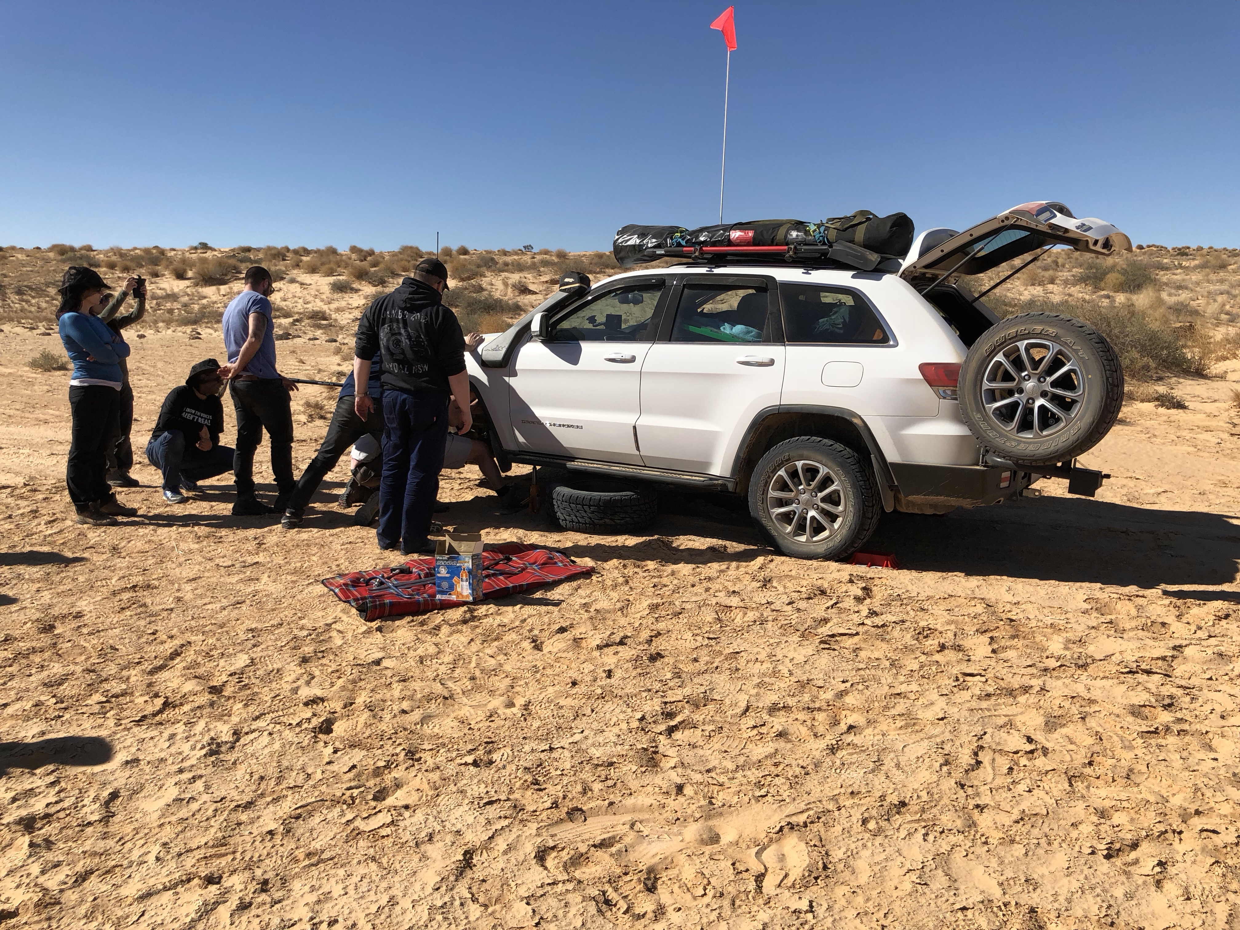
All of the precautionary measures I highlighted above are intended exactly for a situation like this one. Our trip leader was the most knowledgeable of all of us, and had spent a ton of time researching and documenting the gear and supplies he expected everyone to have, and it was simply bad luck that put him into this situation – could have happened to anyone in a moment’s notice.
This is also why a satellite phone is more appropriate than a satellite communicator in these cases – with a satellite communicator, you can text, email, and in a survival situation, hit a big “SOS” button and emergency forces will come to your GPS location. However precisely none of this functionality helps you when all you need is a tow truck, and those tow trucks are only available from the remotest of remote outback outposts – who are most likely not monitoring their email or SMS messages on a terribly frequent basis.
Luckily two vehicles in our convoy had hired sat phones and were able to assist our fearless trip leader in phoning for help.
The decision was also made at this point to split the convoy, with four vehicles staying behind, and the rest continuing on to Poeppel Corner, or as far as we could get before sunset.

While we felt guilty to continue the crossing without the person who had gotten us all safely there, the fact was there was nothing more for anyone to do except wait with him, so once the chosen folks to stay were sorted, off we went.
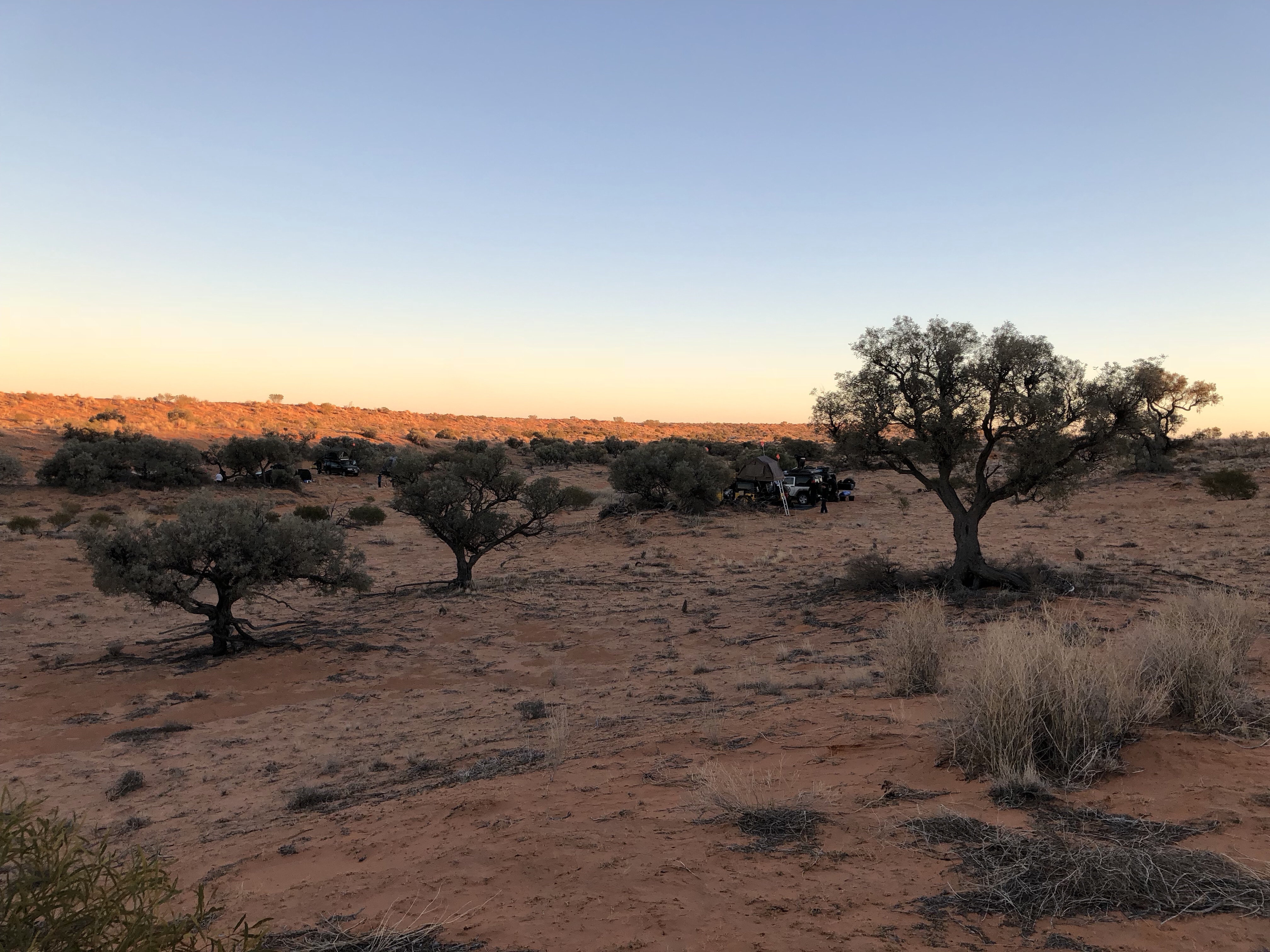
The next morning was a cold one – surely one of the coldest yet – as the sun rose over the dunes and turned everything a beautiful shade of copper. We hadn’t quite made it to Poeppel Corner the night before, and so it was off to check it out this morning and then continue east to Birdsville (and don’t forget about the sand dune boss fight at the end of it all – BIG RED!)

Poeppel Corner is quite a cool place: it’s the “corner” between three Australian states. Of course anything like this requires adults to immediately become incredibly silly and hop from state to state shouting at eachother about which state they’re in now.
It was awesome fun with our crazy crew.
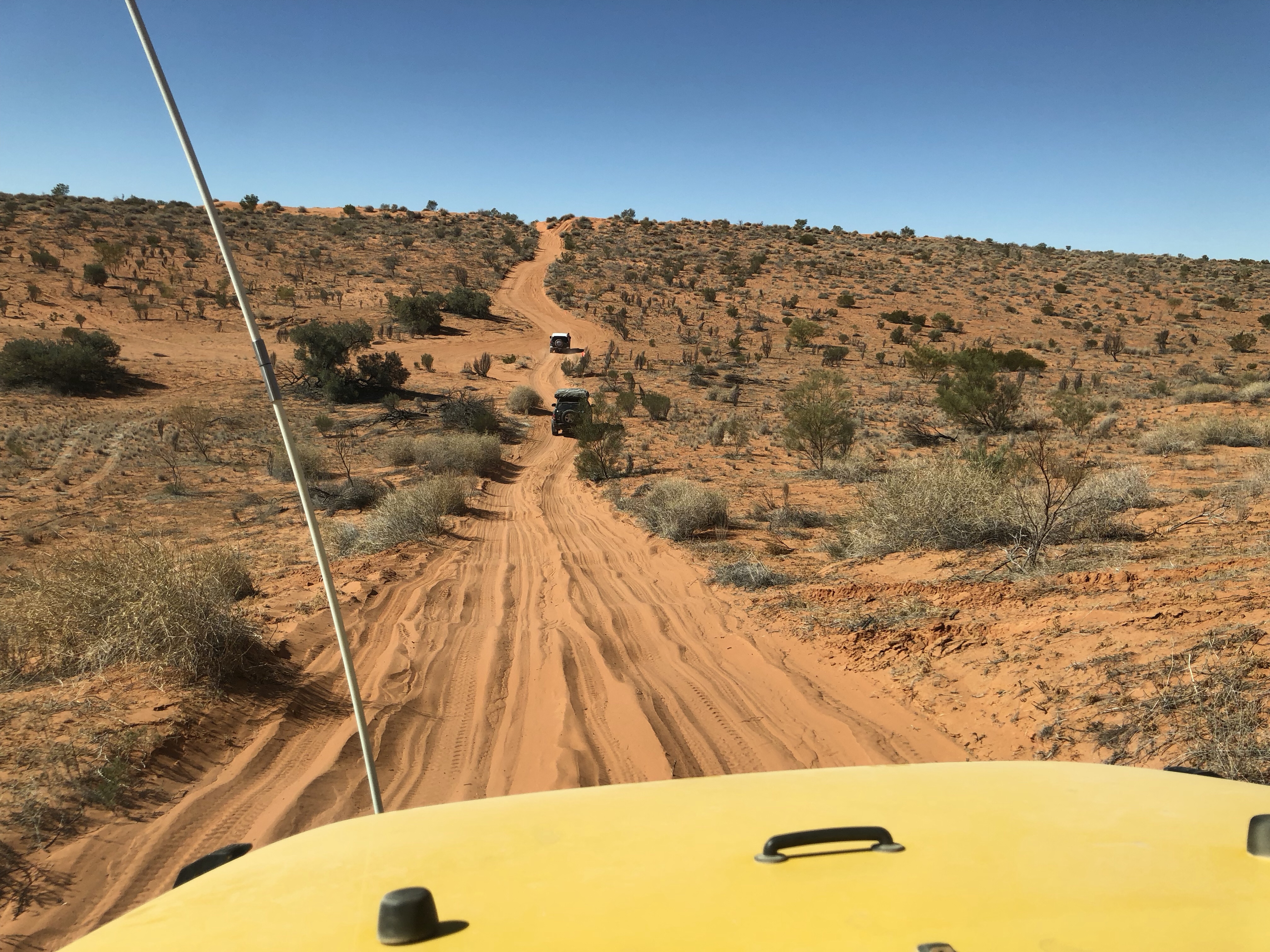
From Poeppel Corner we crossed a large salt flat – stopping for a pic of course – and then the endless dunes heading east.
One safety feature that the Queensland government has recently installed in the Simmo are these “call sign” markers every 5km from Poeppel Corner to Birdsville. All vehicles in the Simpson Desert are required to use channel 10 on UHF radio to communicate with other nearby vehicles. Previously up to just this month, it was up to each individual convoy or driver how they would call out their presence to other vehicles. Additionally, when there was an emergency situation in the desert, the Birdsville police were finding it challenging to isolate the area where the emergency was taking place – especially if whoever called it in was distraught.

The markers were super helpful, most travellers were using them, and they should be very helpful to the police and emergency services locating people in distress. This was apparently a local idea and initiative from Birdsville Police – so well done guys and gals.
We travelled the rest of the dunes mostly without incident (check our Instagram for a few video samples!), and arrived at Big Red with lots of time to have a few go’s…and a brief pause at the bottom to stare in awe at the size of it.
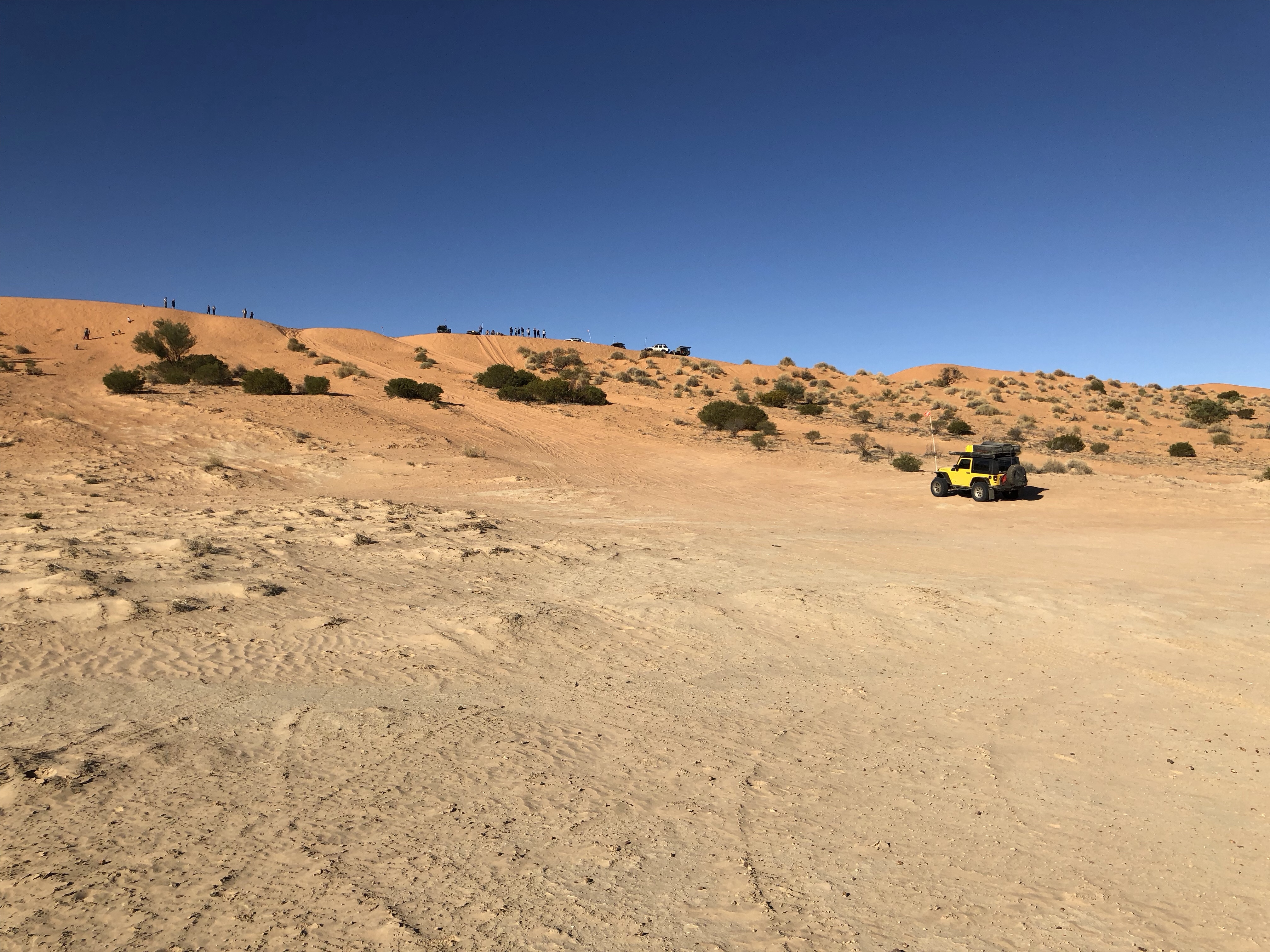
Thankfully, this 4wd boss battle was nothing like had been set up in our minds. This dune is meant to be an Australian legend for chewing up 4wd vehicles and spitting them out, but it turns out the secret to walking it up Big Red is to lower tyre pressures (especially if the day has warmed since you last checked – we thought ours were at 18, but they were up at 25 by the time we reached Big Red) and 4-high (not 4-low) in 2nd gear. (With an automatic transmission, you can ignore gear selections). We had mixed success on first runs in the Jeep Club convoy, but everyone made it up eventually – and a few even turned around and went back up again!
And with that, it was off to Birdsville for a well-deserved beer and an early sleep after a really big day completing our crossing of the Simpson desert!
MVP Award: the unrecognised but constant MVPs of good, polarised, prescription sunglasses. Priceless against the glare of the sun and the brightness in the desert! We take them for granted every day but they’re the true MVP, let’s face it.
So, Where Exactly Is This?
Here’s a screenshot of this leg of the journey from WikiCamps! The red is what we’ve already covered, and the green is what was featured in the post you just read. You can also follow us live at this link – our satellite device pings our shared map frequently.