Cape York Part Three (The Old Telegraph Track)
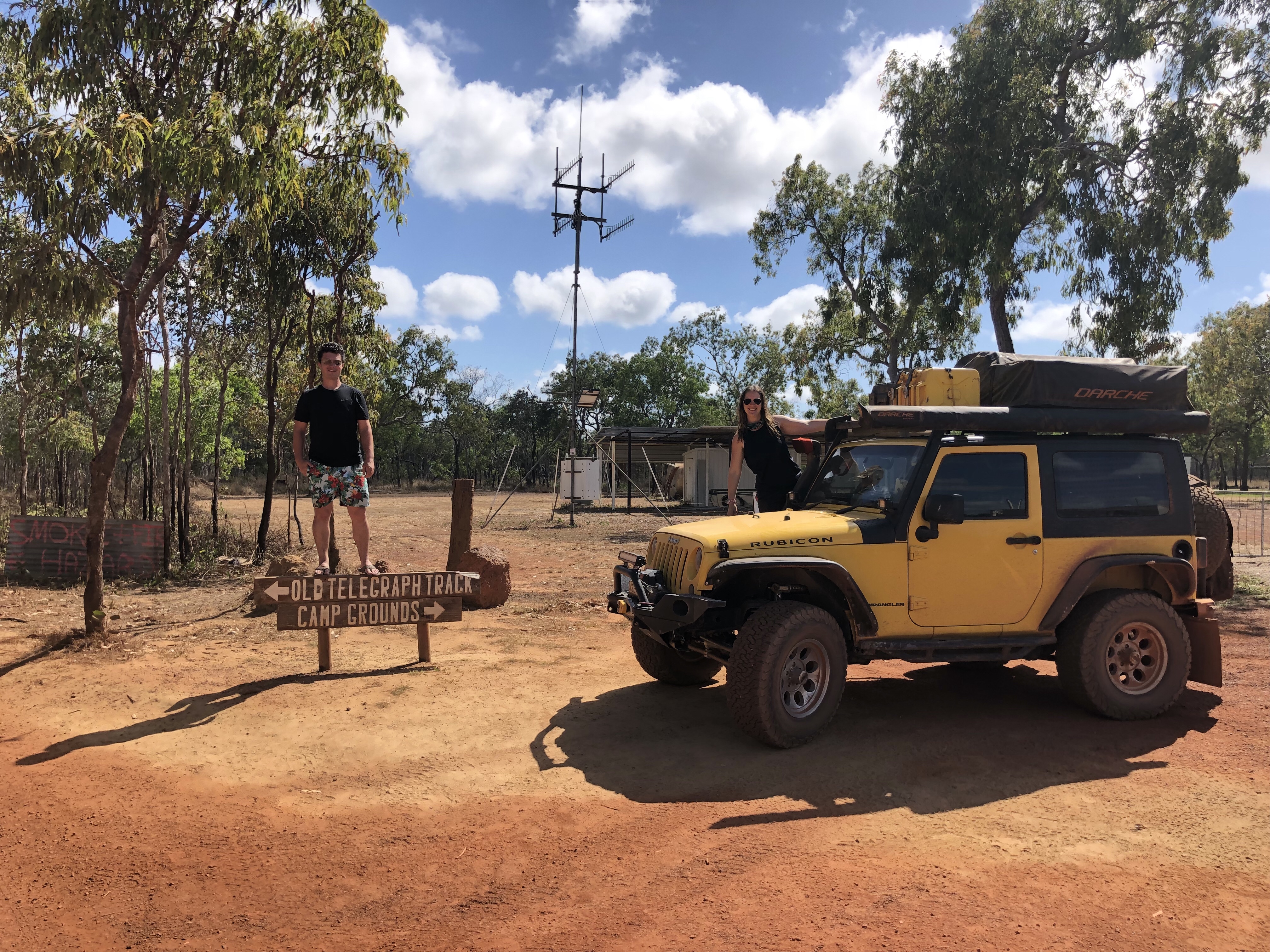
Ready or not (don’t worry to our moms, we were very ready) today was the day for us to tackle one of the most legendary Australian four wheel drive tracks, the Old Telegraph Track, starting from Bramwell Junction and travelling 200km north over corrugated and washed out sections of dirt road and through too many creek crossings to count (yes, some croc-infested and unwalkable!), to the very northernmost tip of Australia.
Here are the always-excellent Hema Maps overviews of the track: OTT South and OTT North.
I love what they say about the beginning of the track: “marked by a small wooden sign and the smell of anticipation in the air”. You got that right!
Most drivers travel the track South to North and we were no different. In fact it’s recommended to not travel the track in the ‘reverse’ direction, and even considered a bit rude to, as the majority of traffic is heading towards you and there are limited places to pull off and pass each other.
Our small convoy of two was well prepared with supplies for humans (food and water) and supplies for the vehicles (fuel, fluids, and spare parts). We planned to take three days (two nights camping) making our way north to the end of the track at the long and deep Nolans Creek crossing and then over to the Jardine River Ferry to take us up into the Northern Peninsula Area (NPA), or otherwise known as The Tip.
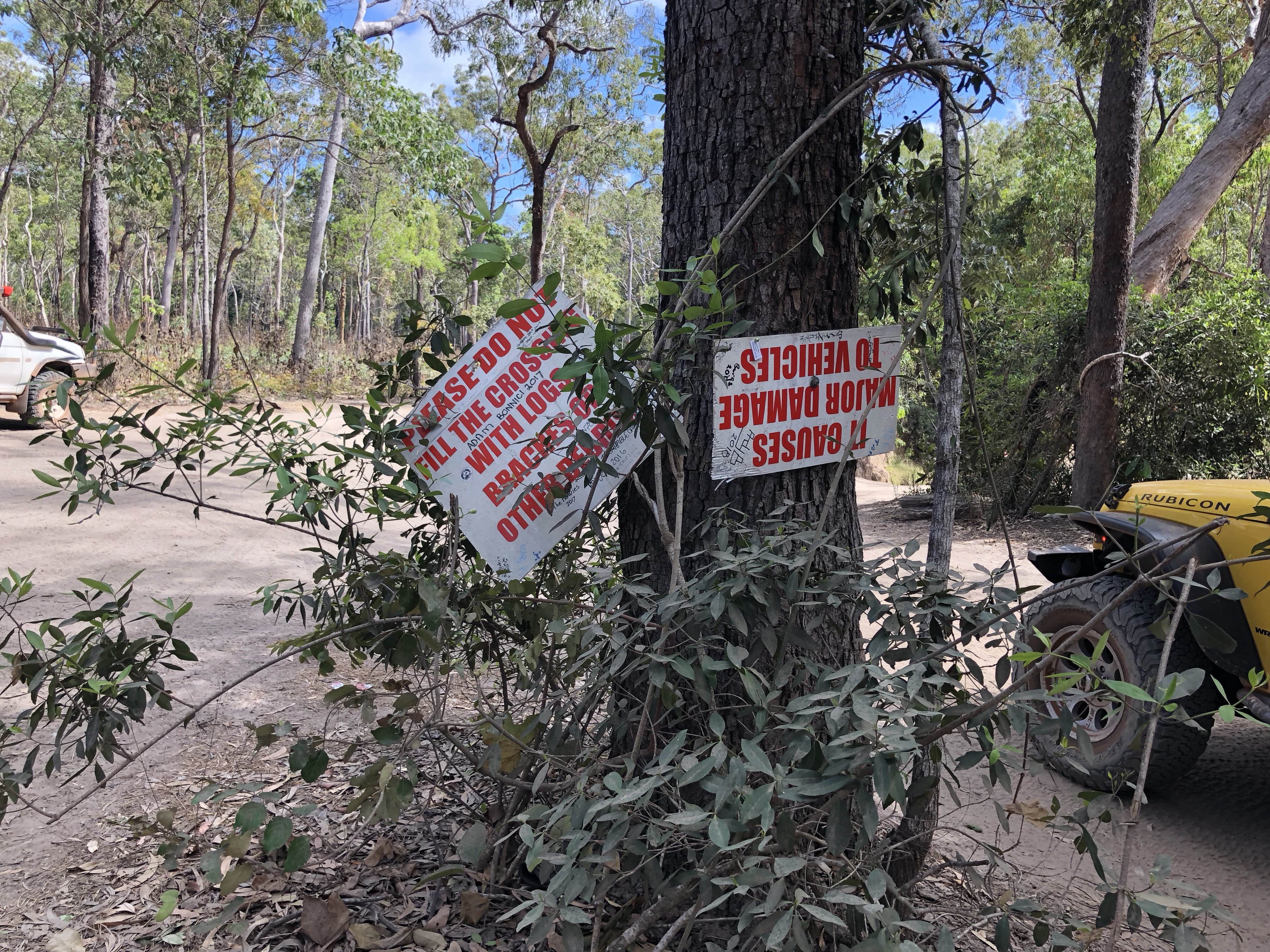
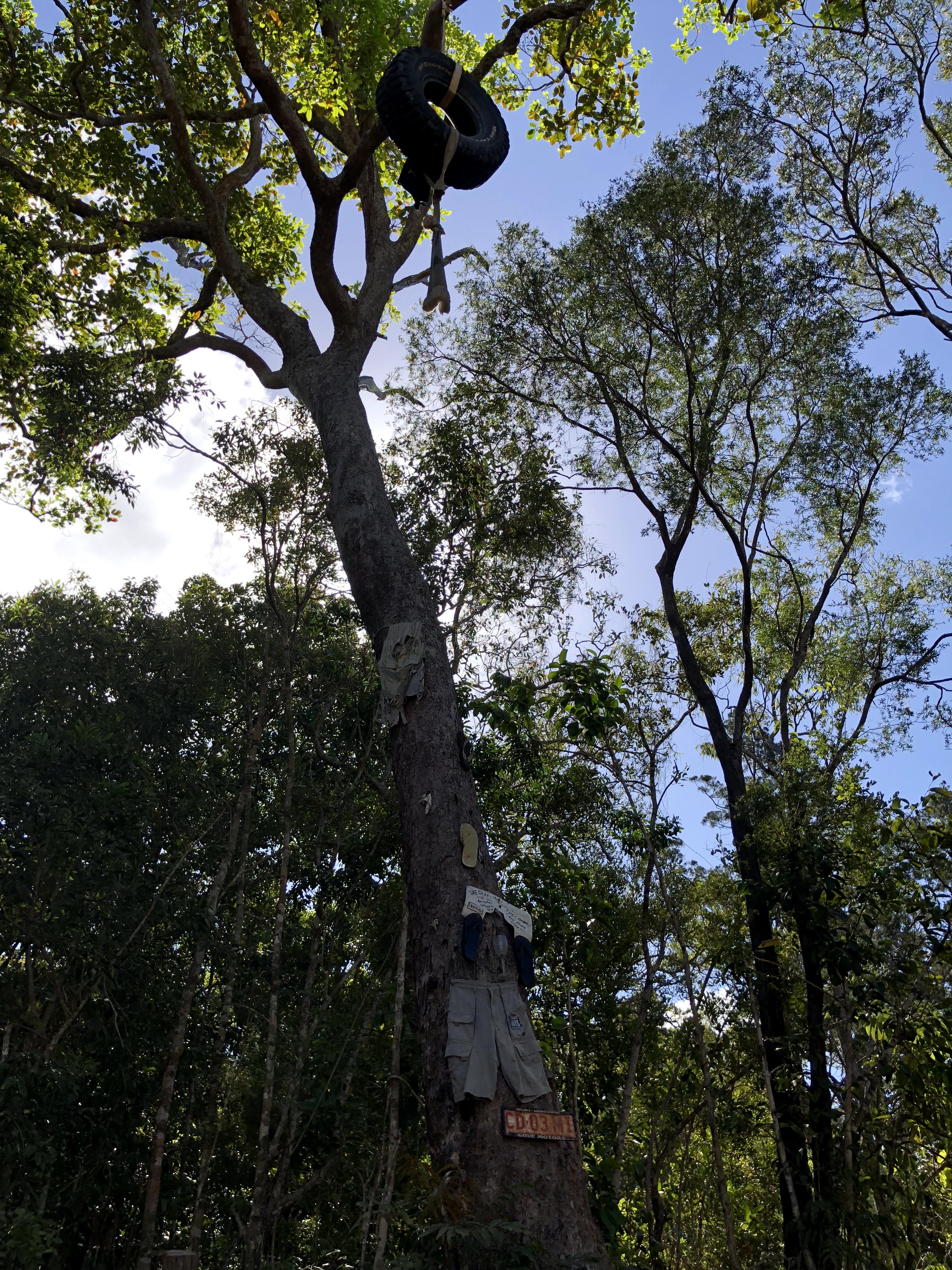
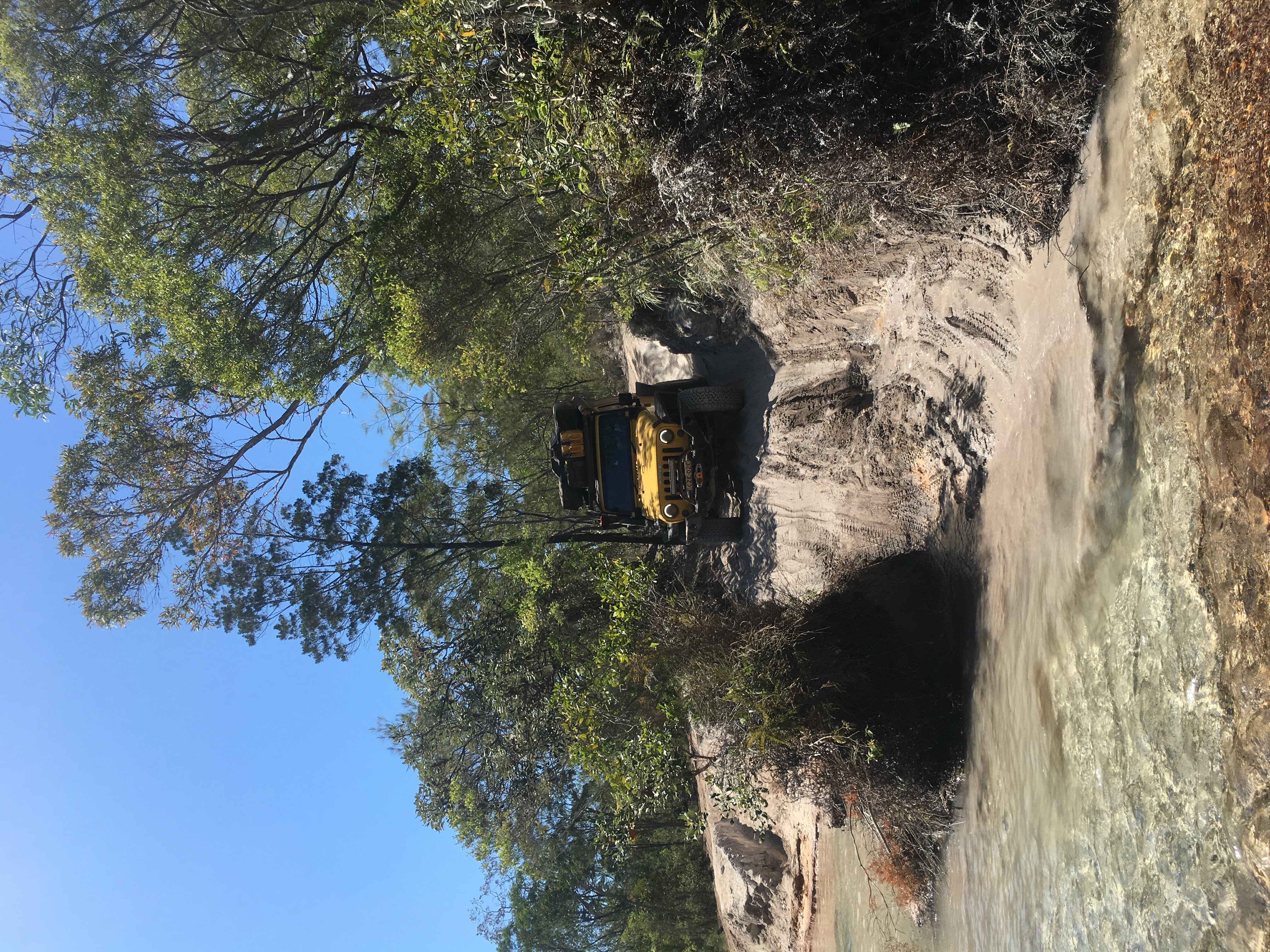
A short way up the track is the first obstacle, Palm Creek, previewed by a few warning signs nailed to a tree. I guess Palm Creek is the ‘gatekeeper’ of the OTT, as some folks will get this far, see this and then turn back. It’s a pretty steep entry into what was merely a puddle when we were there late in the dry season (mid-August), but can you imagine if this was all muddy and slippery and then deep water at the bottom?

With a little trepidation, turns out this initial test was no issue for either of our vehicles. Confidence boosted, onward we went!
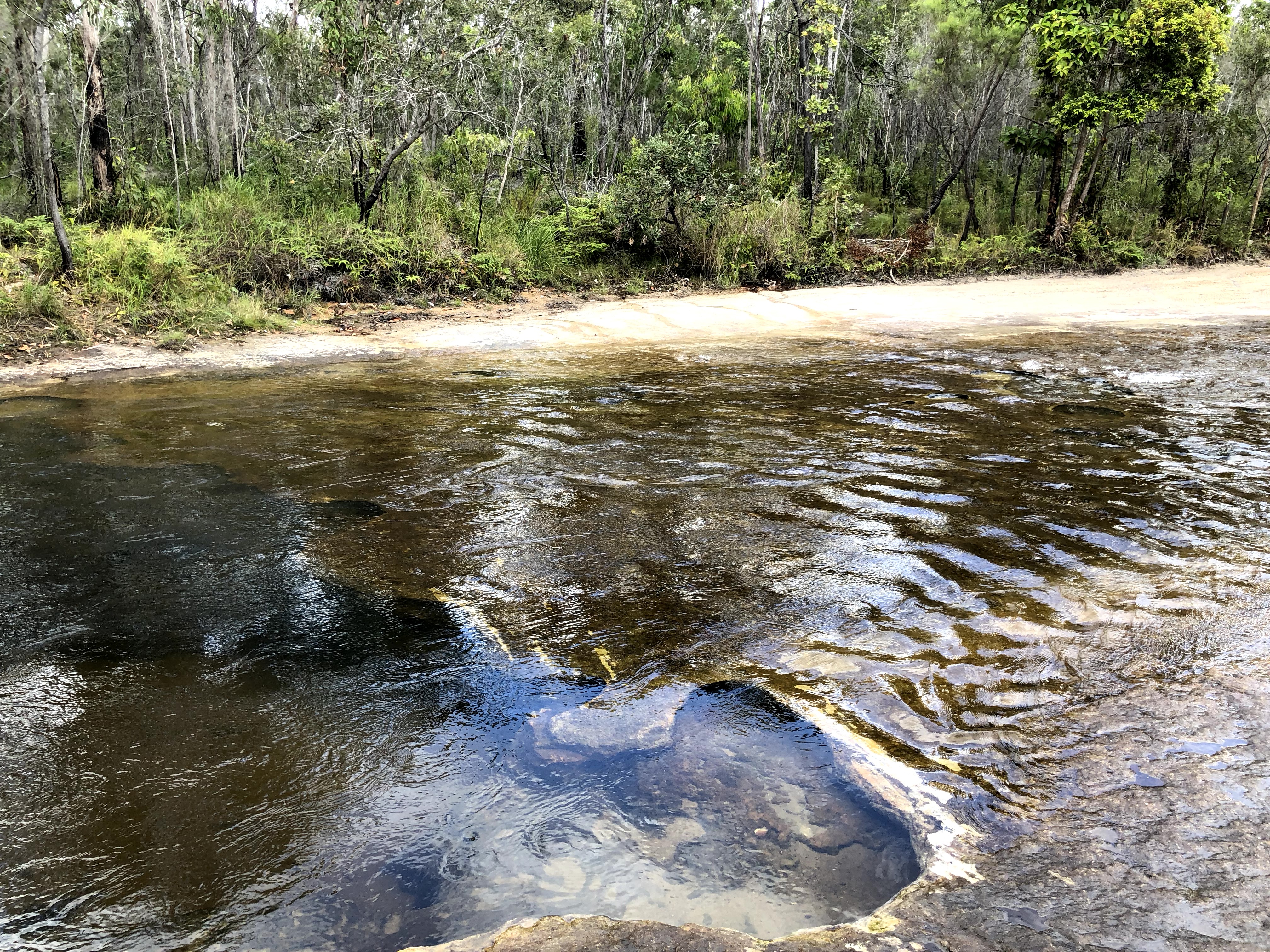
The next phase of the track was pretty cruisey, with a few more absolutely gigantic termite mounds, and a few more dry creek crossings not worth photographing.

The next major obstacle we faced was Bertie Creek, about 35km into the track.
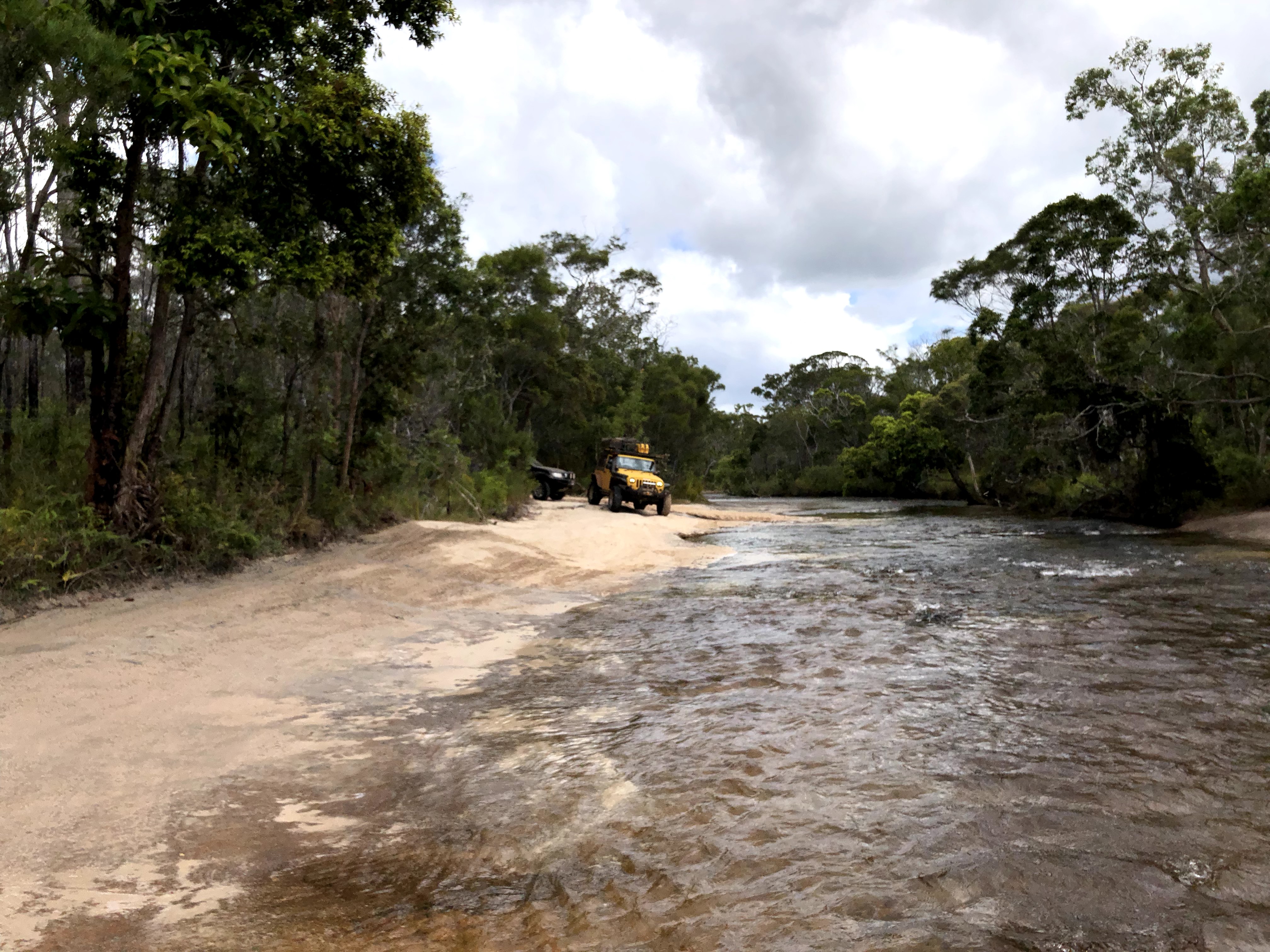
Looks pretty shallow and tame from this angle, until you realise the bottom is littered with these treacherous and deep holes and drop offs which could easily cause you to at best get stuck and at worst drown your vehicle if you happened to slip off into a really deep part.
This is a great example of why, whenever possible, you should walk any and all water crossings before driving them, and have a spotter to guide you through.
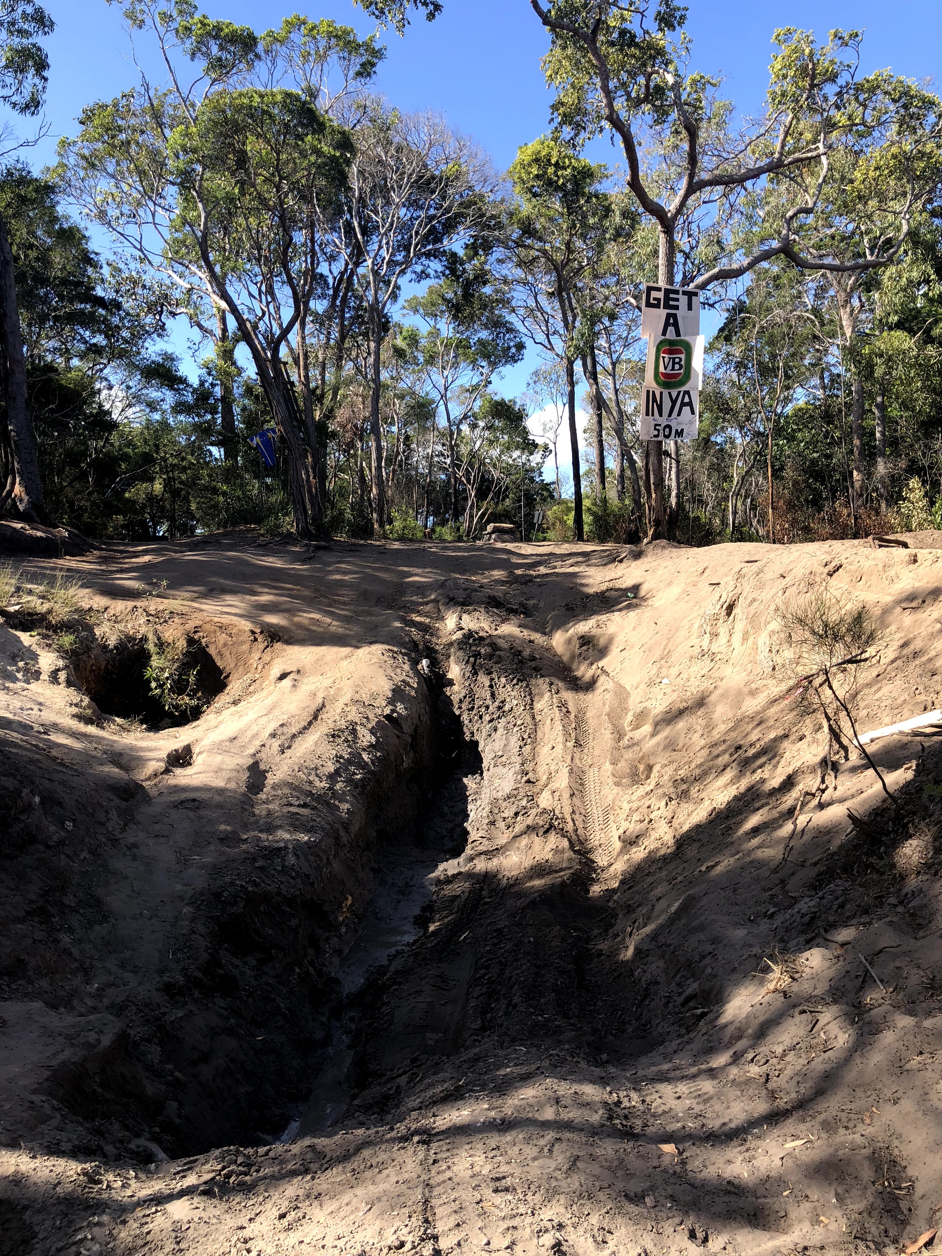
Only 12km north of Bertie is the infamous Gunshot Creek. Having done extensive research and reading (a virtual reccie if you will), Gunshot and Nolan’s were the only two OTT crossings that Nick and I were really worried about (and having made it through the track, were we to do it again I’d also add Logan’s to the list). Gunshot isn’t a deep water crossing, but the entry points are so eroded that some of them are nearly a 90 degree drop. They also get worse every year as vehicles and camper trailers chew them up early in the dry, when they’re still muddy and soft.
Needless to say, we took the absolutely chicken-est of chicken tracks on this one, and didn’t even try “the real Gunshot”. Have a look on YouTube for examples of those who’ve tried if you’re curious, it’s pretty insane what some folks will put their vehicles through (and our families thought WE were insane!).
I have to call out again here the importance of walking the full track before tackling it – Nick and I were so happy to have conquered Gunshot (even via the chicken track) that we didn’t walk the exit track, and nearly took a pretty poor line which may have caused us to be in need of recovery in a pretty tight spot – luckily we’ll never know what might have happened, as a kind bystander waved and shouted us down. Who knows, it may not have been an issue as the Jeep is quite capable, but I’d rather not have tried it anyway.
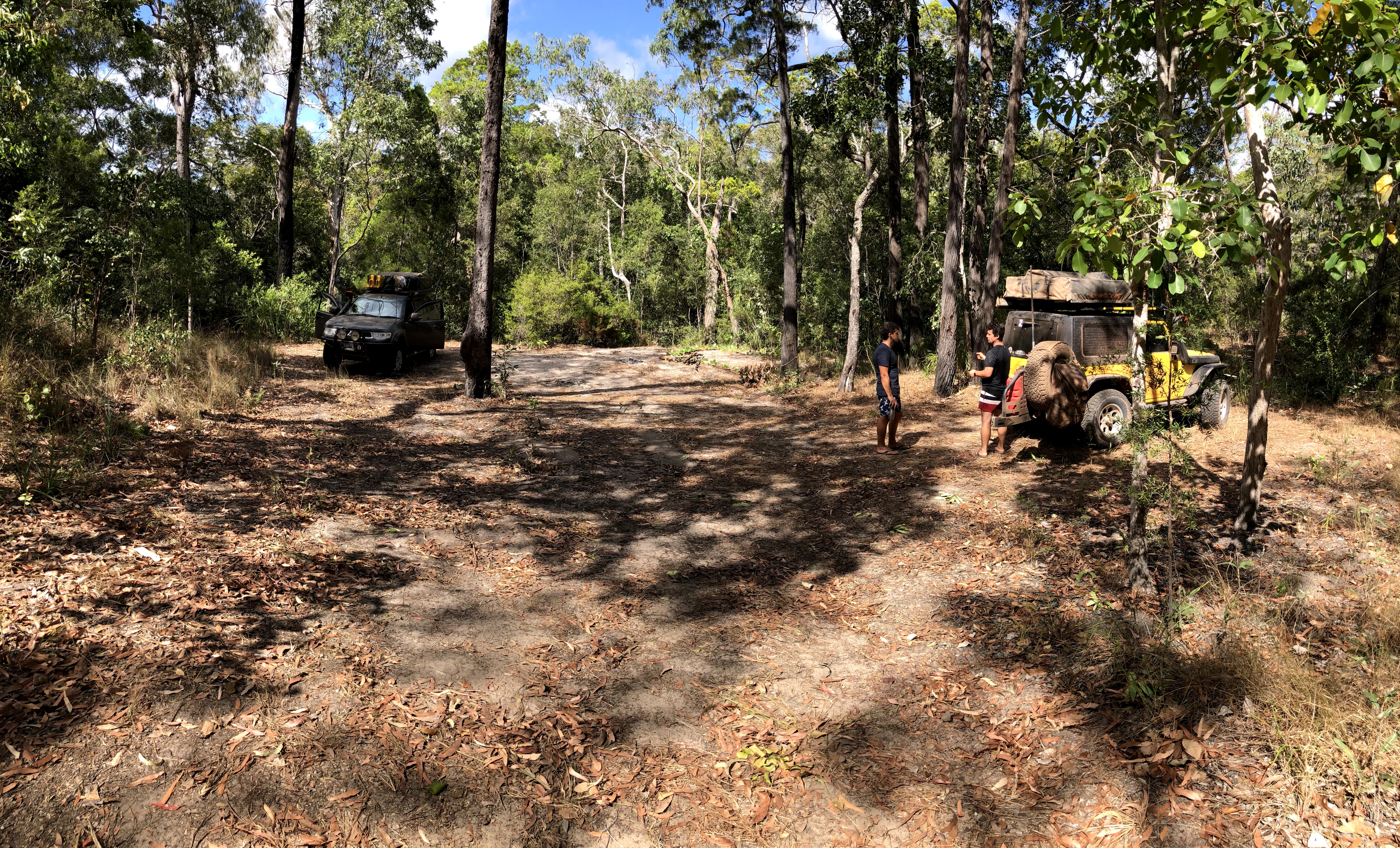
Just one more tame creek crossing and it was time to set up camp for the night. We scored an awesome free camp at nearby Cockatoo Creek – all I can say is that you really need to go and have a good drive around when hitting a campground, as there are often secluded and tucked away spots where you might not realise. We had a whole section of Cockatoo Creek to ourselves that afternoon and took our time celebrating our victory over the southern half of the OTT with a swim and a few well deserved beers!
We had planned the next day as a short and easy day, in part because there were a few spectacular waterfalls on this short 35km section and we wanted time to relax and swim, and partly as a buffer day in case the previous day didn’t go to plan (for example, a recovery can sometimes take an hour or more and we may have needed to camp somewhere en route instead of where we planned). Luckily we had all the time in the world and after a nice relaxed morning it was off to hit the track again.
There’s only one creek crossing (Sailor Creek) between Cockatoo Creek and Fruit Bat Falls, and it must have been a pretty relaxed one as I don’t even have a photo of it…
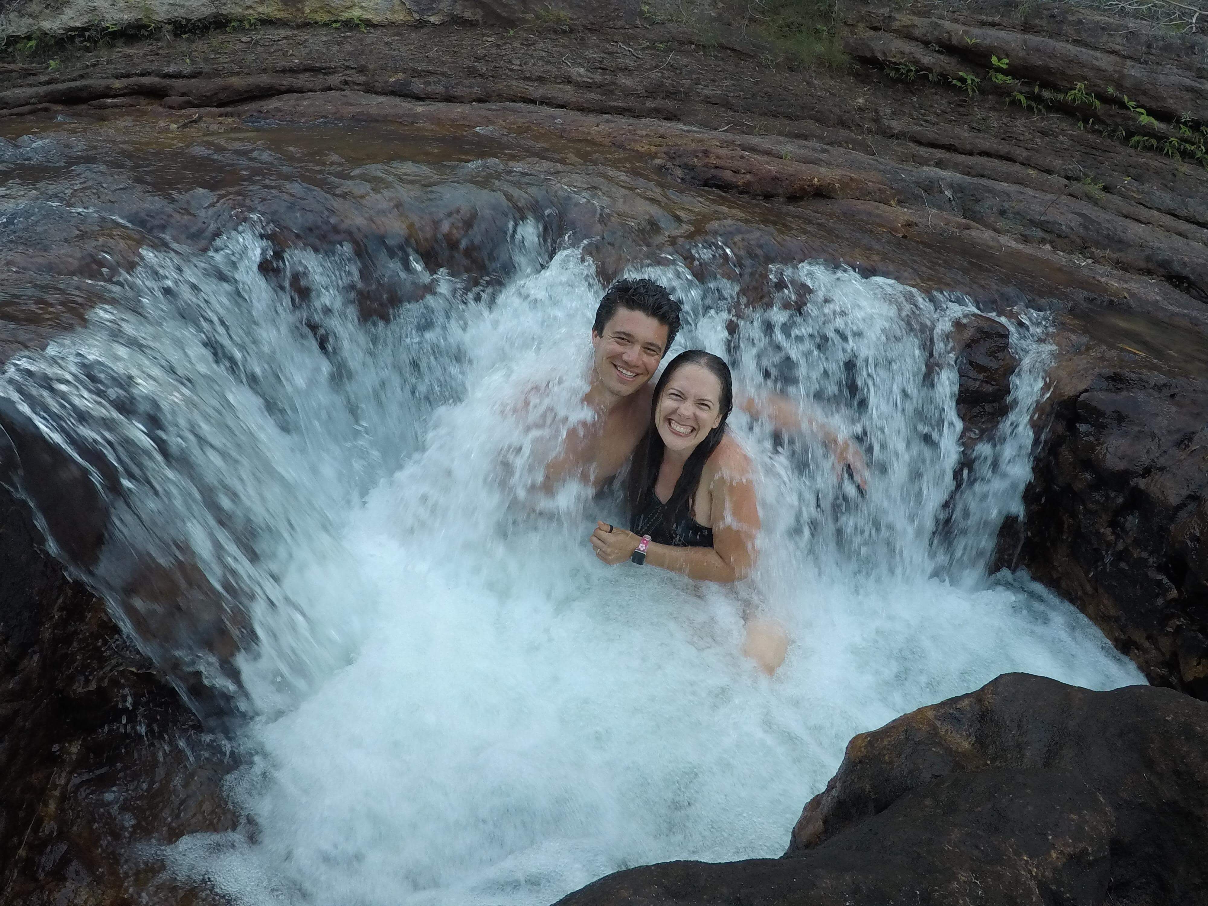
I do however have several photos of our first destination and lunch stop, Fruit Bat Falls.

This place was so stunningly beautiful, and while it got a little busy over lunch, it was nothing like it’d be if the falls were located somewhere more easily accessible, and we even had the place to ourselves for about 15 minutes at one point.
We set up our chairs on top of the falls where it was shallow, dipped our feet in the water, and had snags & beers – paradise.
After a long relaxed lunch and swim, it was off to set up camp for the night at nearby Eliot Falls & Twin Falls, only another 11km up the road.
After Fruit Bat Falls it was hard to believe that Eliot / Twin Falls would be able to compete, but we were thrilled to find yet another slice of paradise only a short walk away from our campsite.
After all that swimming, we were absolutely starving, and luckily – it was pizza night! Our convoy companions Sam & Nicky (or we can call them by their newly-created OTT call sign, Saké) and us (Pam & Nick, aka OTT call sign “Panic”) pooled our resources and had an amazing spread of cheese, crackers, pate, and camp oven homemade individual pizzas. Apparently we were slightly into the beers by then, because I don’t have any photos of the pizzas – which were absolutely deliciously amazing, you’ll just have to take my word for it.
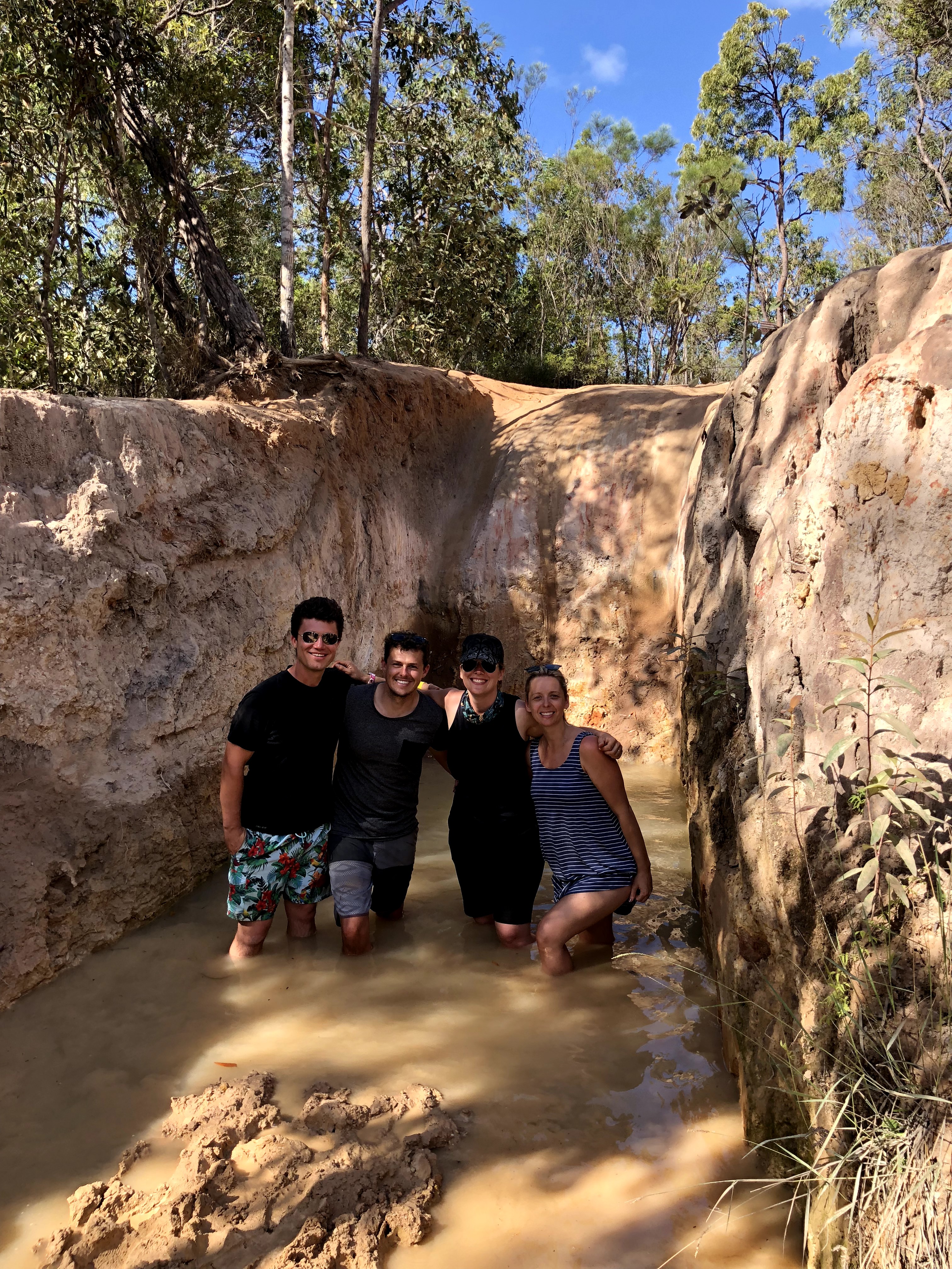
At Fruit Bat, Saké had recognised another couple they’d run into at Rinyirru National Park, Ben & Kiz (OTT call sign “Biz”), who joined us for swimming, dinner, and also agreed to join the Convoy of Awesomeness ™ for the rest of the Cape York trip. Wheeling is always better with friends and we were so happy to be making some new connections with like-minded people. By the end of our Cape York trip, a solid friendship between the three couples had well and truly been built and we were super sad to part ways – I described it as “friendship hangover”! It felt just as sad as when we had to leave our friends in Sydney.
OK, enough mushiness sorry – back to the track!!
Day three was a big one, with 70-ish kilometres left to cover (30km on the OTT) and a couple big creek crossings ahead of us.
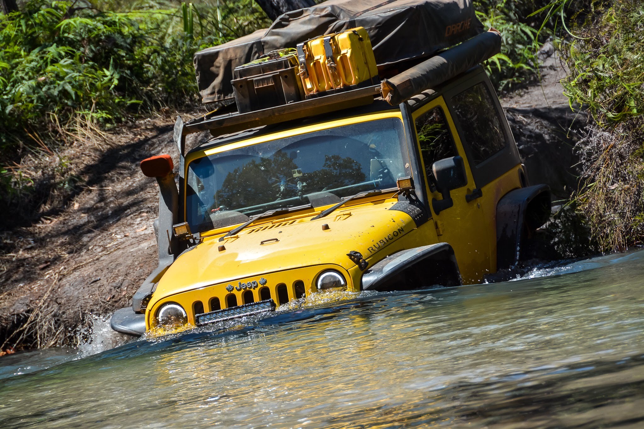
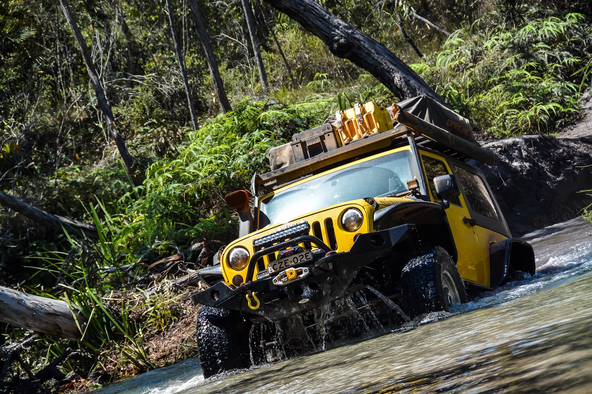
Seven creeks to cross in total in the 27km between Eliot Falls and the end of the OTT was no small feat, but the real challenge awaited us at the last one – Nolan’s Brook. You’ll recall from earlier in the post where I mentioned that in all our research, Gunshot and Nolan’s were the two that we were concerned about. Gunshot for the ridiculously steep entry (which thankfully we were able to avoid), and Nolan’s for the depth of the water. While we’ve done our share of water crossings in the past, a deep water crossing runs the risk of getting water into your engine, which is an unrecoverable disaster and can happen even with a snorkel and diff breathers fitted (which we have). Once you’ve got water in your engine, it’s dead – and we were definitely not interested in having this happen to us just two months into a year-long trip (or really at any time, let’s be honest). We agreed that if we thought Nolan’s was too deep to cross safely, we’d turn back and take the bypass road to the Jardine River Ferry.
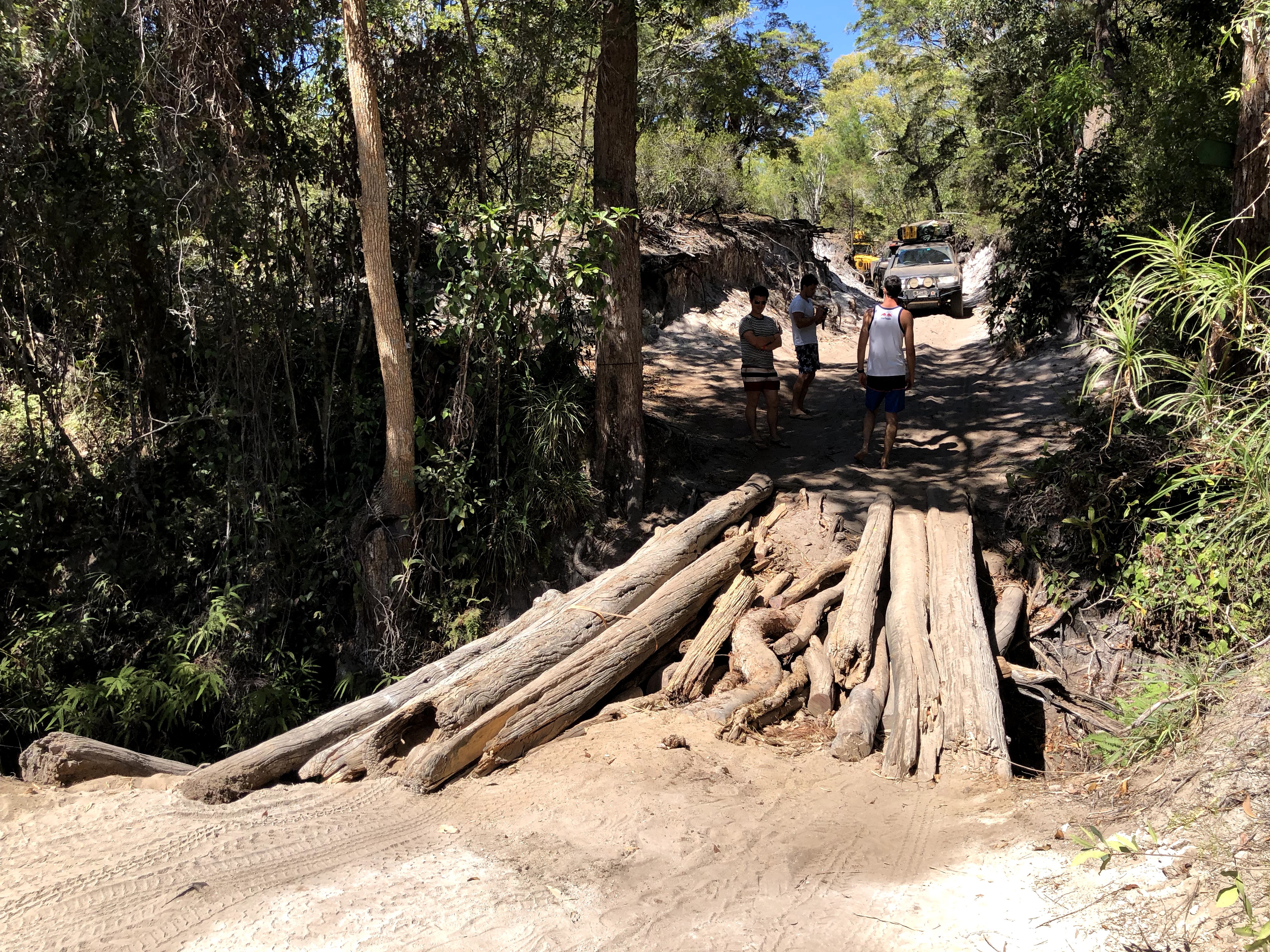
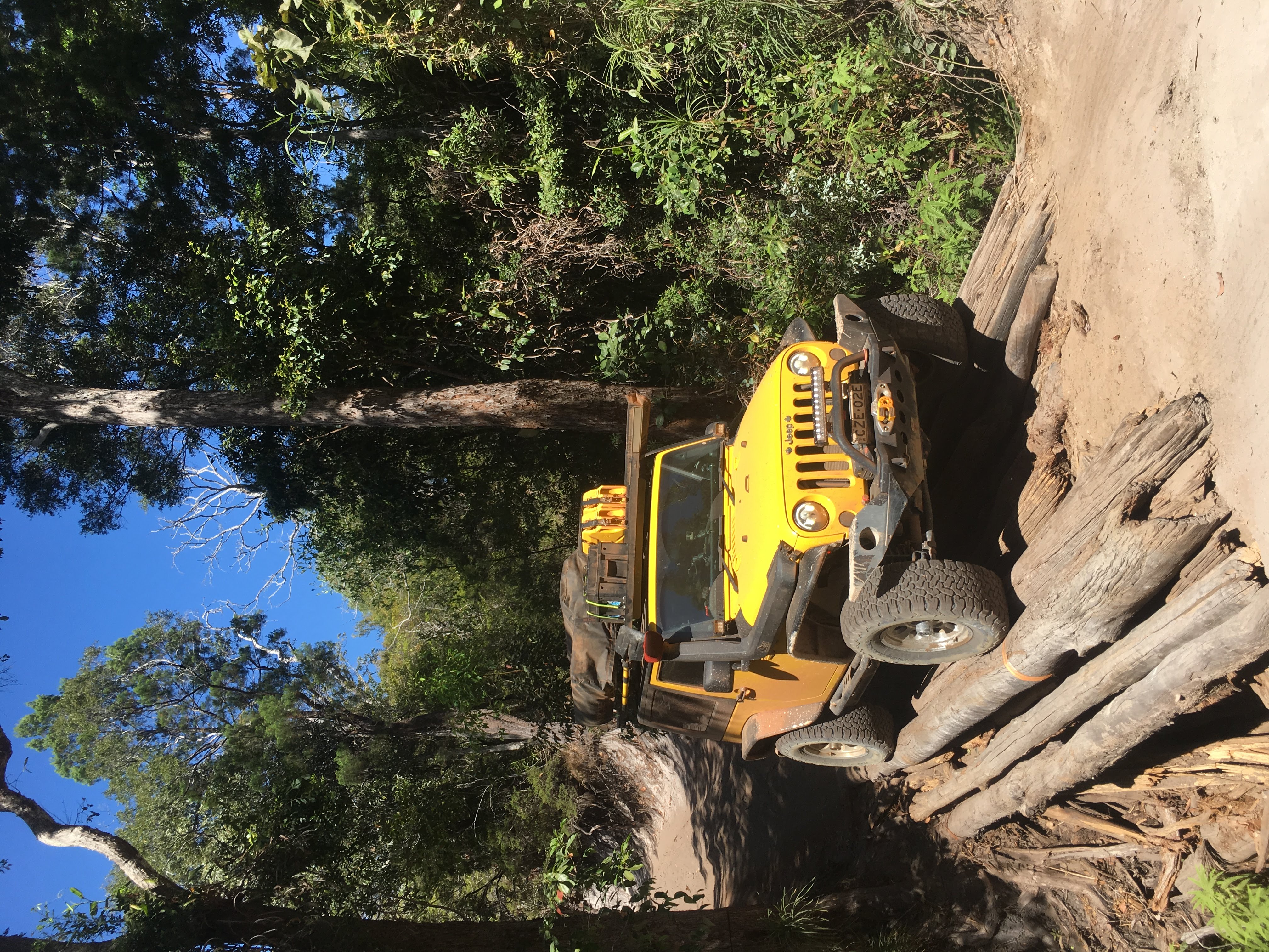
I’m not sure what’s worse on this track, the creek crossings or this attempt at bridging over one of the creeks (Cypress Creek specifically)
Only one more creek crossing til Nolan’s now…but imagine our surprise when the crossing immediately before Nolan’s – which wasn’t even named on our map nor did it have tips and pointers in our Hema app like every other major crossing including the log “bridge” crossing above – turned out to be just as deep as we were expecting Nolan’s to be! Not to mention it contained cloudy water and so was not safe to walk due to the (admittedly small but why chance it) risk of crocodiles.
We found out later this creek is called Logan’s and many other travellers were surprised by it as well. Good to know it wasn’t just us I suppose. I don’t have a photo of this crossing but here’s a video. Just a little bit nutsy for an un-named crossing eh!!
A few kms after Logan’s is Nolan’s which we should have felt ready for given all we’d done so far (actually all Nick had done, let’s be honest, I didn’t do a speck of driving), but I’m not sure you can ever get yourself prepared for dipping your vehicle into a bath and risking destroying what’s meant to be your home for the next 12 months.
Well, no worries, we made it… Nick walked every line, chose the one he thought was best, and then took it easy, and made it through with absolutely no drama. We even had a bit of an audience – Nolan’s, being the last crossing on the track, attracts a crowd, and the yellow Jeep being so distinctive caught some attention. I felt like I was in a paparazzi mob while I attempted to video our own vehicle!! Here’s a few amazing photos taken by one of the mob (thanks to 4020media for these!).
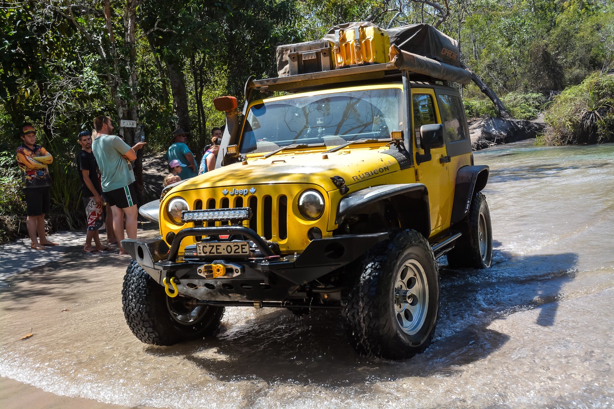
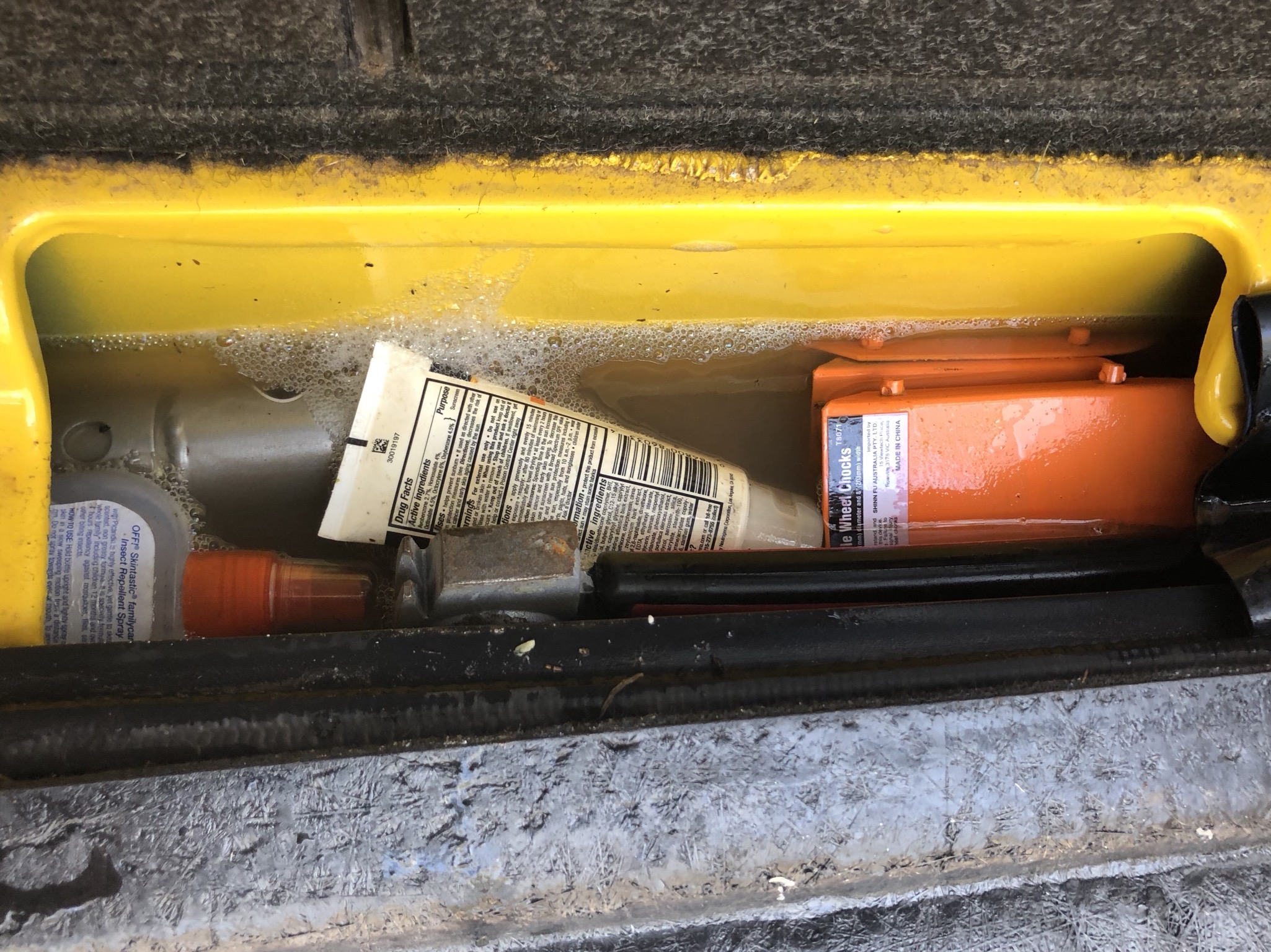
And that’s it – we had done it – the Old Telegraph Track! With virtually no casualties but three broken eggs and some water in the jack compartment (which Jeep has anticipated and was easily drained by way of a removable plug in the floor of the compartment!).
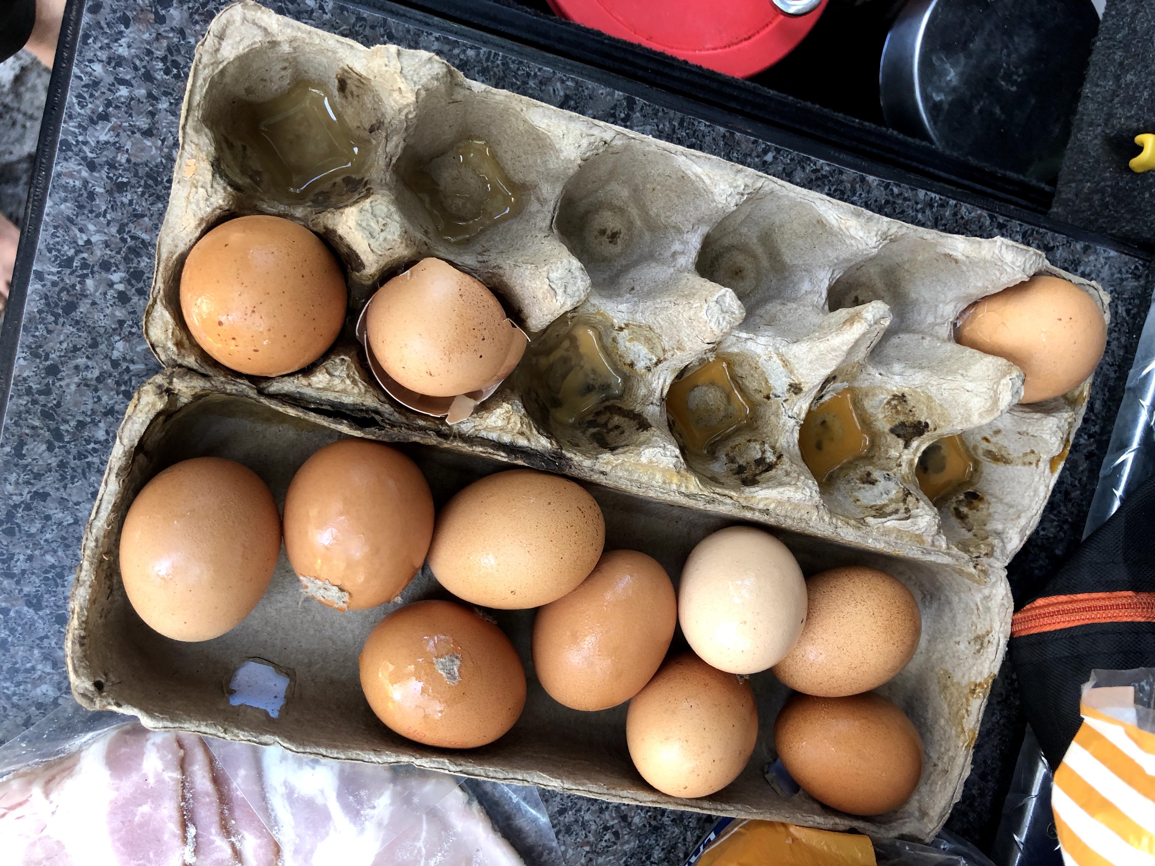
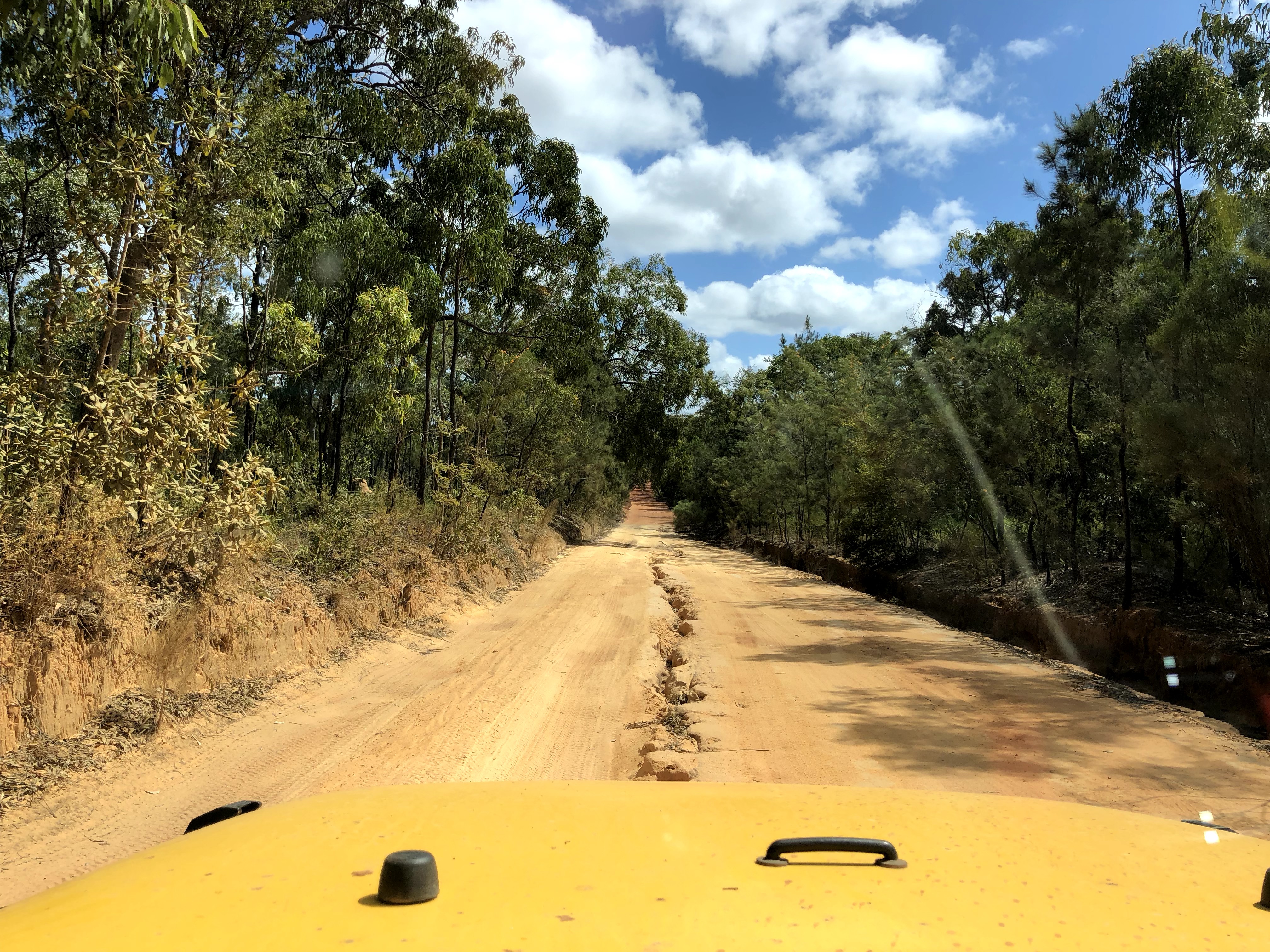
After a few bacon egg rolls for lunch to use up our broken and cracked eggs, it was now an easy drive up the Peninsula Development Road (PDR) to the Jardine River Ferry.
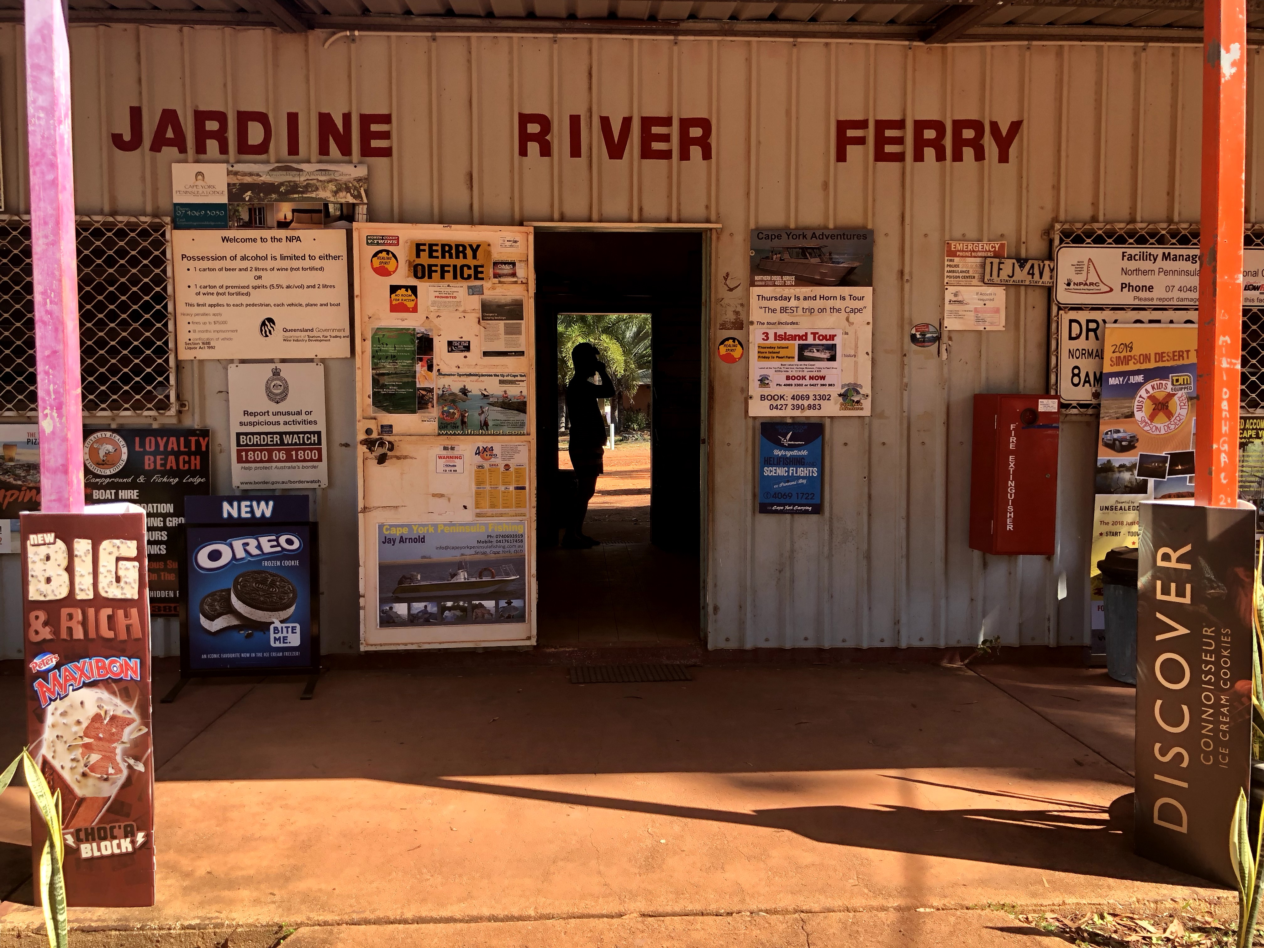
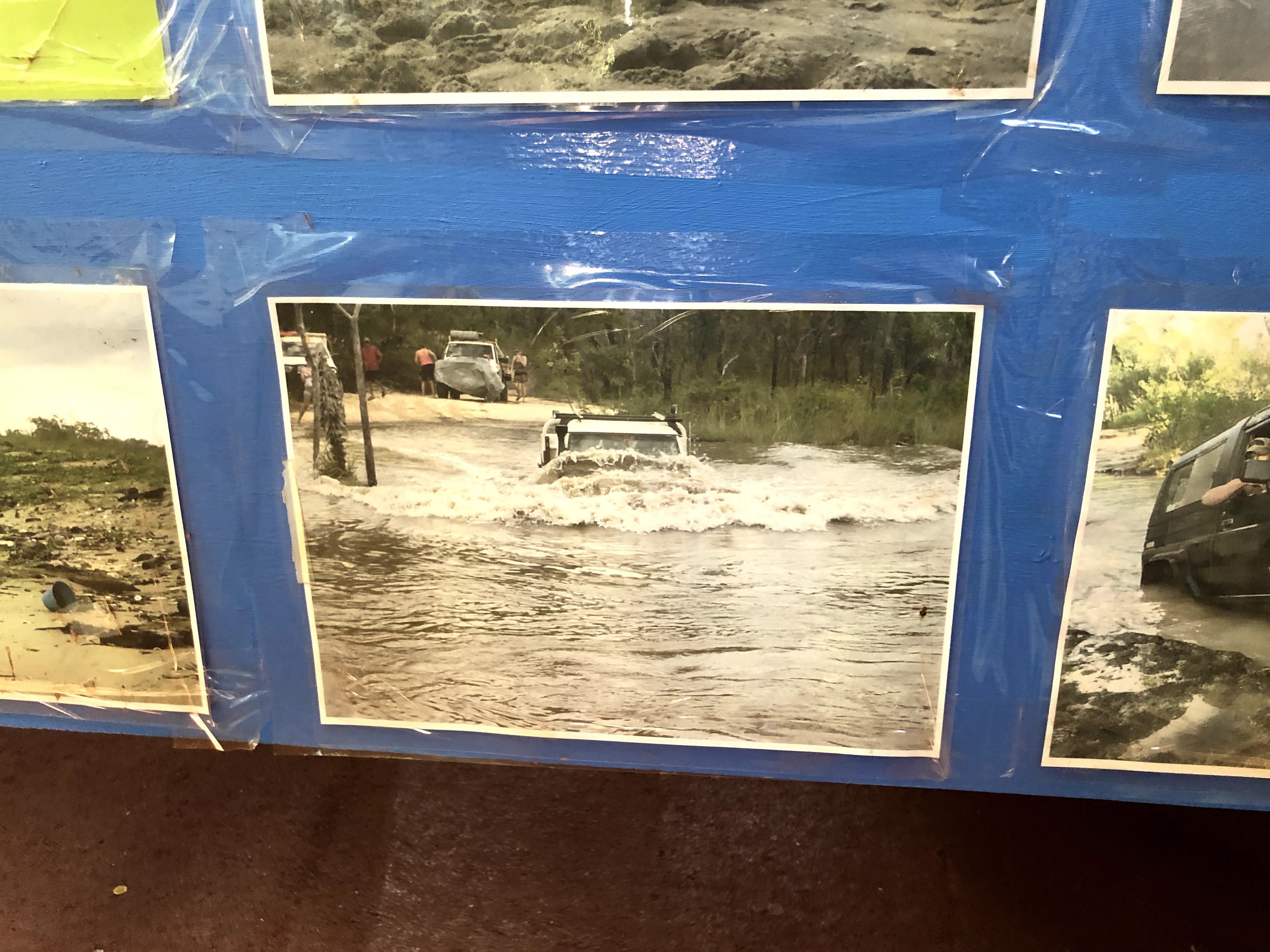
Inside the Ferry Terminal are some photos and reminders of what it can be like to tackle the OTT earlier in the season when the creeks are still topped up from the wet…
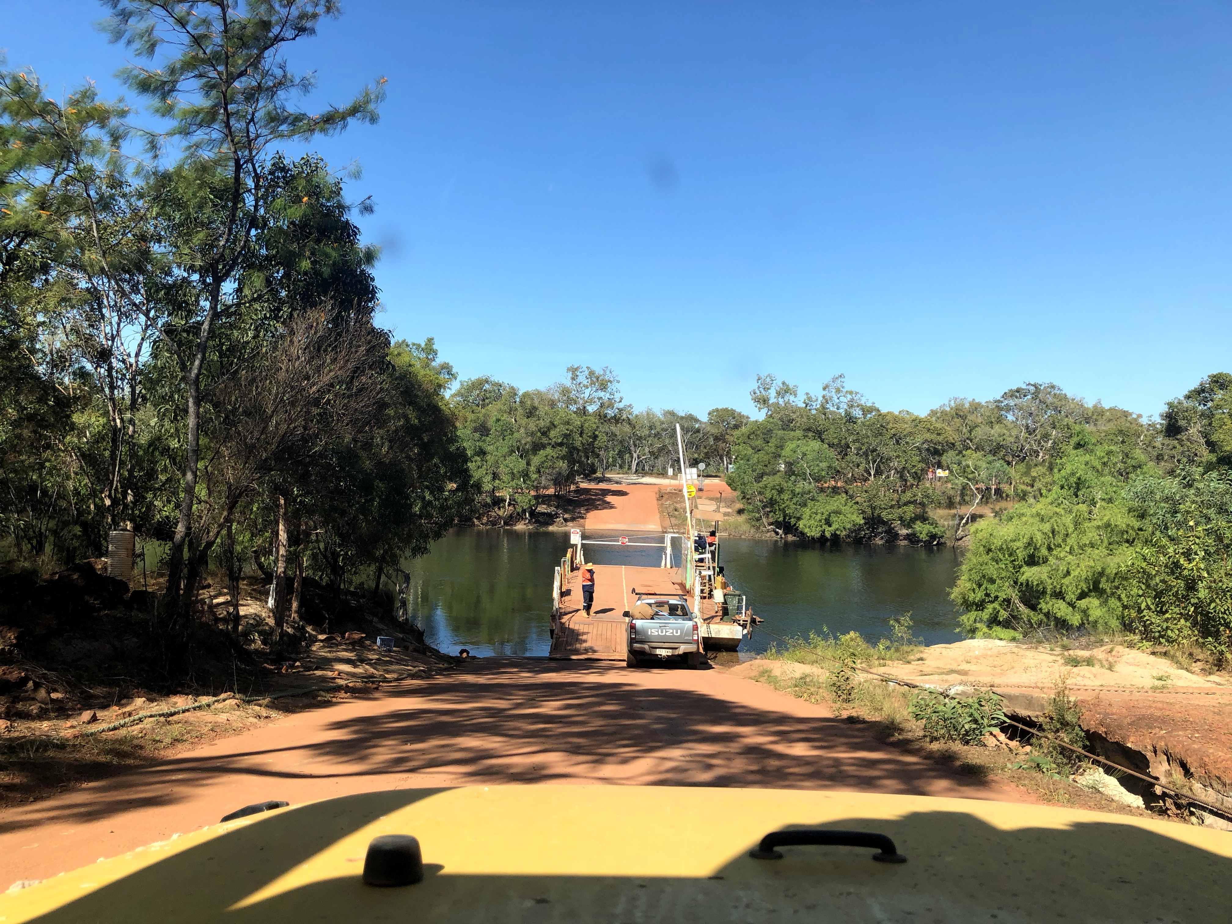
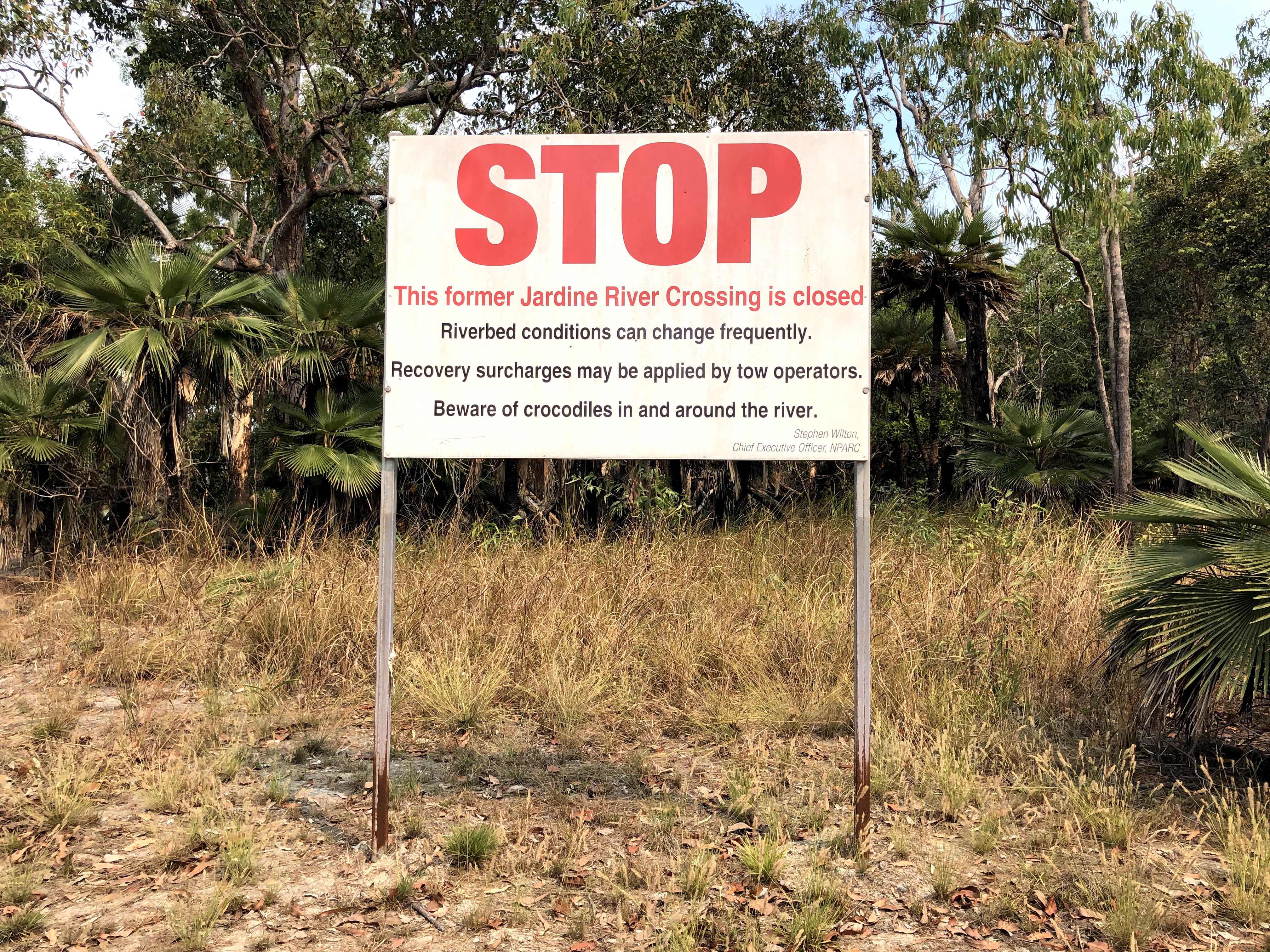
A few years ago it was actually also possible to cross the Jardine River by vehicle, but the crossing has since been closed and it’s now only possible to cross by ferry. I can’t blame the locals for closing the crossing, if you look up videos on YouTube of past attempts, it is terrifyingly long, deep, and has a fast-moving current, not to mention the crocodiles…and sadly a crocodile did kill a man swimming in the Jardine River in 1993.
We’ve heard and read a few people complaining about the cost of the Jardine River Ferry at round-trip $100 per car and insinuating that the locals have dug out the banks to make the crossing more dangerous on purpose, and put up signs to close the crossing, just for financial gain. Really though, we think that if the locals were really interested in maximum financial gain, they’d leave the crossing open since a remote recovery up here from the middle of the Jardine River has got to cost $5k or more!! Not to mention, it’s some of the best free beach camping and ocean fishing all of Australia has got to offer up there at the tip…well worth the ferry ticket in our opinion.
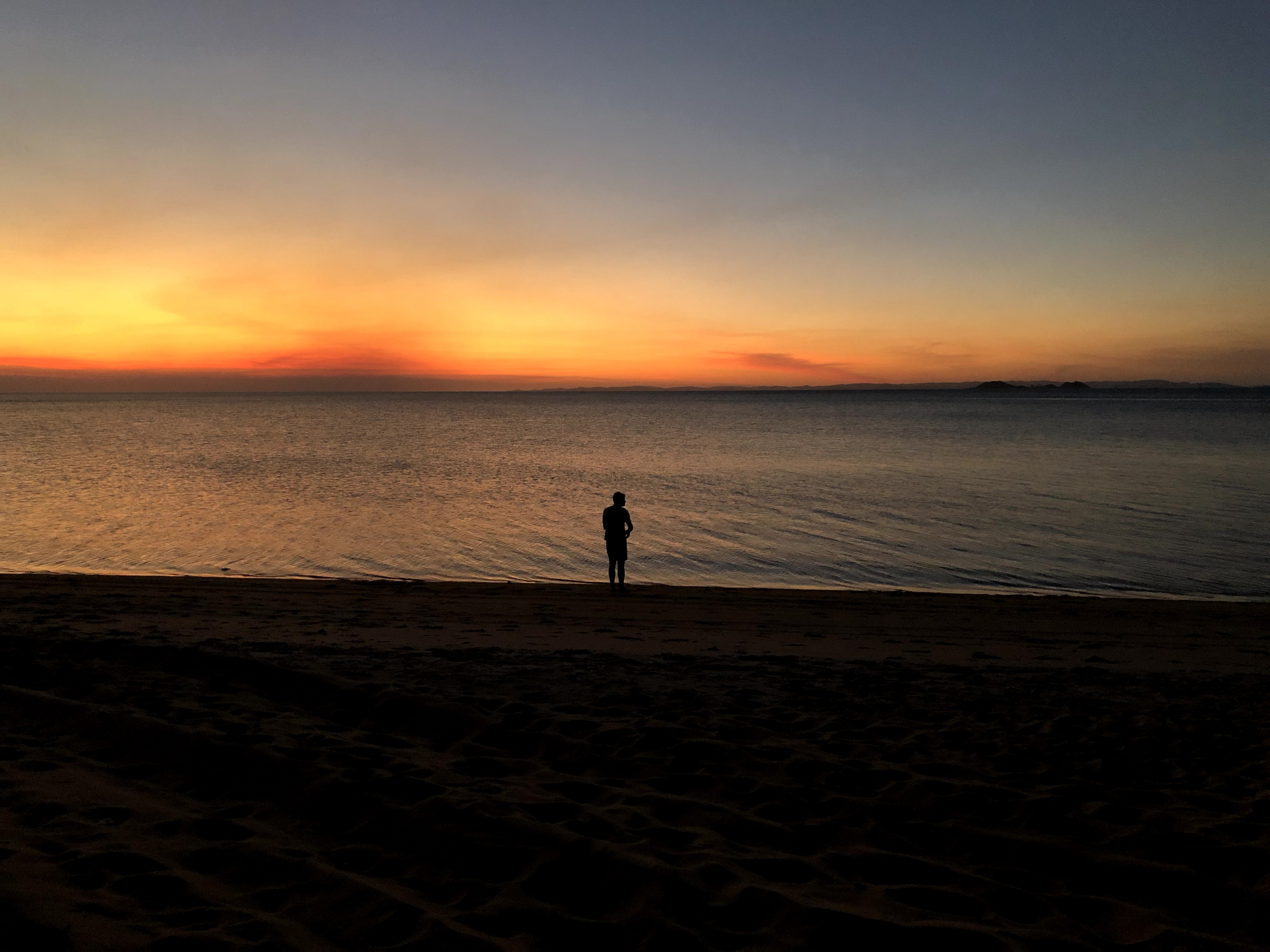
Our first camp spot at the tip was at Alau Beach where our happy and accomplished crew pulled up to the beach, grabbed some snacks and drinks (or a fishing rod), and watched our first Australian west coast sunset. Pure bliss.
Tomorrow, it’s off for a few days of adventuring at the Tip.
MVP Of This Leg: the JEEP!! Obviously. She can do (almost) anything. ‘Nuff said.
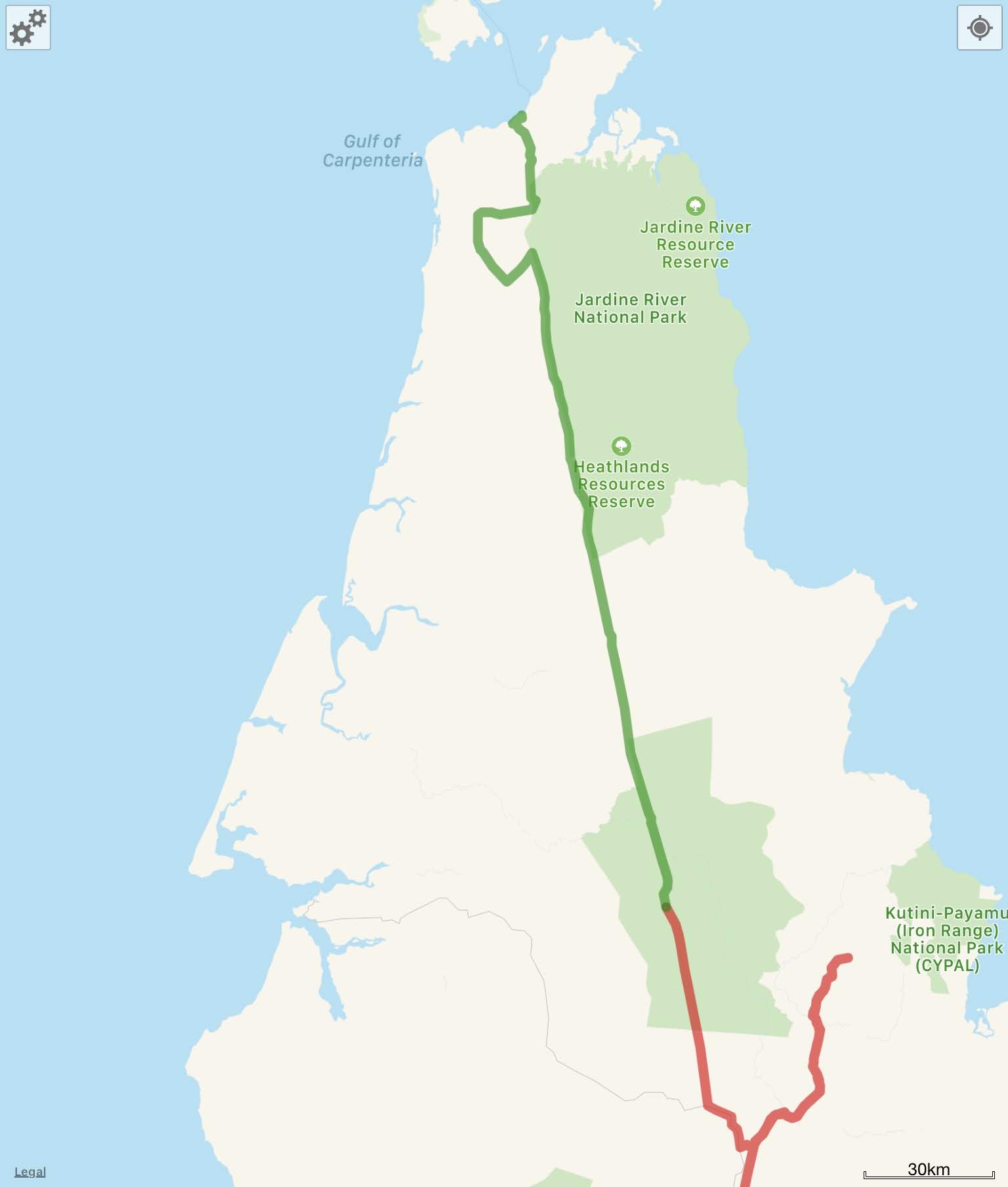
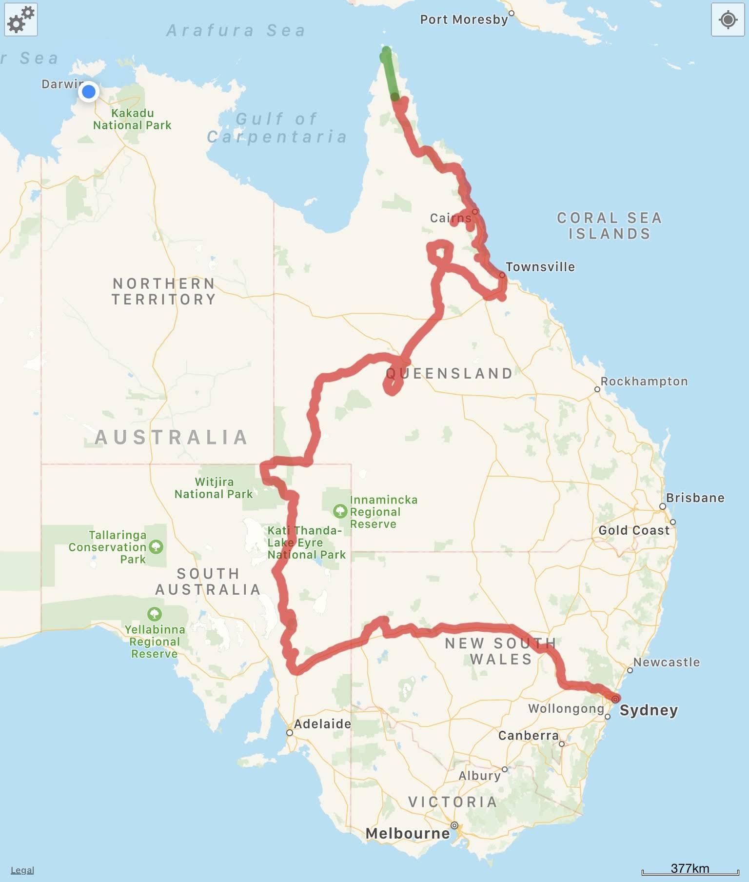
So, Where Exactly Is This?
Here’s a screenshot of this leg of the journey from WikiCamps! The red is what we’ve already covered, and the green is what was featured in the post you just read. You can also follow us live at this link – our satellite device pings our shared map frequently.