Tasmania Part Two: blue water, orange rocks, white sand, and an introduction to foodie paradise
After getting a bit of a soak as our introduction to Tassie, it was blue skies and sunshine again as we hit the east coast and started driving south along the gorgeous Bay of Fires, on our way to Freycinet National Park.
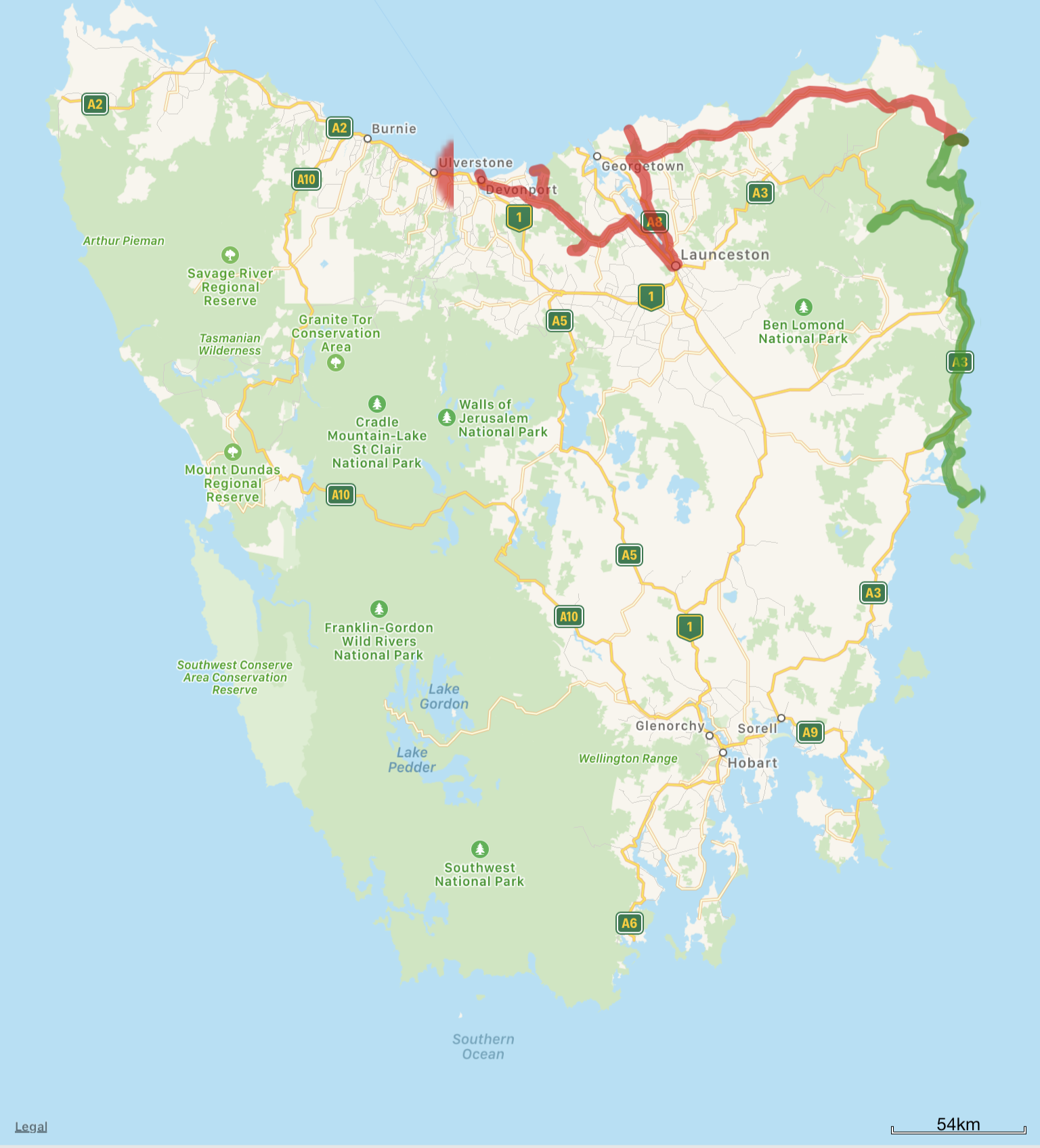
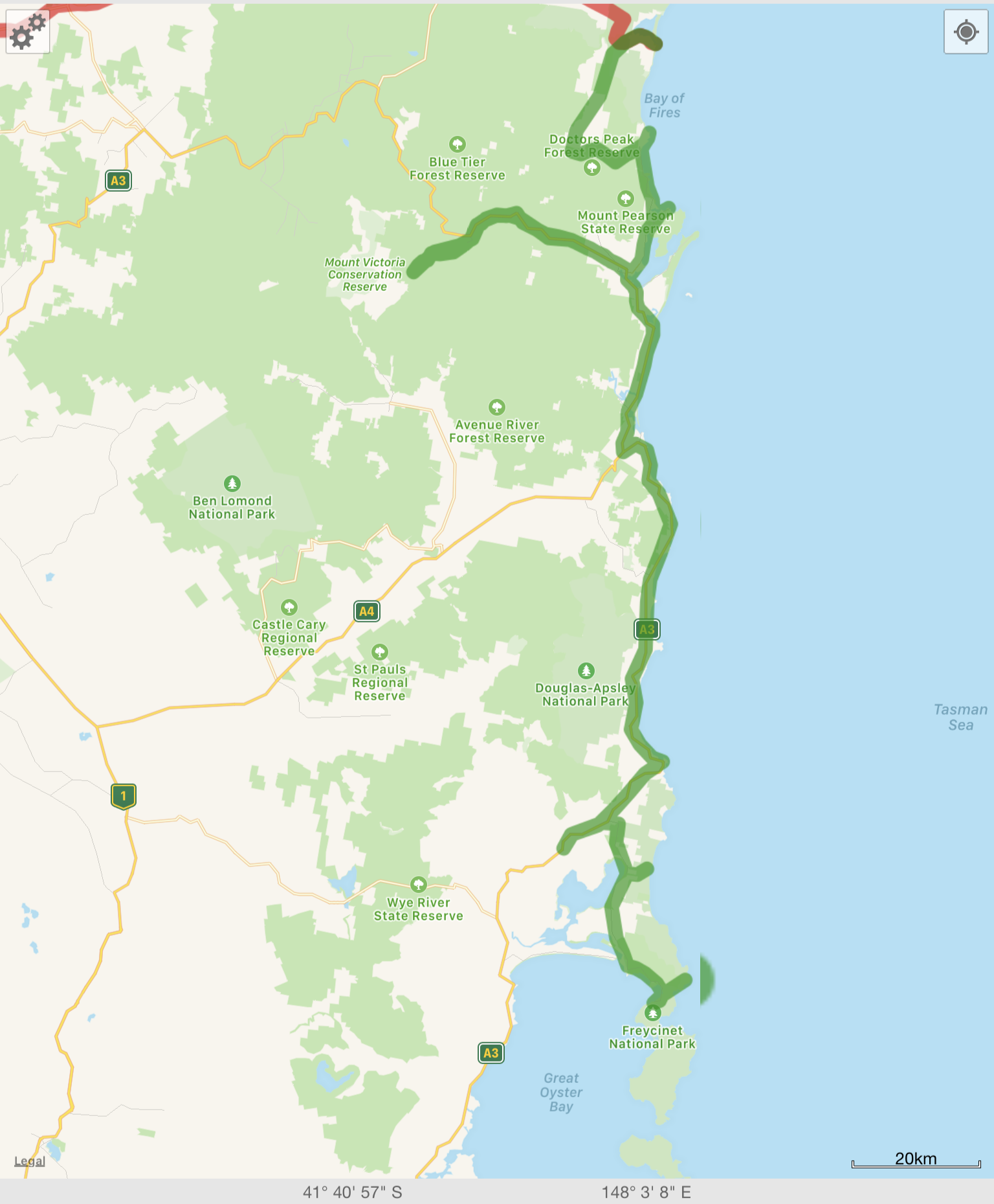
Here’s a couple of maps of what’s covered in this post – the first is all of Tasmania, and the second is a detail of this post’s route, marked in red (previously covered) and green (this post).
The Bay of Fires is…well…I’ll just quote from the Wikipedia article because it’s written better than I could manage:
The Bay of Fires (indigenous name: larapuna) is a bay on the northeastern coast of Tasmania in Australia, extending from Binalong Bay to Eddystone Point. The bay was given its name in 1773 by Captain Tobias Furneaux in Adventure,[1] who saw the fires of Aboriginal people on the beaches.
Bay whaling activities were carried out in the area in the 1840s.[2]
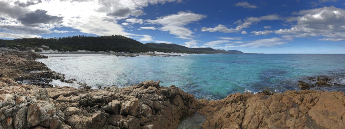
The Bay of Fires is a region of white beaches, blue water and orange-hued granite (the colour of which is actually produced by a lichen). The northern section of the bay is part of Mount William National Park; the southern end is a conservation area
It’s also absolutely stunningly beautiful.
There’s not much to do at the Bay of Fires other than to go for a long walk along the beach, so after a morning of leisurely exploring, we were happy to take a crazy selfie and move on.
At this point, we’d been in Tassie about a week and it was time to re-stock! One of the things we loved about Tasmania is that it’s really friendly to campers and caravaners. In many towns around the rest of Australia, you have to pay to fill a jerry can of water, or if you choose to fill from the water tap at fuel stations, the water will be marked as not drinkable (which is usually rubbish…most water in Australia is potable). In Tasmania, they invite you to fill up!
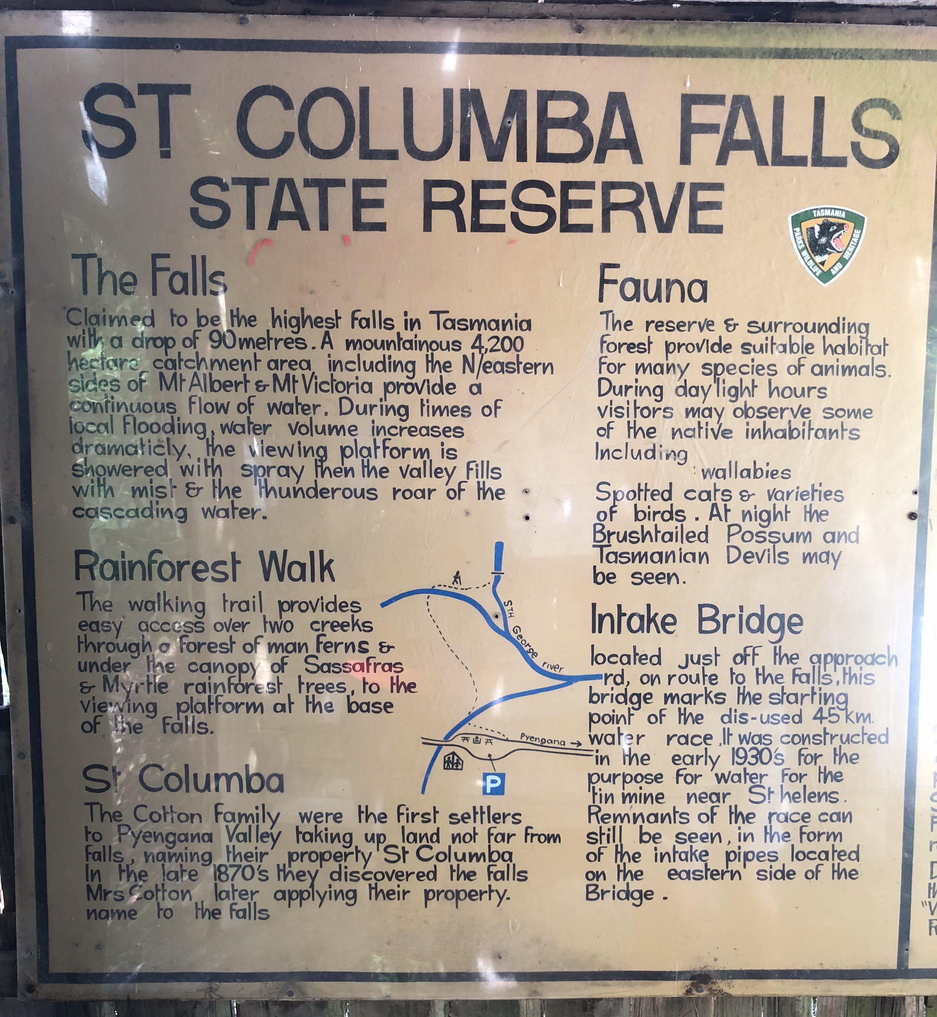
After our re-stock we ventured inland west a bit to Pyengana – home of another pub in our Bush Pubs book – called “The Pub In The Paddock” (properly known as the Columba Falls Hotel). This is the only pub in our book that’s located in Tasmania so we wanted to be sure we visited!
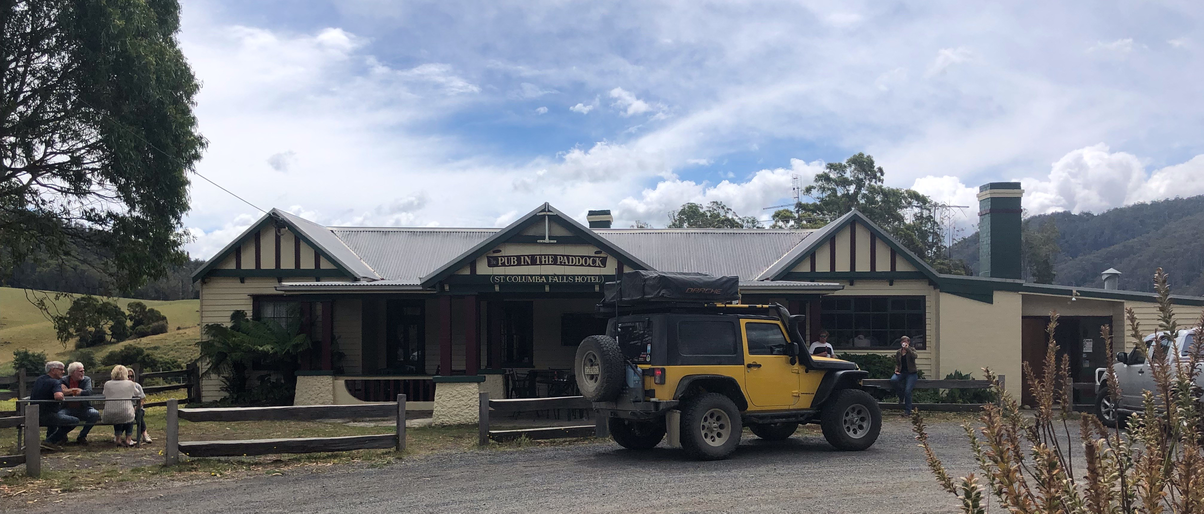

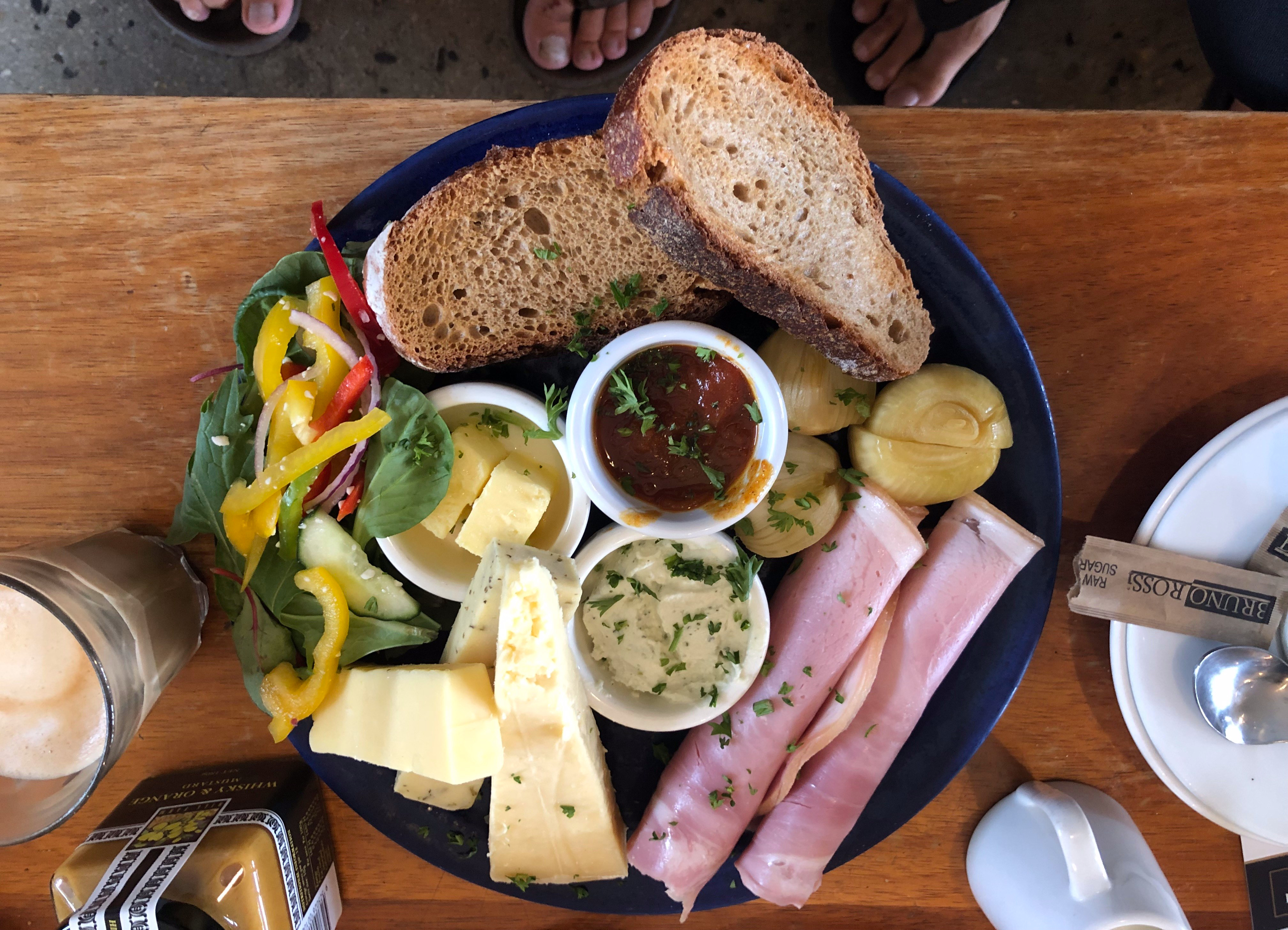
There are a couple notable things to see near Pyengana as well, namely the namesake of the pub – the tallest waterfall in Tasmania (St Columba Falls), and the Pyengana Dairy where we had this incredibly yummy ploughman’s lunch featuring Tassie produce!
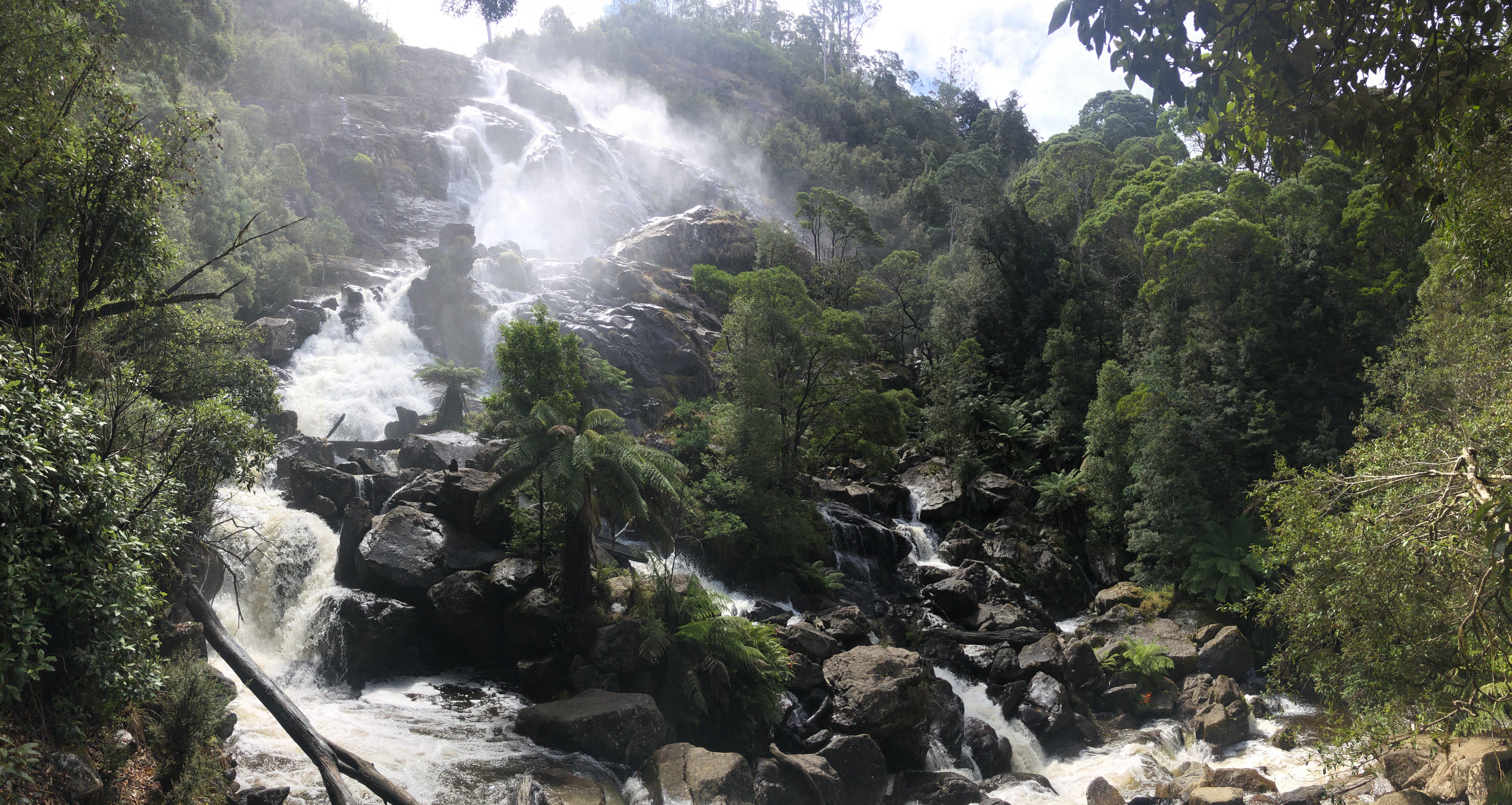
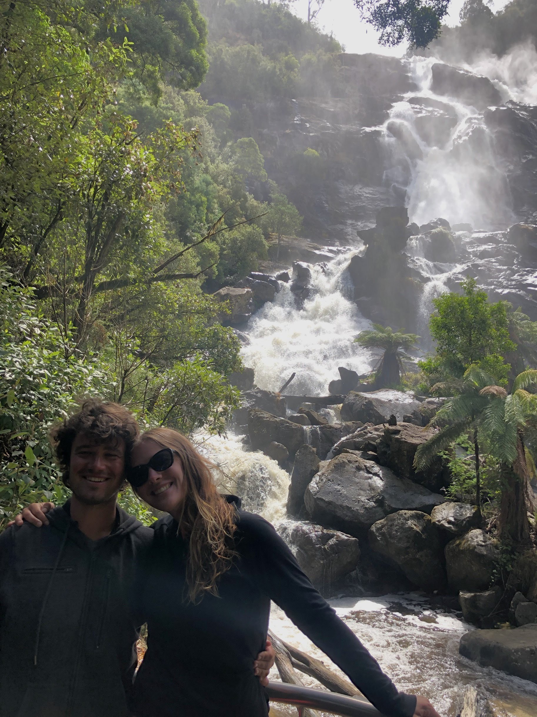
St Columba falls is a short drive from the Pub in the Paddock and Pyengana Dairy, and then a short cool walk through the rainforest from a car park, and can I just say they are well worth checking out – they were roaring when we arrived!
From St Columba/Pyengana we headed back out towards the coast to check out Friendly Beaches (yes, that’s a real place name), and ultimately heading for the Freycinet Peninsula. Driving through the beautiful pastures of inland north-eastern Tassie is such a change from the arid Australian plains.
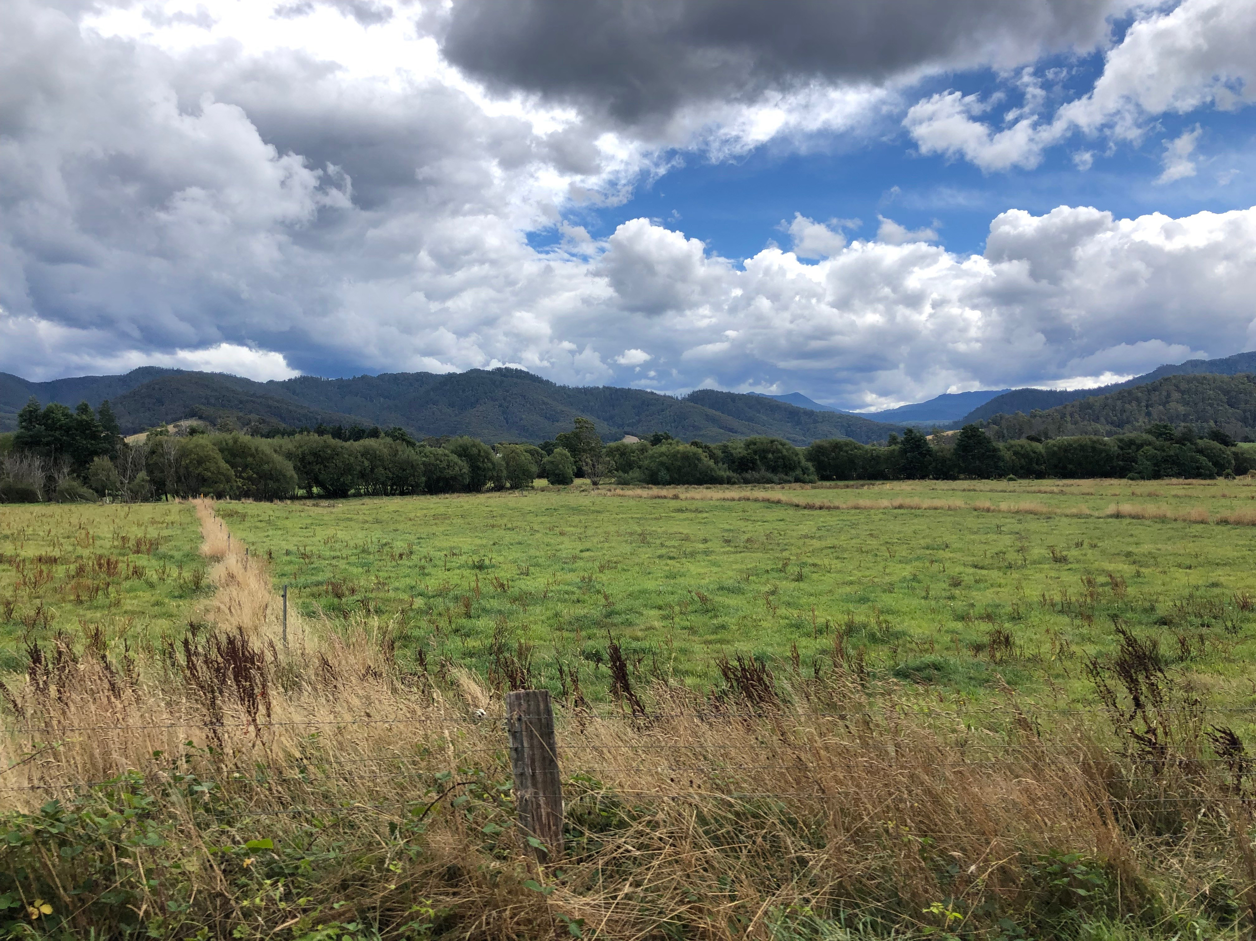
Actually, Tasmania reminded us quite a bit of New Zealand – it’s New Zealand with an Aussie flavour. Or Aussie, with a bit of Kiwi flavour. Take your pick.
A brief interlude here for a bit of a cautionary tale – in our Yorke Peninsula post I shared that we were now into truck stop and aquatic centre showers – where you can have a nice, hot shower for around $2-$5, and therefore don’t need to pay to stay at an expensive ($30-$50) caravan park campsite with showers. We discovered that we could have a $5 shower at the Pyengana Community Centre, and decided to stop in and partake. Well. The Pyengana Community Centre also happens to offer camping for $5 per person, based on an honesty box system. Unfortunately for us…we thought the showers and the camping used the same honesty box, and so we put $10 into the honesty box at the entry point…only to discover that the showers were coin-operated. At least the cold water still worked – and the showers themselves were clearly brand new and really nice – but a freezing cold shower certainly wasn’t what we were looking forward to!!
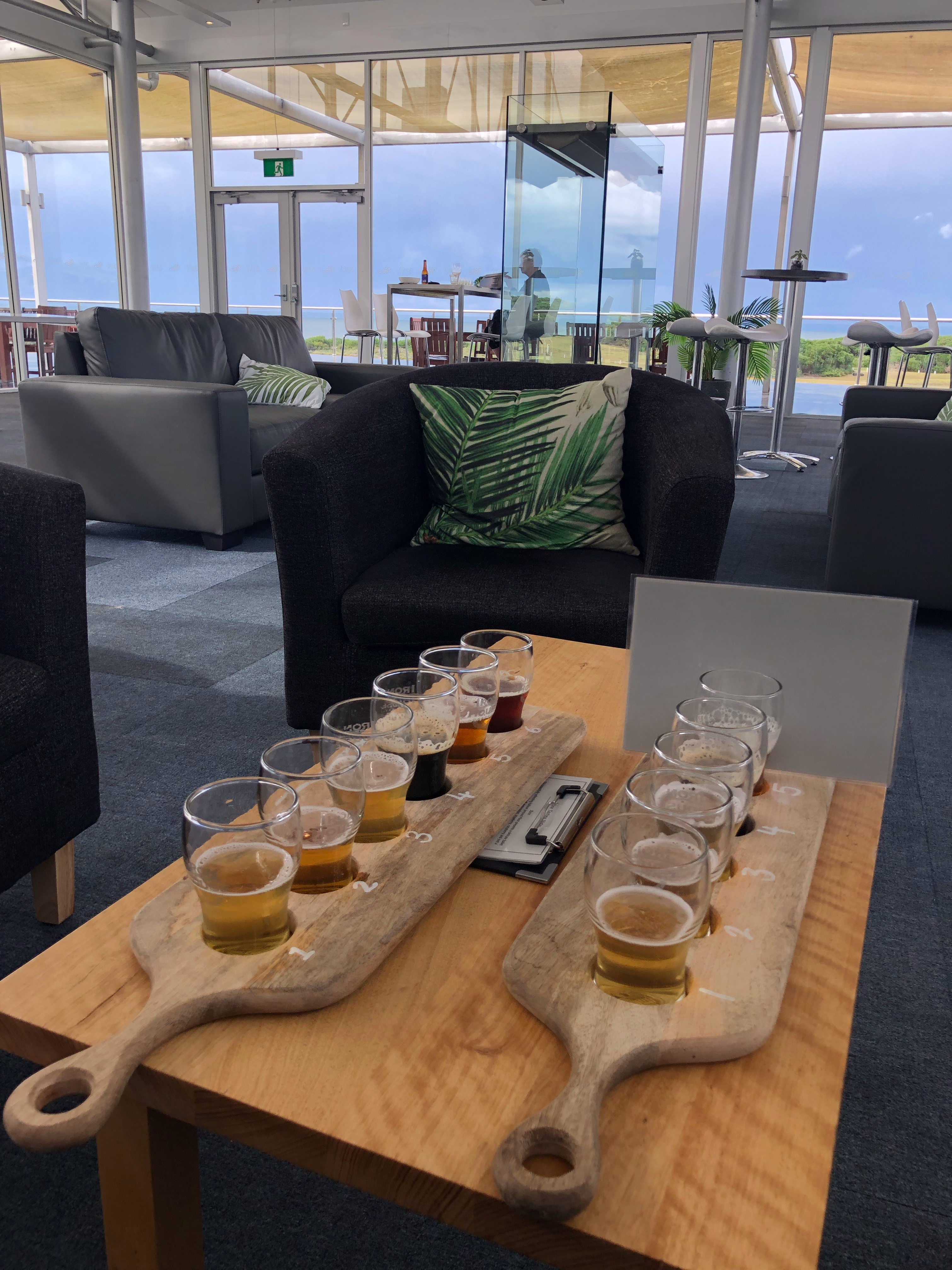
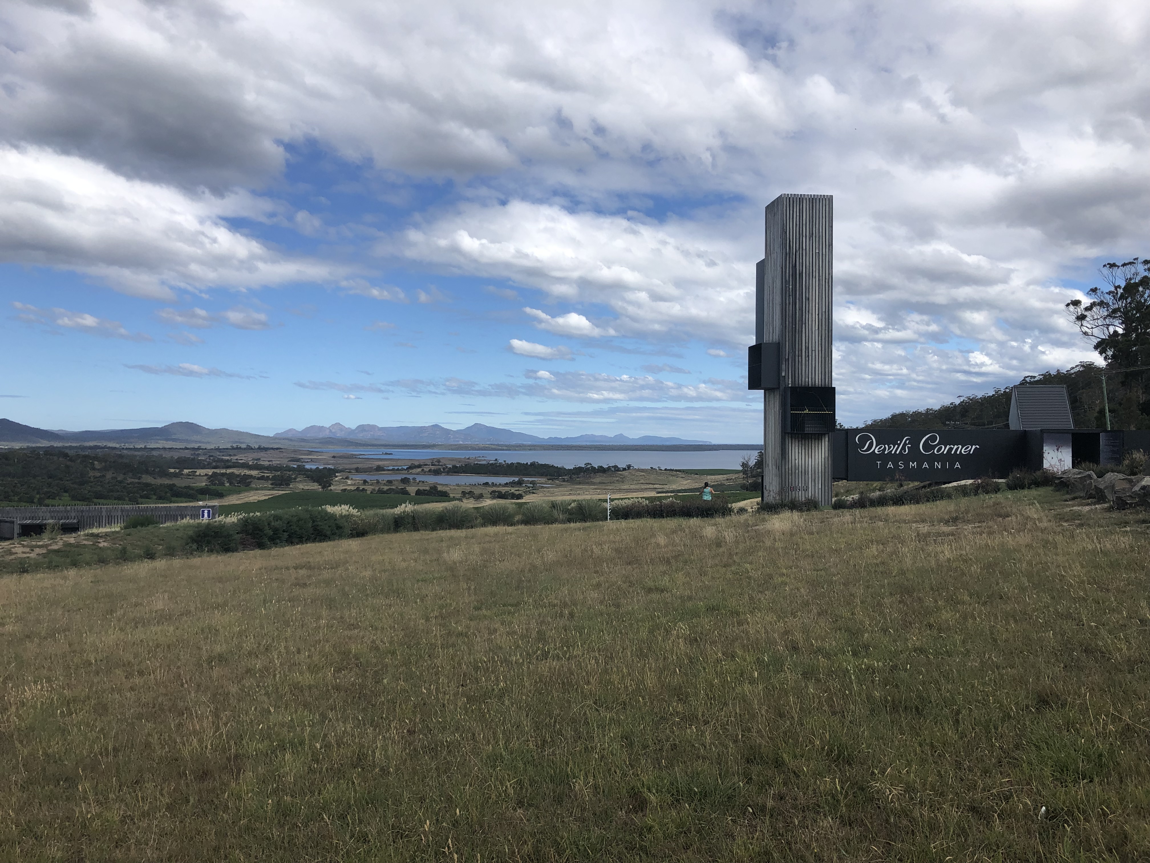
After our freezing cold showers, we decided to warm up by continuing on our sampling tour of Tassie’s food and drink – which, in hindsight, we definitely got sucked into and probably spent a bit too much time drinking and eating our way around – and made a couple of stops at the Iron House Brewery, and Devil’s Corner Winery.
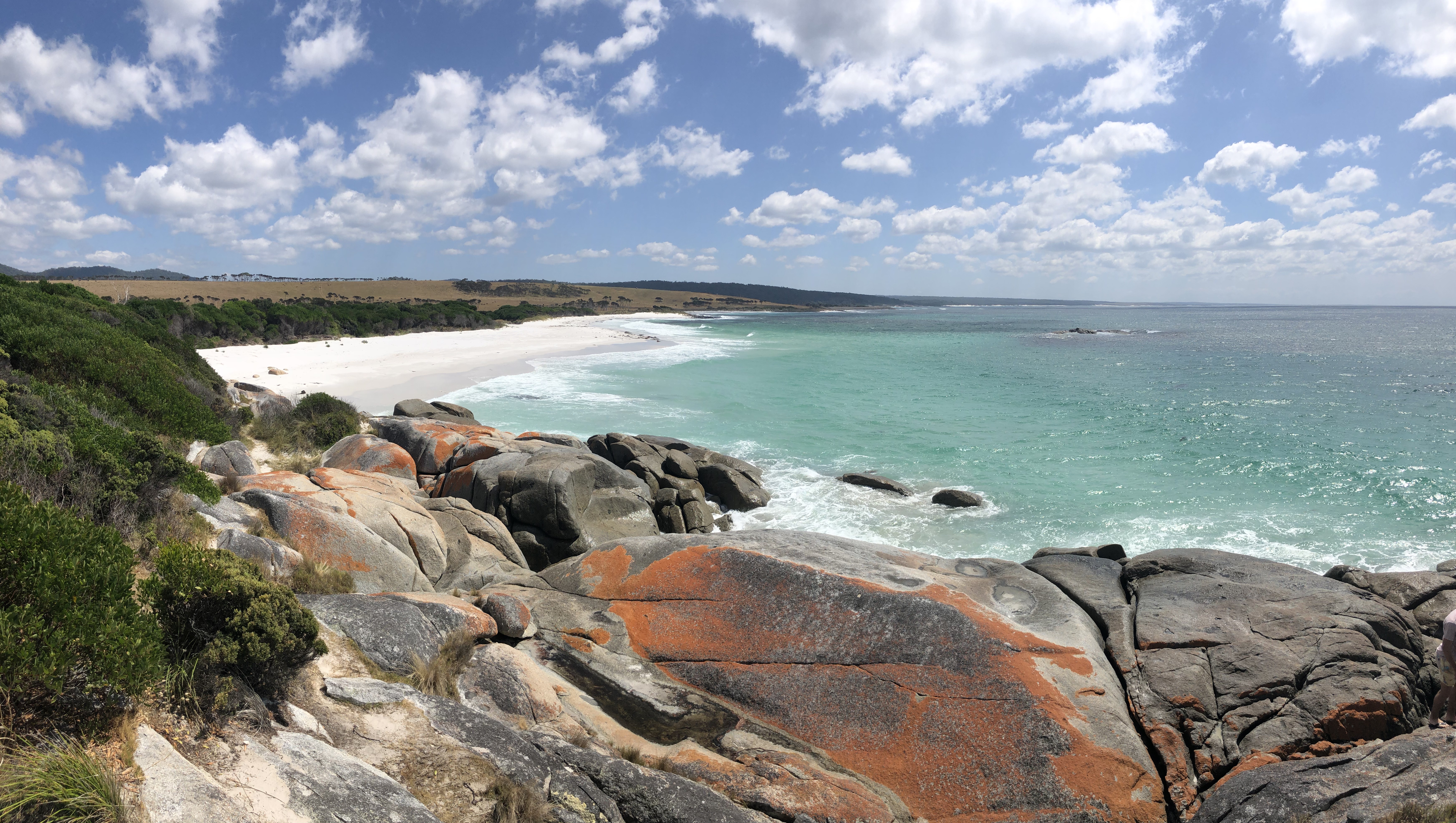
Thoroughly warmed, it was time to get back outside and go for a walk at Friendly Beaches, at the northern end of Freycinet National Park, and where there are more orange lichen-covered rocks and bright blue ocean beaches.
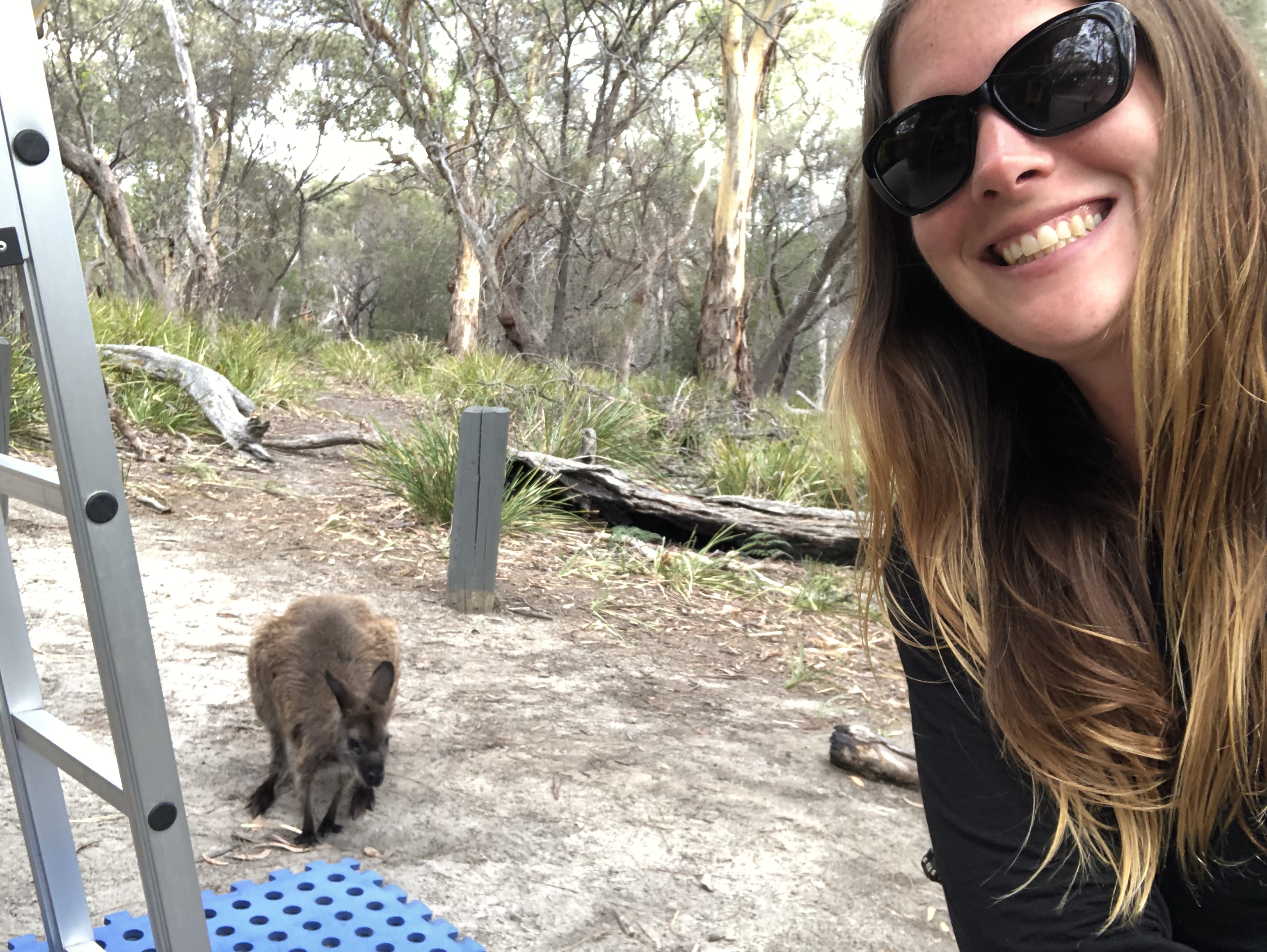
We camped up that night at Whitewater Wall, a free campsite at the north-eastern shore of Freycinet National Park, popular among 4 wheel drivers and rock climbers, and home to some overly friendly wallabies.
We had planned to camp close to Freycinet National Park because the park contains one of Australia / Tasmania’s most famous walks to one of Australia’s most famous beaches – Wineglass Bay.
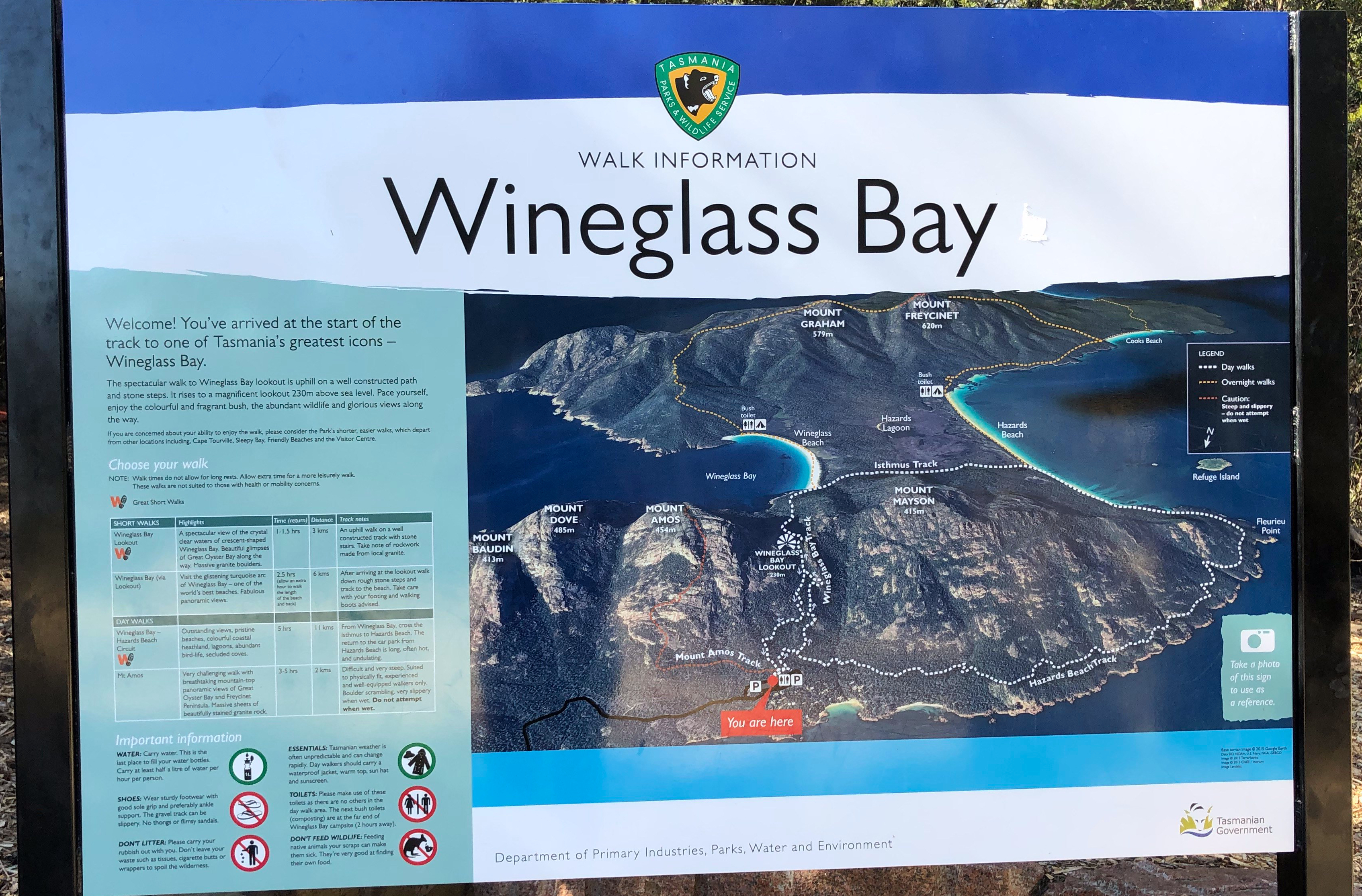
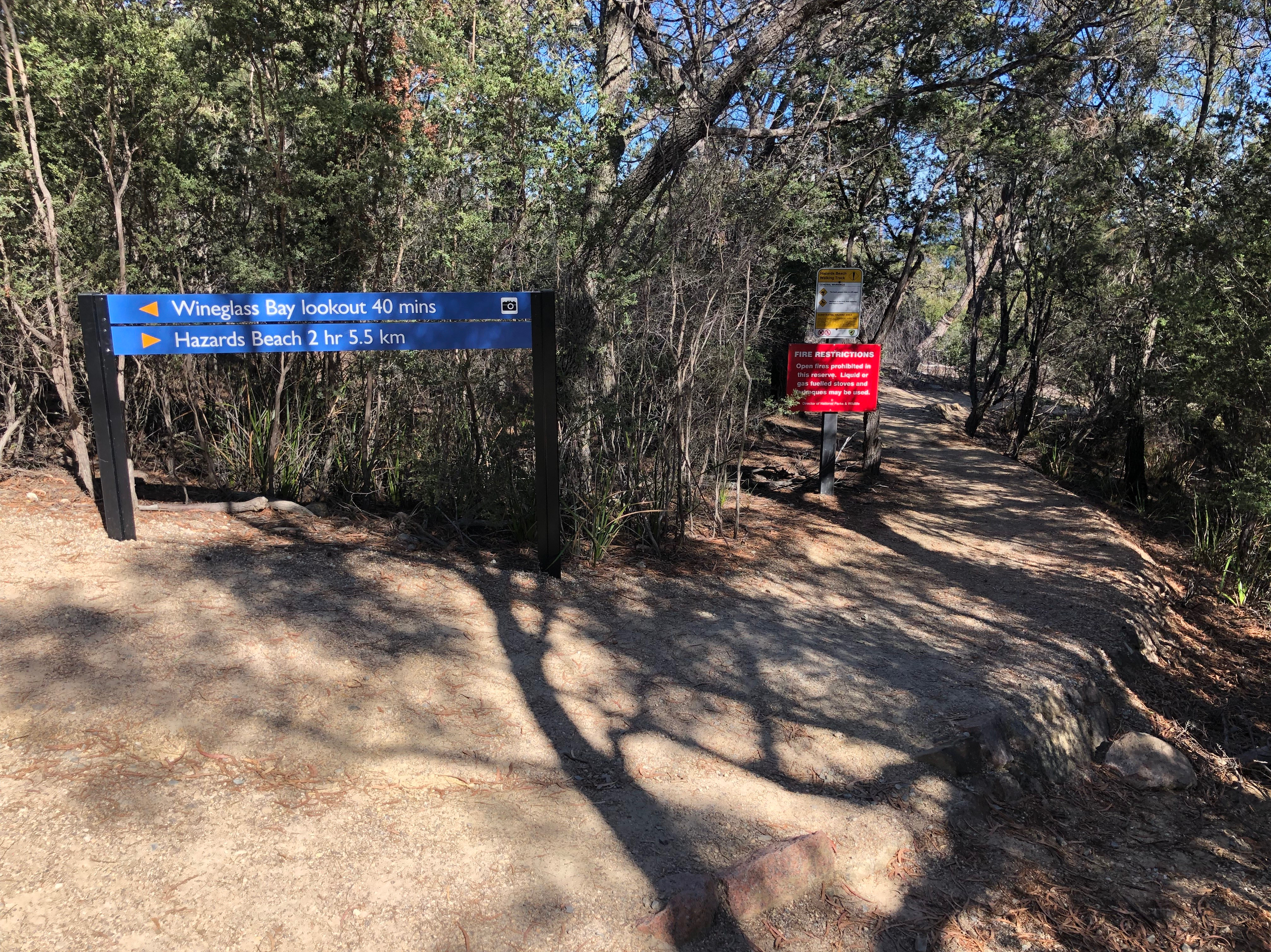
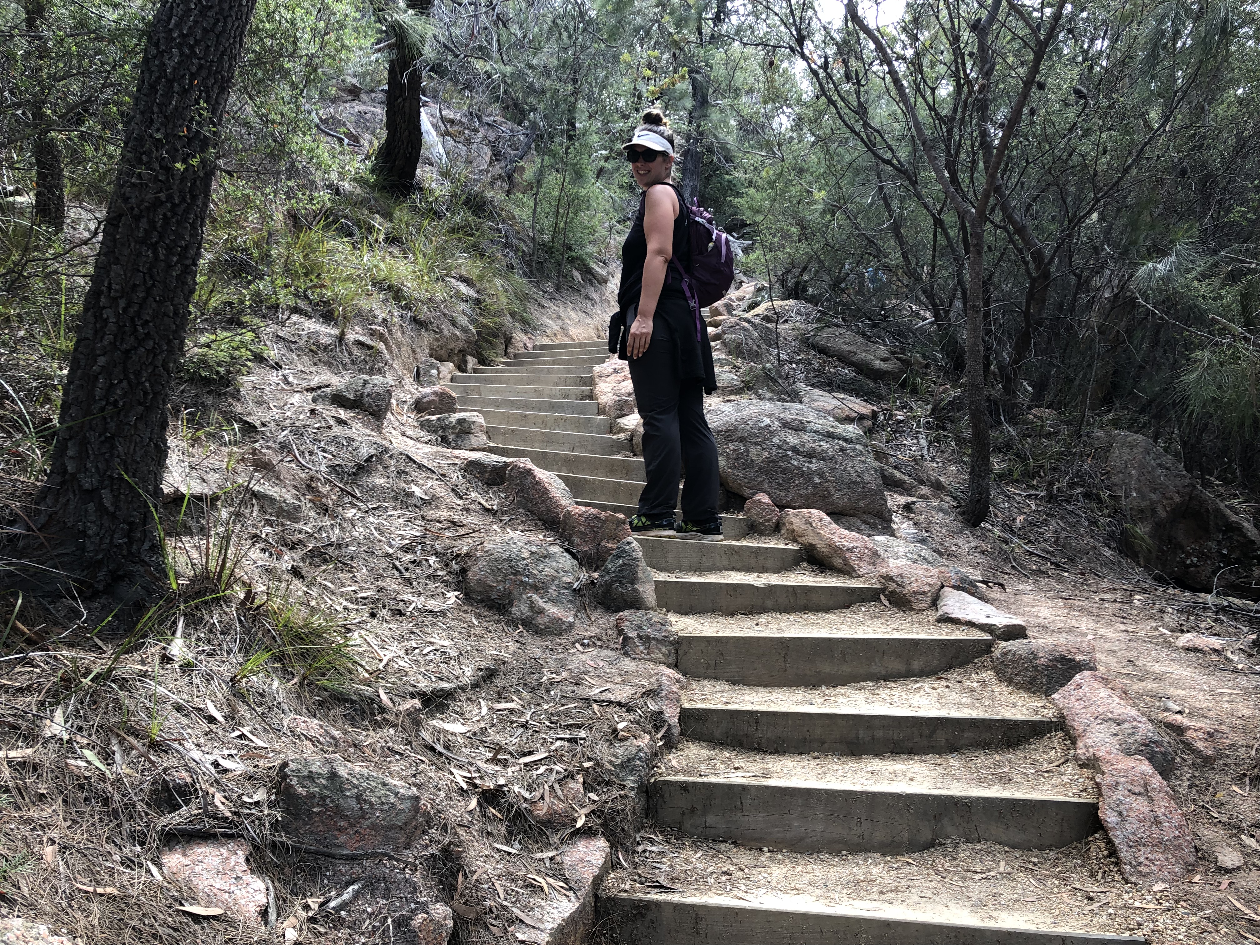
You can get to Wineglass Bay only a few ways (you can’t drive) – you can walk down and up a set of 1,000+ stairs, or you can walk in a loop track via the Hazards Beach track (the Hazards are a mountain range), or you can boat in! Boating is by far the least strenuous route, but sadly the Jeep is a bit too heavy to float and the snorkel isn’t quite long enough to classify her as a submersible. So, we chose the Hazards Loop Track because we like seeing as much as possible! But if you’re pressed for time, the out & back track is a good option, or even just walking to the lookout platform (about 40 minutes round trip) and having a peek from above.
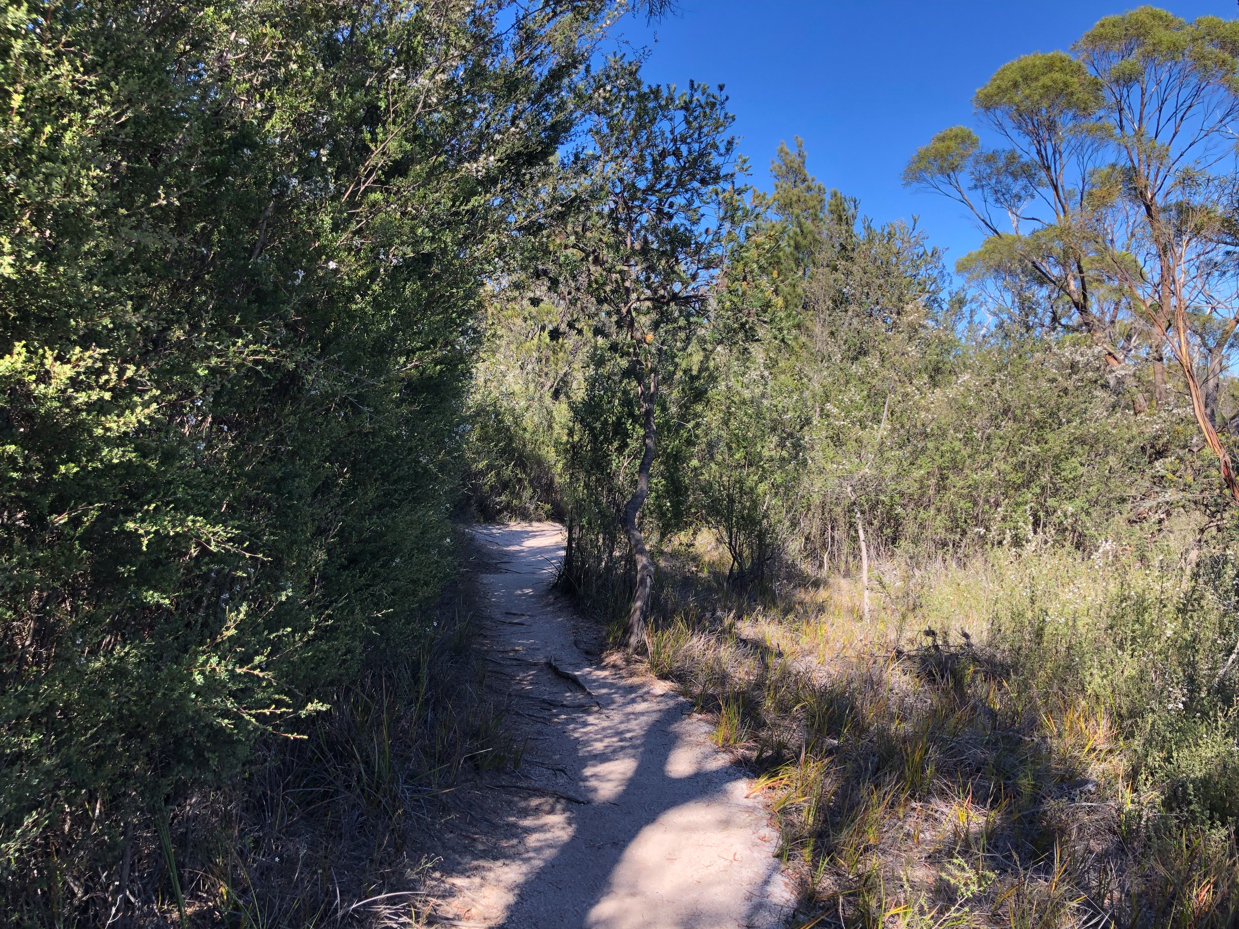
Most of the Hazards track is pretty easy going, taking a quiet winding route through the trees, and with quite a few photo opportunities along the way.
Once you finish the Hazards track and reach Hazards Beach, you then walk along the beach and across the isthmus of the Wineglass Bay peninsula, to reach Wineglass Bay itself.
Reaching Wineglass Bay was incredible…it really is as beautiful as it looks in photos. The white sand stretches along forever, and the water is crystal clear and turquoise blue. Yes, you’d better believe we went for a swim – although we didn’t last long, the Tasman Sea is bloody cold!!
By this point we’d walked about 11km – and had a bit of a swim – but we still had the rest of the track, along with those 1,000 stairs to climb ahead of us!! Ultimately we ended up walking 17.5km that day (which is 20,297 steps according to my Apple Watch), and climbed 106 storeys. Whew!!
Finally we made it to the lookout, and snapped a couple of photos while taking in the view.
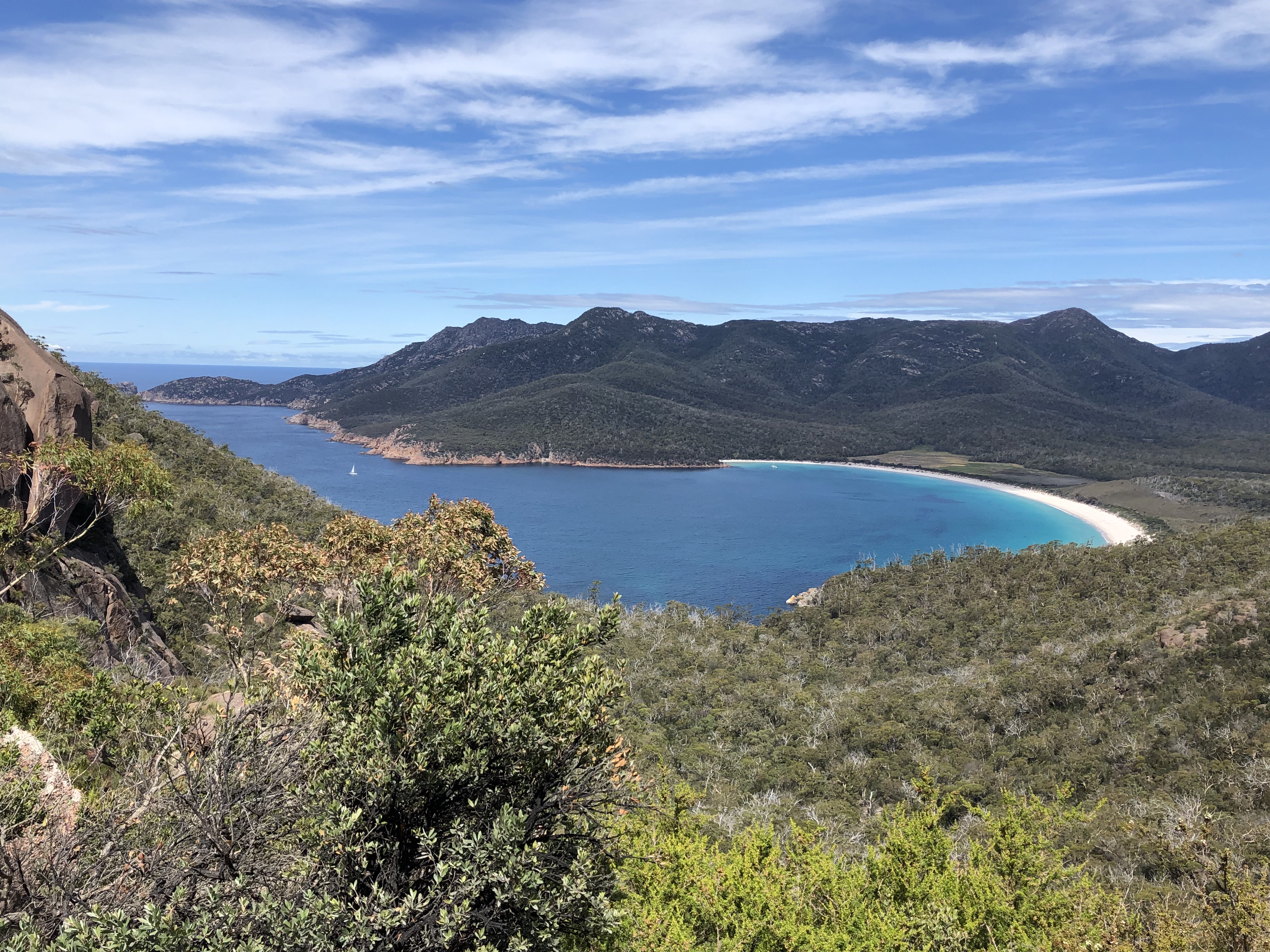
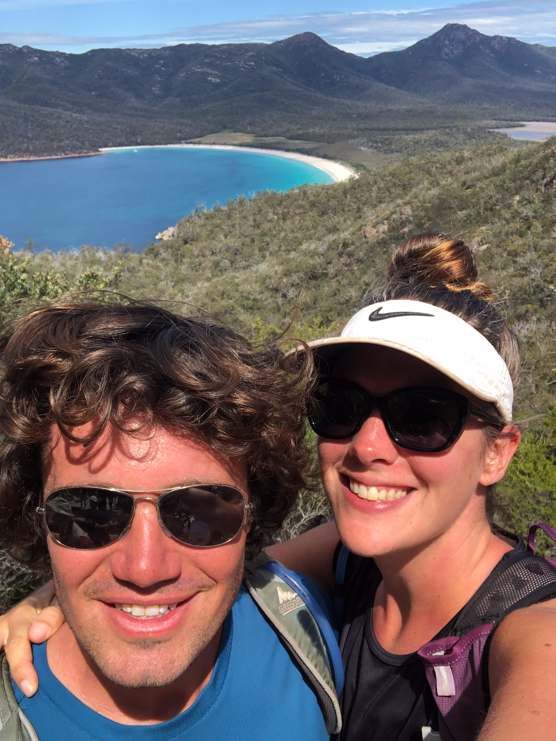
Wineglass Bay Lookout is a pretty popular place for tourists – even though we didn’t see too many other folks doing the hike, or on the beach itself – it seems like tons of people go to the lookout to snap a photo!
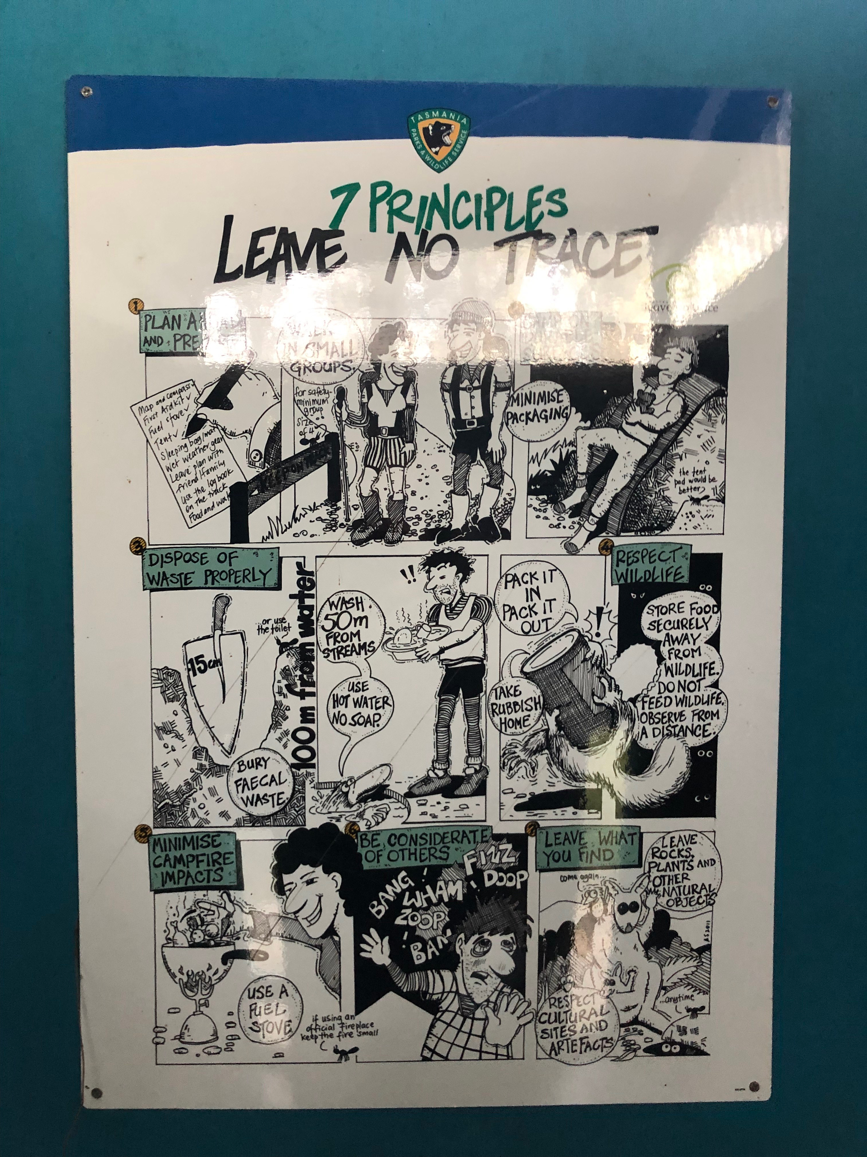
And speaking of tourists, here’s a special bonus sign from one of the campground toilets, helping to educate rookie campers, in what I thought was a cute and friendly way.
Next time – we hit up Port Arthur and the surrounding area, tackle another epic walk, and have the weirdest shower in all our months of travelling…

