Tasmania Part One: Bush Camps, Pademelons, Devil Screams, and RAIN!
Tasmania!!! Wow. This was another huge milestone in our trip. Thinking back to when Nick and I were in planning mode, and our friends and family were asking about our route, I would tell them that all we had planned for this far ahead was to spend February in Tasmania, since that’s the end of summer and when it would be warmest (Tassie has a reputation for being a bit cold, according to Aussies – and acclimated Aussies, like me).
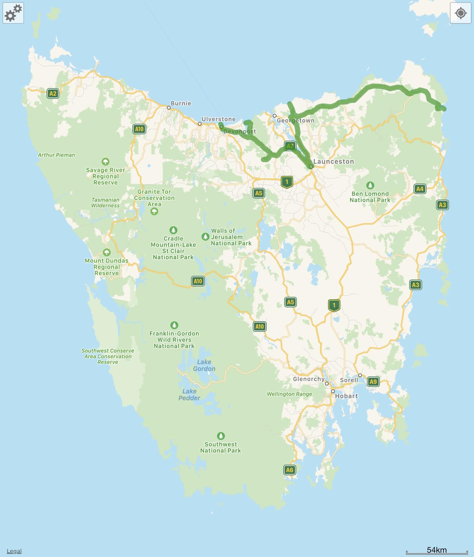
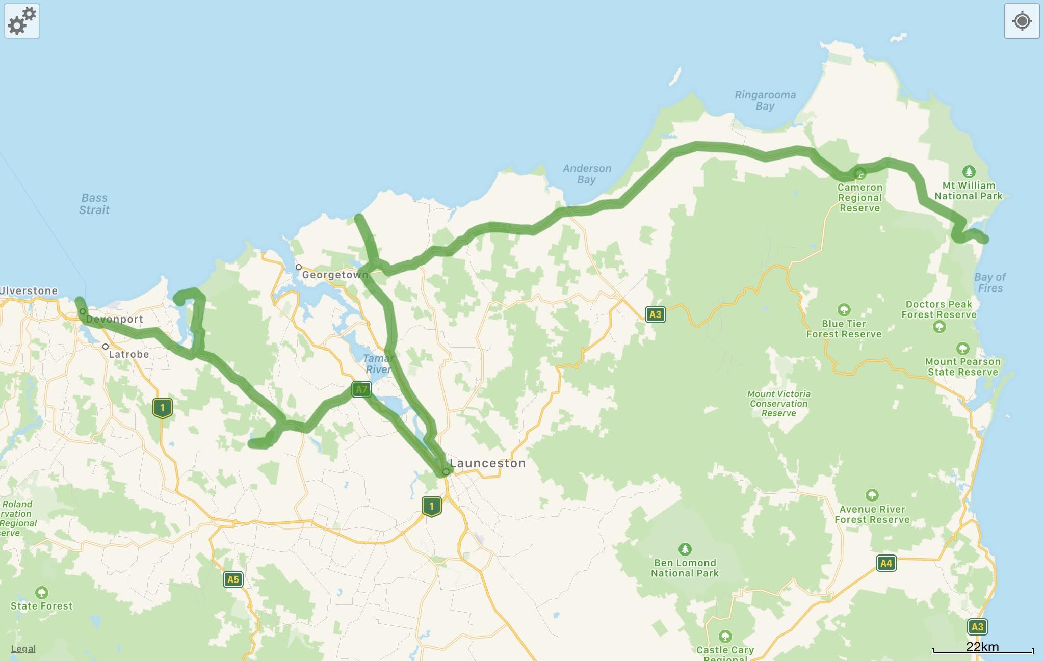
Here’s a map of the area I’ll be covering in this blog post, courtesy of our favourite camping app WikiCamps! There’s both a detailed map, and a map of all of Tasmania to help orient you to the rest of the post.
Our first stop the morning after we got off the ferry was a short drive east out of Devonport to Narawntapu National Park, on the north coast. We had originally intended to go west, to prioritise exploring the wild untouched coast of Tasmania, but had to change our plans due to the immense bushfires raging throughout the state.
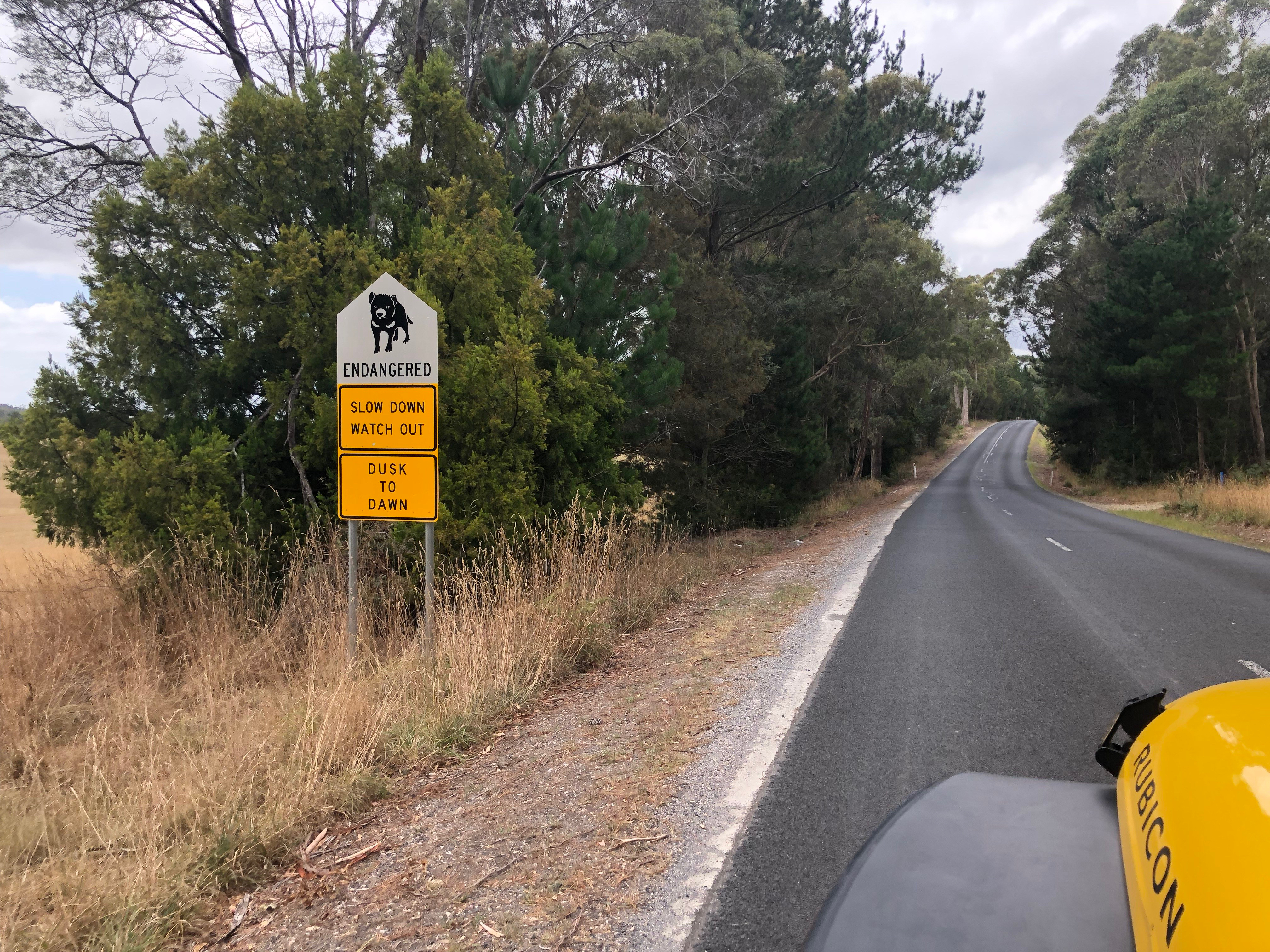
On our drive into Narawntapu, we saw this sign to slow down and watch for Tassie devils! Yes, Tasmanian devils are real – and their population has been devastated by a contagious cancer called, descriptively, Devil facial tumour disease. There are only about 15,000 devils left in the wild, and measures are under way to quarantine and isolate the healthy population in case they die out. We didn’t see any devils in the wild (except for a possible sighting of one quickly running through our campsite after dusk one night, it was too dark and too fast to tell), we DEFINITELY heard them – they scream at each other at night – sometimes quite close to our tent!
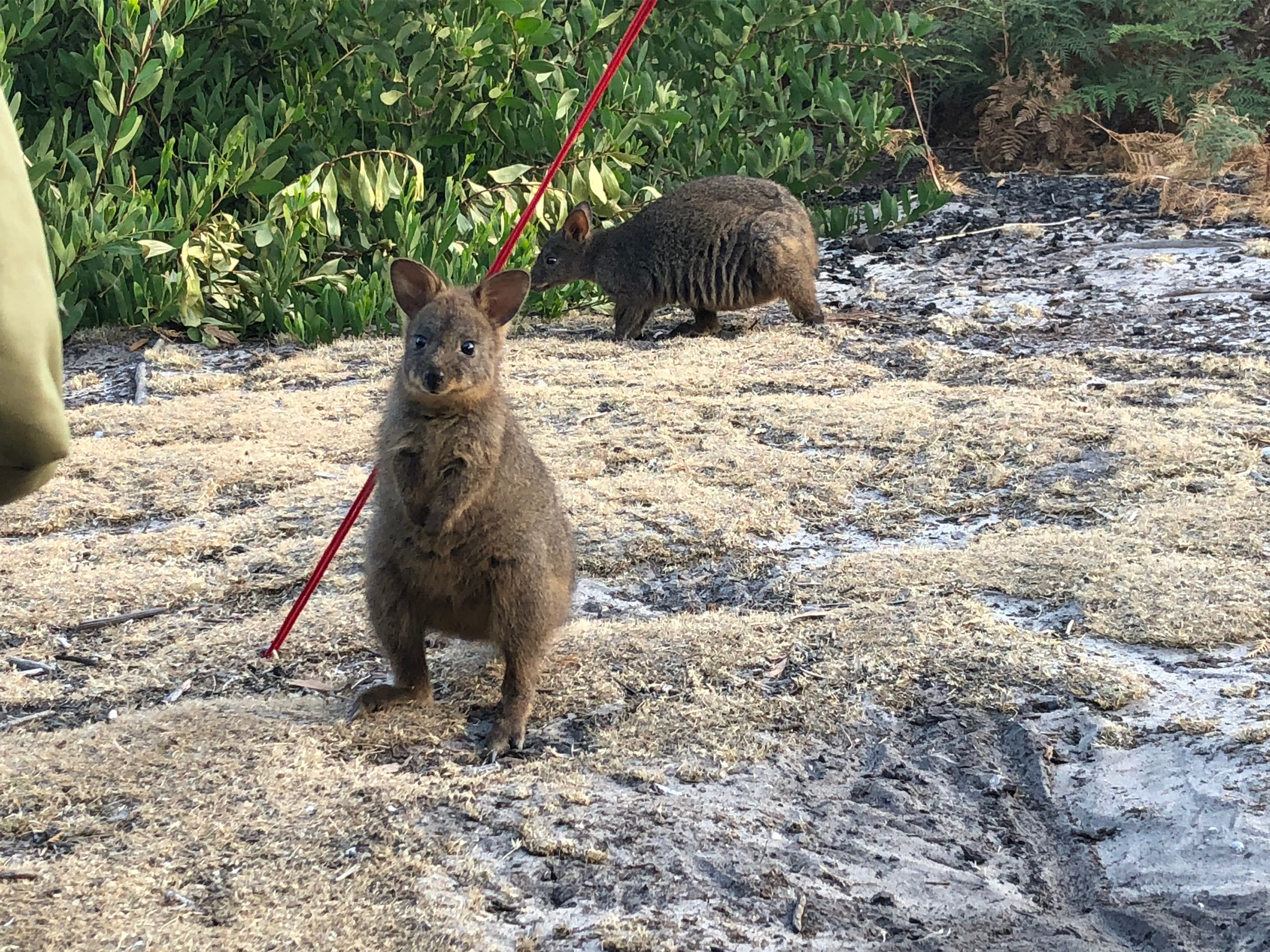
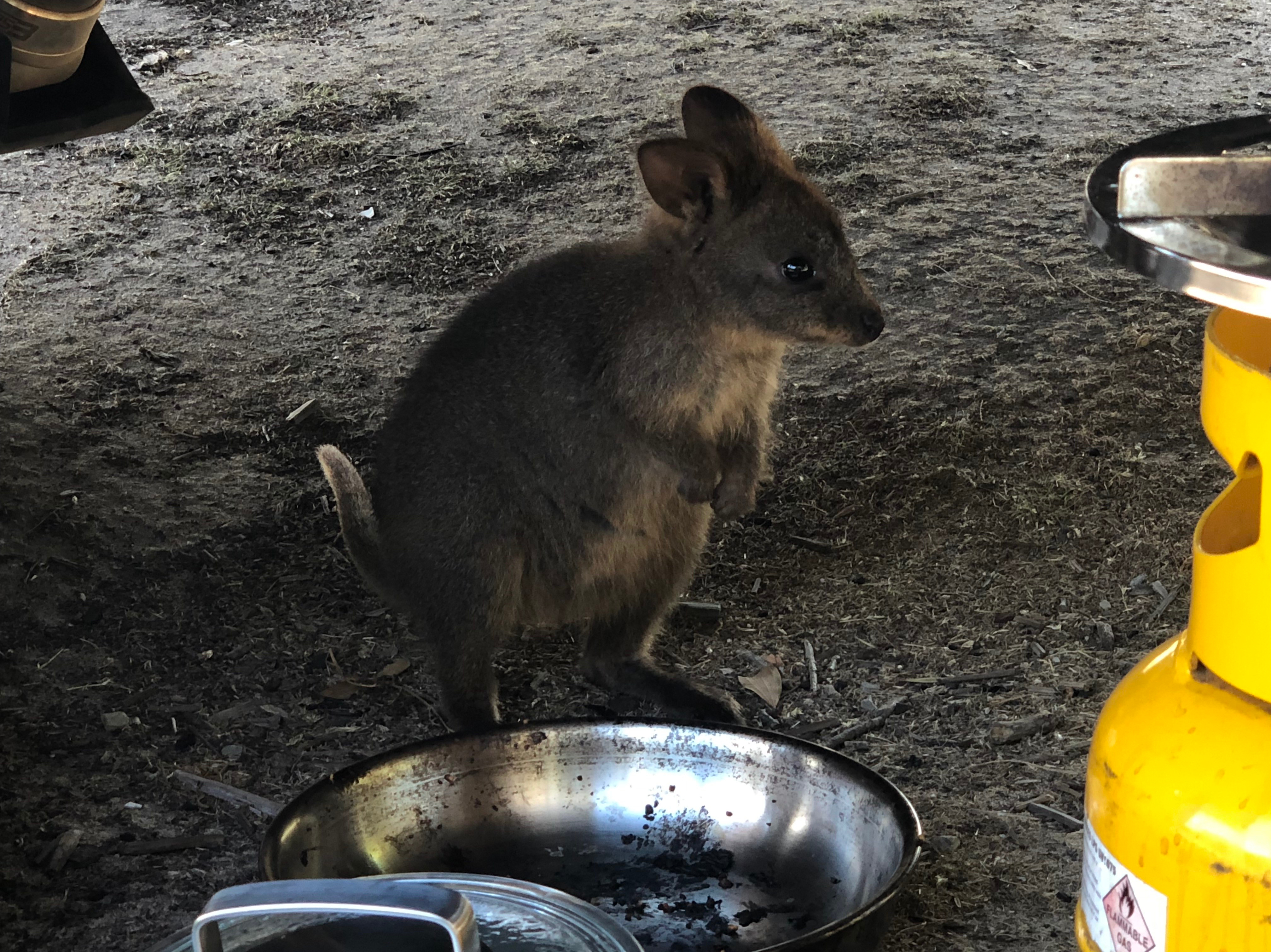
Even though we didn’t see any Tassie devils, we did meet these guys – they look like tiny kangaroos, and are called Tasmanian pademelons. They are absolutely adorable – and SUPER fat – so we took to just calling them “melons”. It’s evident that other campers (not us!) have been a little too generous with food scraps.
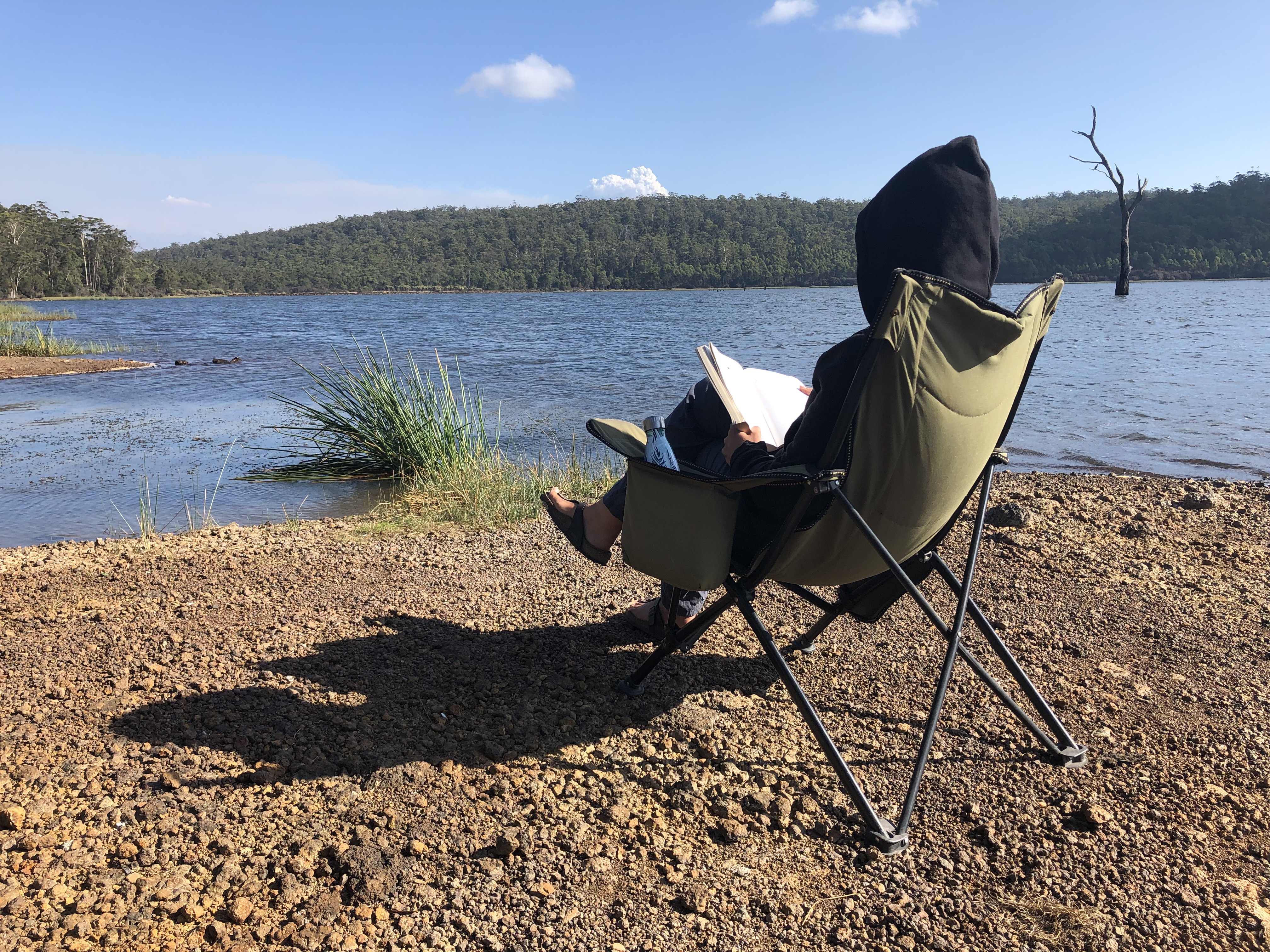
While camped up at Narawntapu, we took the opportunity to relax for two nights, write some blog posts, and swim at the nearby beach. The beaches in Tasmania were all really gorgeous, even though the water is super cold compared to Sydney! While we were there, I think the water temperature was probably around 17ºC to 20ºC (don’t want to stay in for long), compared to in Sydney near the end of Feb/beginning of March the water is up around 26ºC (nice and warm, can absolutely linger for as long as you want). Didn’t stop us, though.
Through the months of this sabbatical, one of the lessons we’ve learned is that if we spend time trying to move quickly, cover a lot of kilometres or a lot of sightseeing/activities, we’ll likely need a couple days break or quiet time after a week to ten days of hustle and bustle. Not only for life admin and connecting with family, but also just for our own sanity – turns out that it’s not very relaxing to be on the go all the time, even if you are on an extended holiday! We really had to zoom through South Australia and Victoria – so we were looking forward to a few two or three-night stays in Tassie.
However, we’re also the type of people who get bored with sticking around somewhere for too long (guess we’re the exploring type), so after two nights in Narawntapu communing with the pademelons, it was off to the next – this one with a bit of offroading involved!
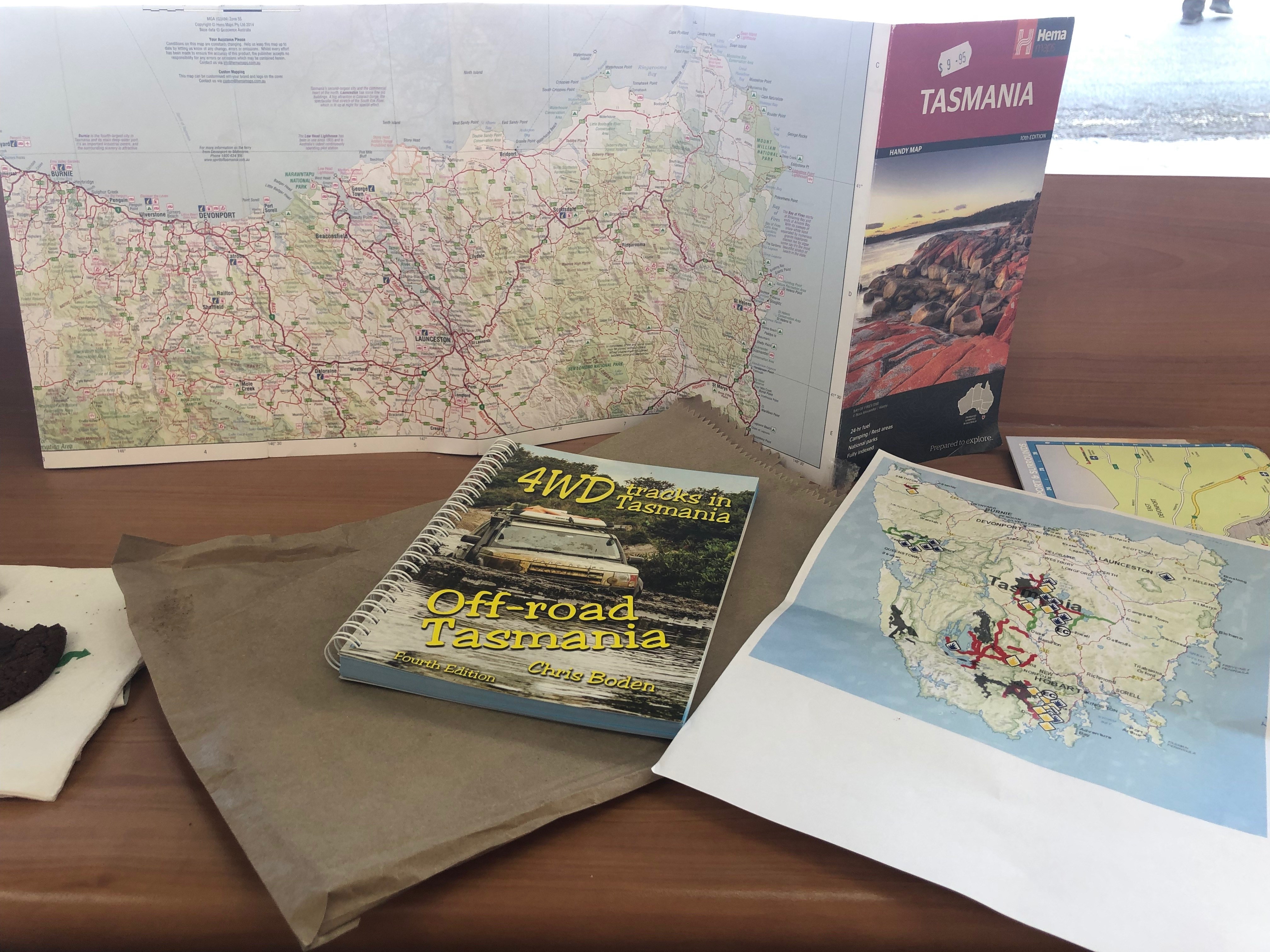
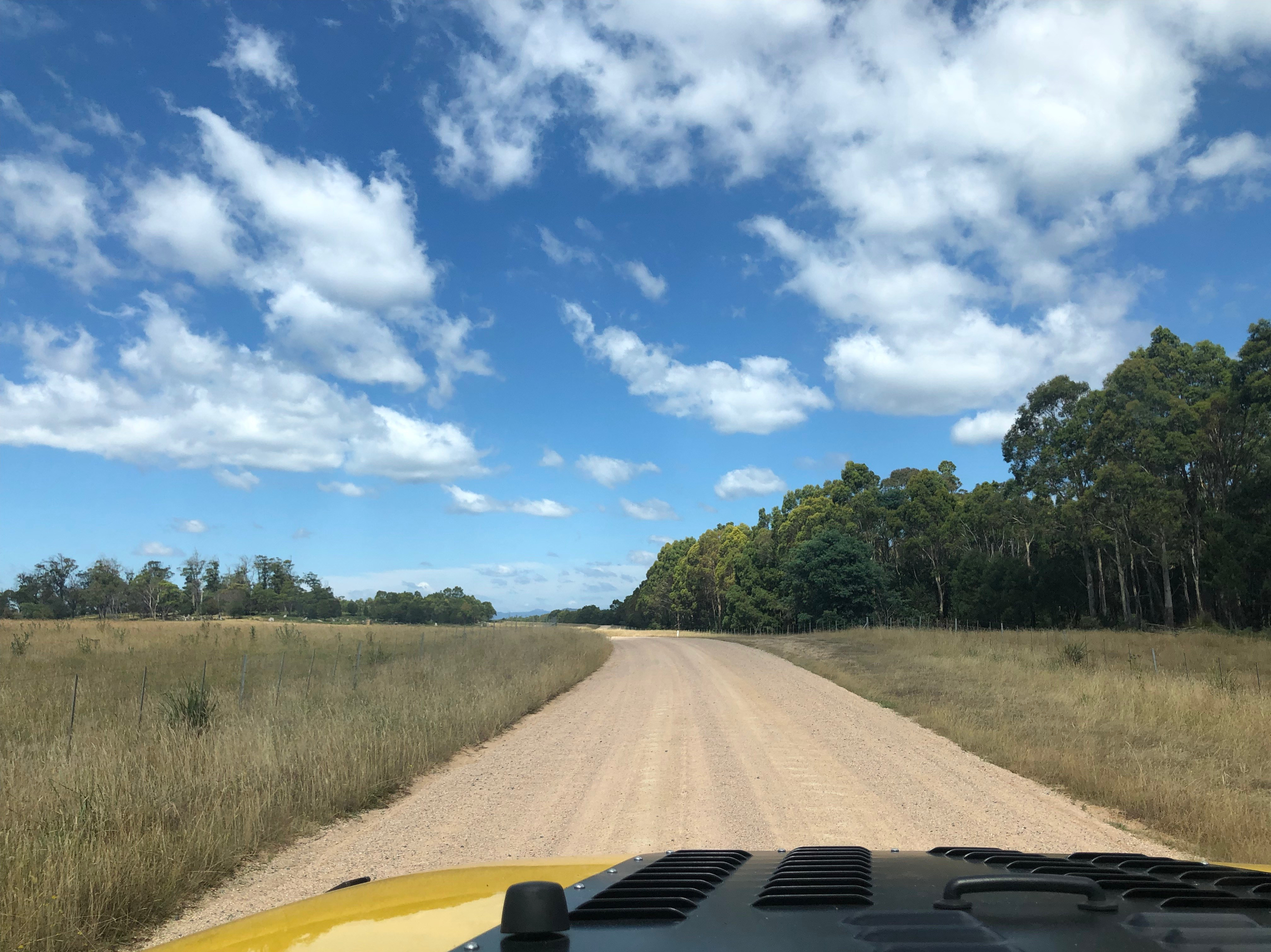
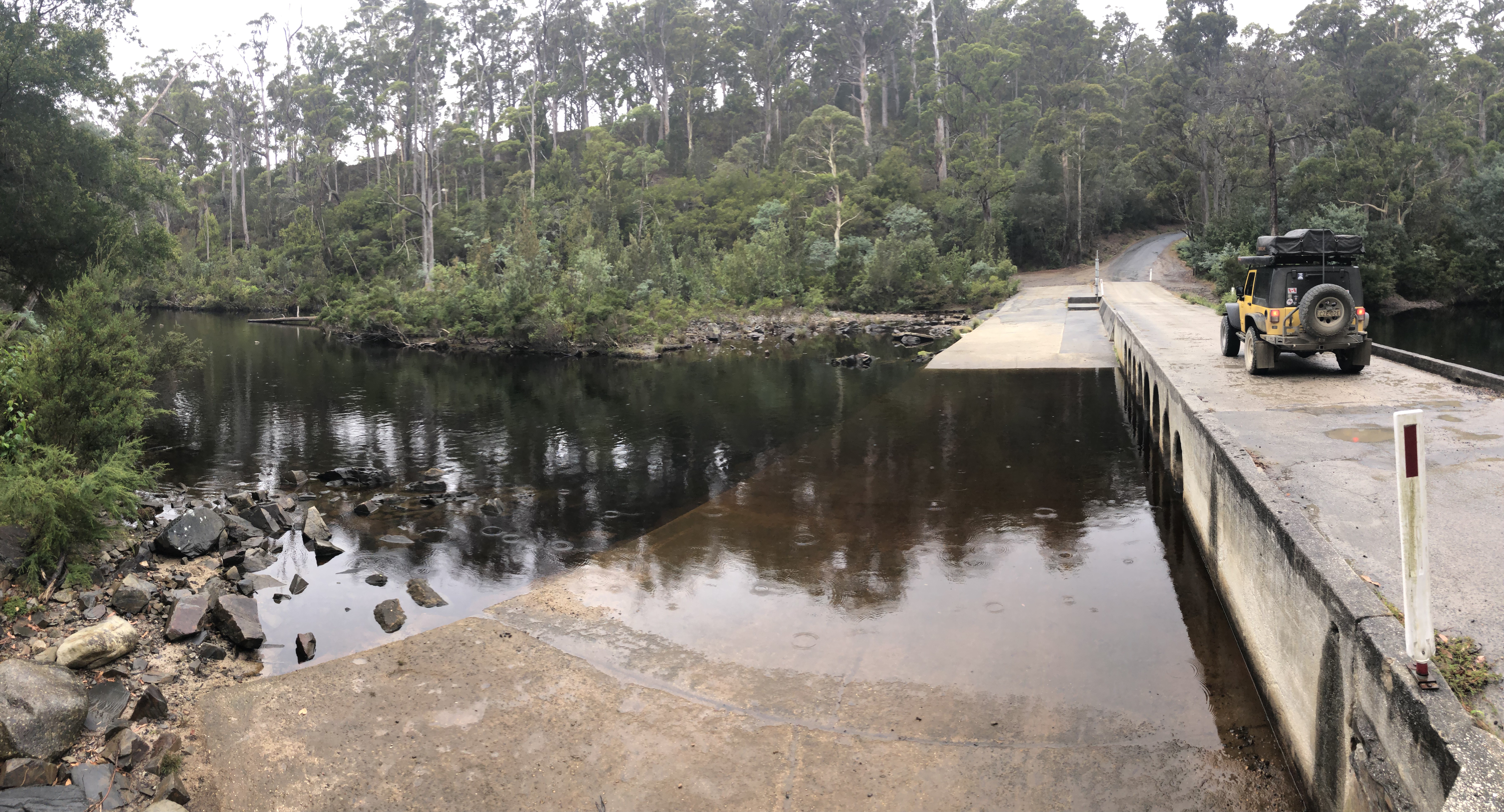
We had purchased this “4wd Tracks” book on the advice of the one and only Dave, who you may remember as the trip planner of the Simpson Desert Sydney Jeep Club trip at the beginning of our year off, back in July. This book, just like Dave, is full of local knowledge and great campsites that weren’t on WikiCamps. We certainly weren’t disappointed in our first selection of a track+campsite from the Tassie Tracks book! Check out the video for a short example of the track out – which was pretty much like this the whole way (really not too bad since it was so dry, but it’d be pretty muddy after a rain!):
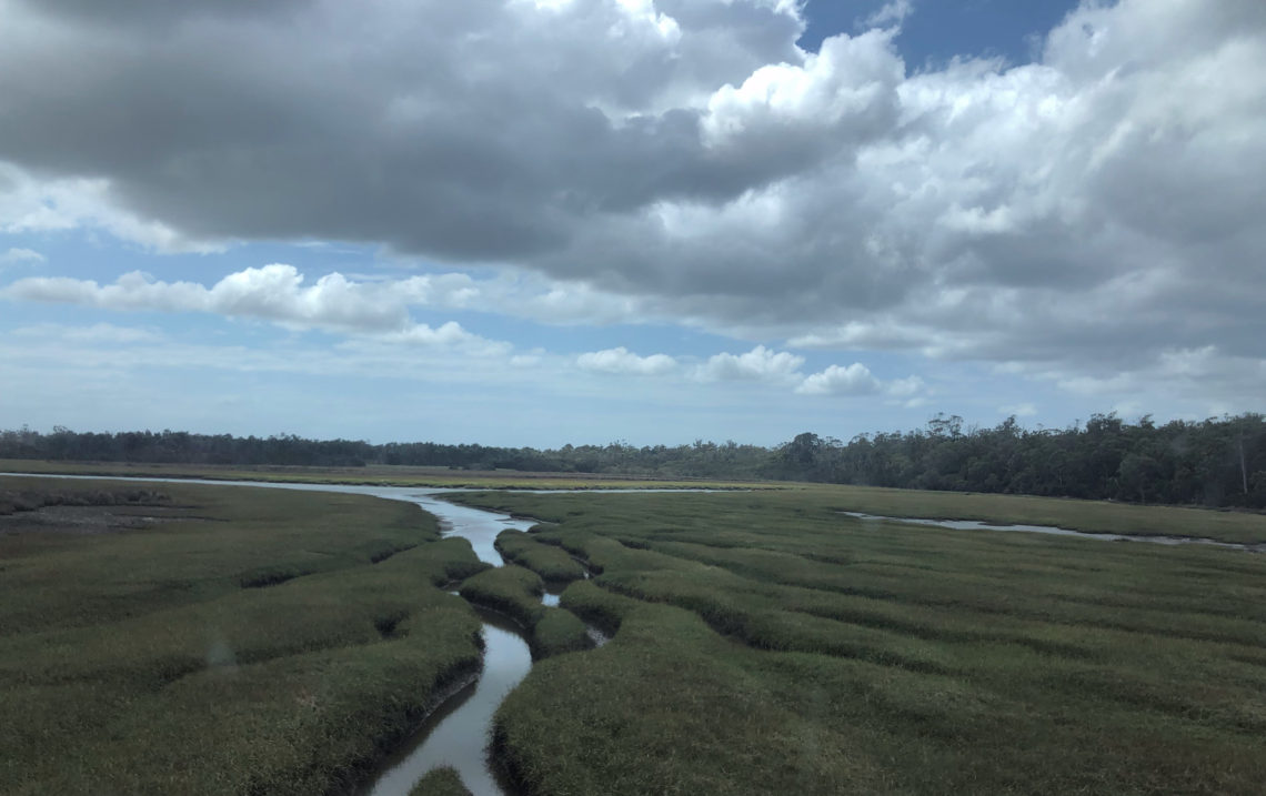
The track led us to a quiet and isolated camp site next to a peaceful lagoon – our favourite type of spot.
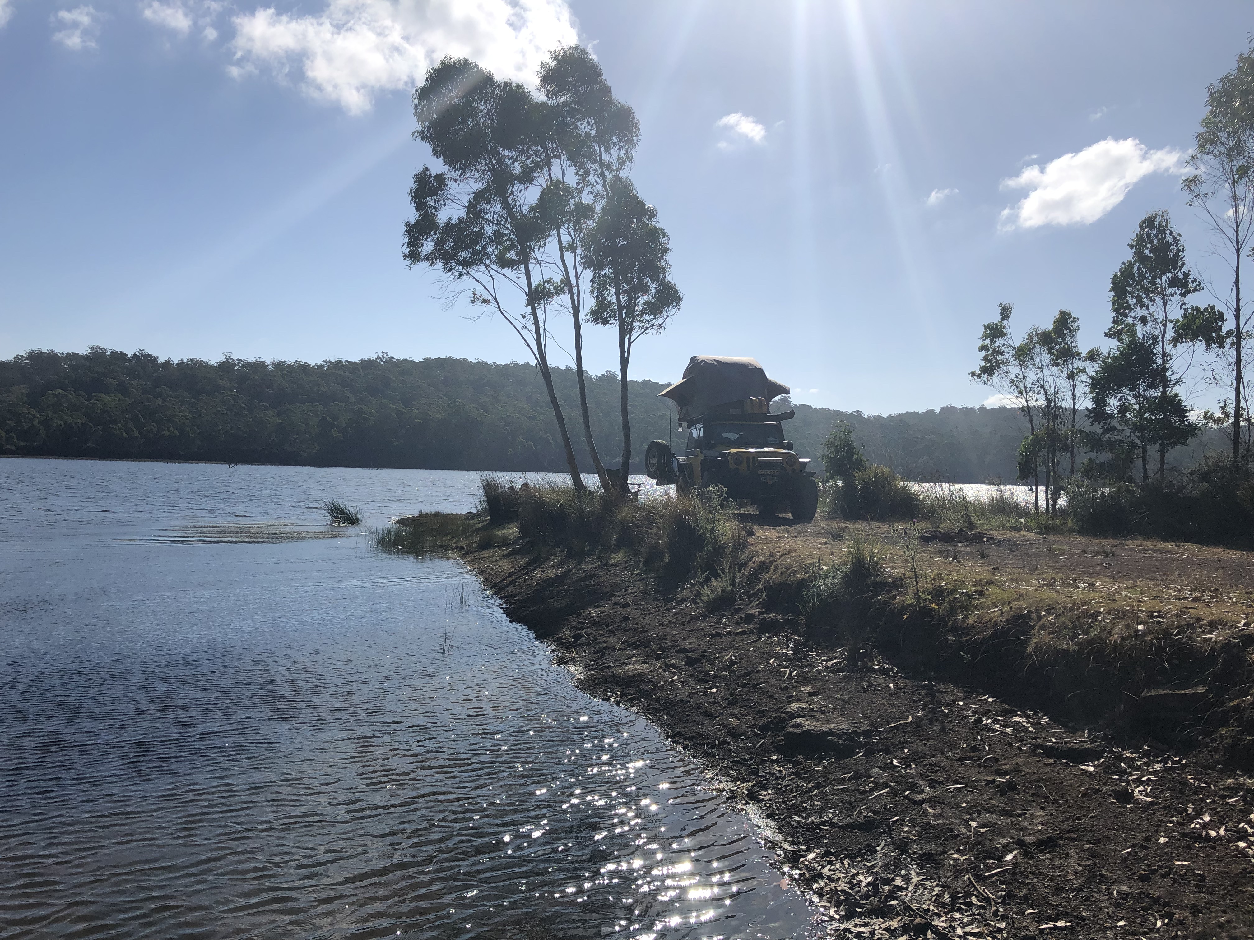
Just one night at Brushy Lagoon for us (I know…after telling you that we were looking forward to slowing down a bit), because there was rain in the forecast! We knew we’d have rain to look forward to in Tassie – it rains a lot there – and we weren’t fussed, because we’d had almost NO rain the whole trip from June to February so far, and certainly none worth planning ahead for – more like little drizzly showers that aren’t a worry at all. This storm ahead though, was set to drop about 35mm of rain on us and all those fires, so we knew we’d better pick a spot and be ready to wait it out.
Brushy Lagoon wasn’t going to be a suitable spot for rain, as it had no toilets, no mobile phone reception, and we thought the road out would get pretty slippery and muddy. We weren’t terribly interested in playing in the mud, since the last time we did while up in Cape York we broke our winch rope and a wheel speed sensor. No thanks. We wanted somewhere on relatively high ground, accessible on bitumen, with toilets, and with mobile reception so we could wait out the rain by watching movies and staying cosy in the tent.
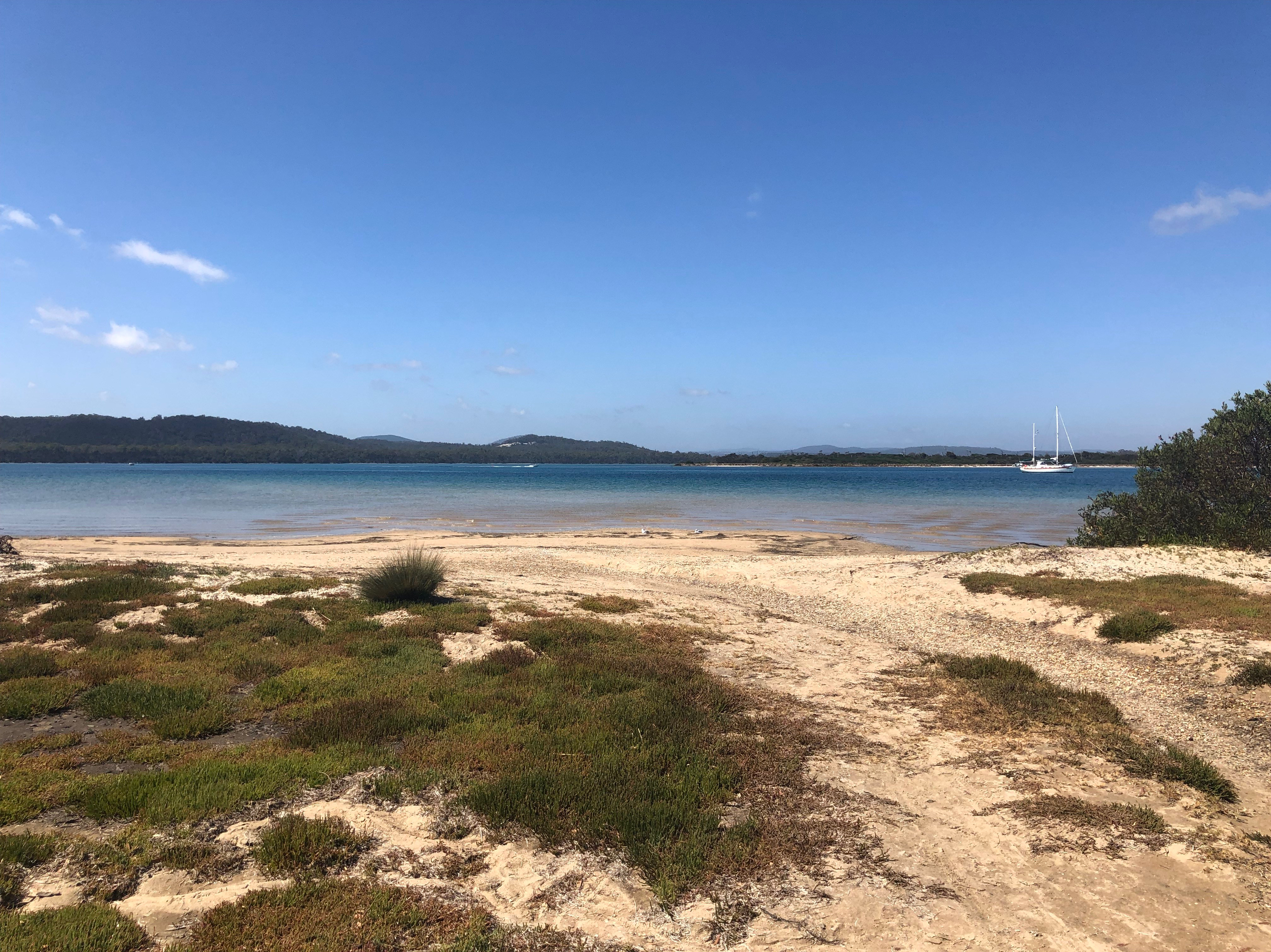
After talking to some other campers, we decided to head to Policeman’s Point, up on the northeast coast at the north end of the famous Bay of Fires. The Bay of Fires is one of the most beautiful stretches of beach in the world, and was next on our list to explore once the rains stopped in a couple of days.
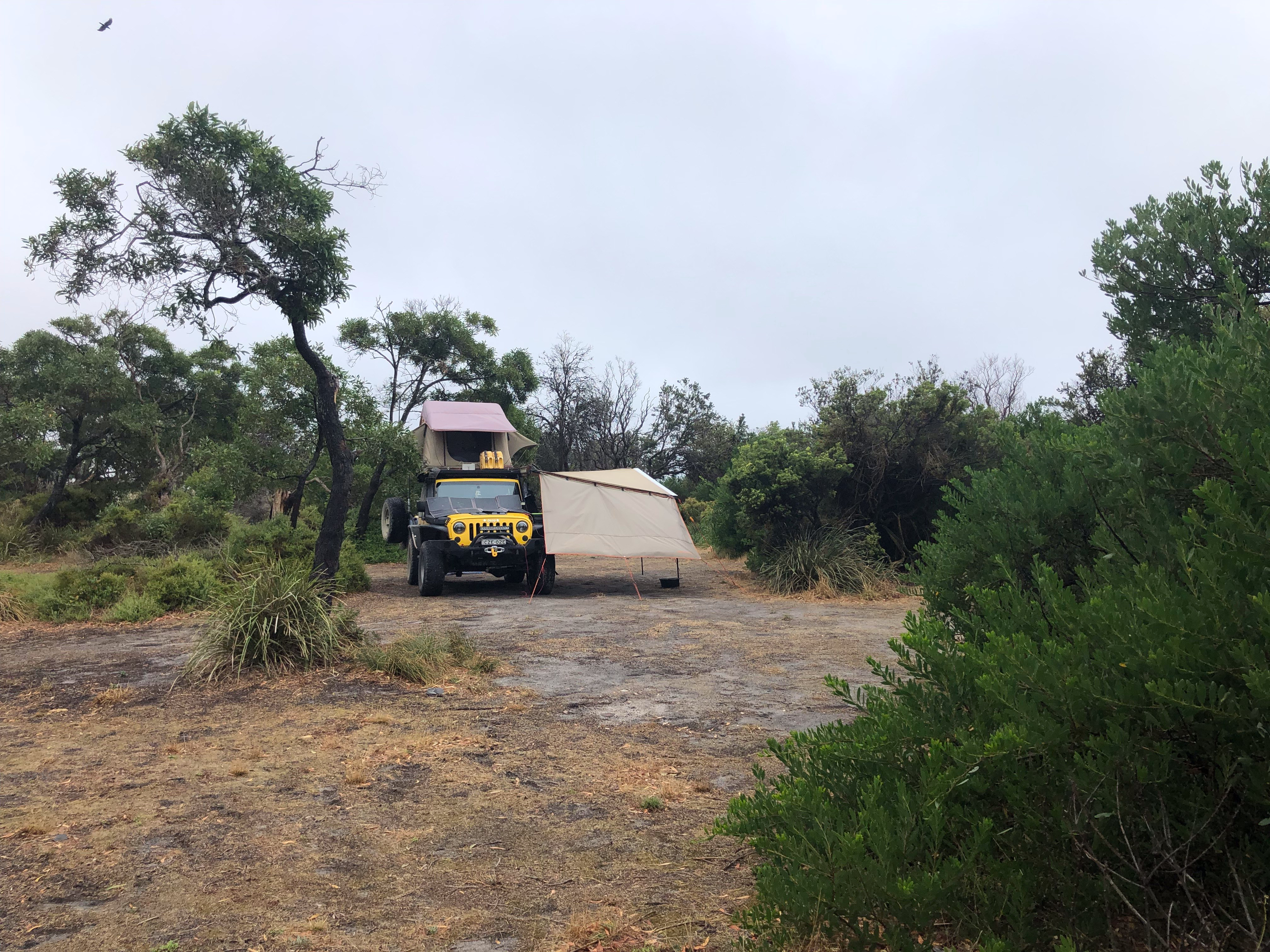
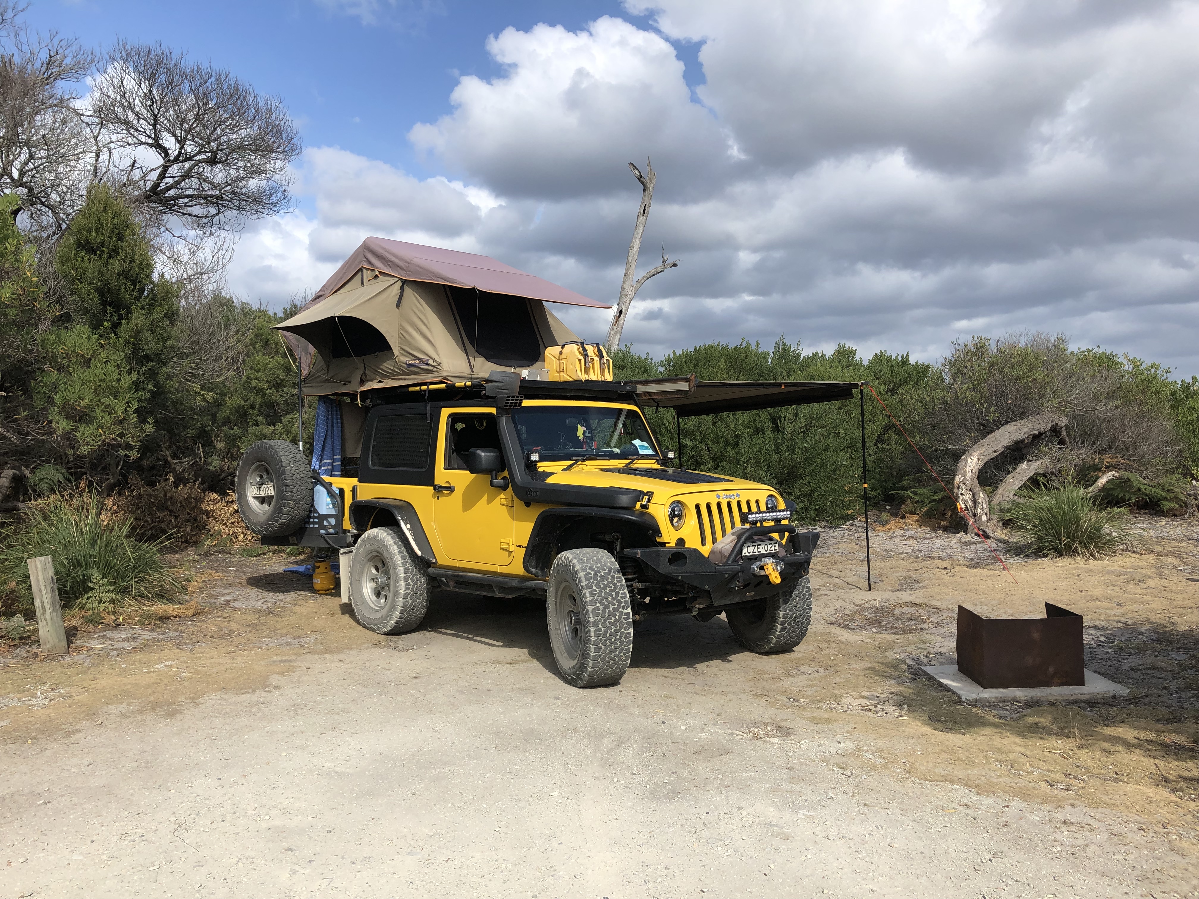
Our rain setup is pretty simple – we pull out the awning and extension, make sure to drop one corner of the awning so water doesn’t pool in the middle, guy wire everything securely, and put a bucket under the corner to catch rain water for dishes or washing mud off feet. Nothing changes with the tent, except we do put down the rain fly if there’s driving rain coming into the tent from one direction or another. At the back of the Jeep, the overhang of the tent provides shelter for cooking and rummaging through our things. It works really, really well! We’re very happy with our setup. And good thing too, because check this out…did it ever POUR.
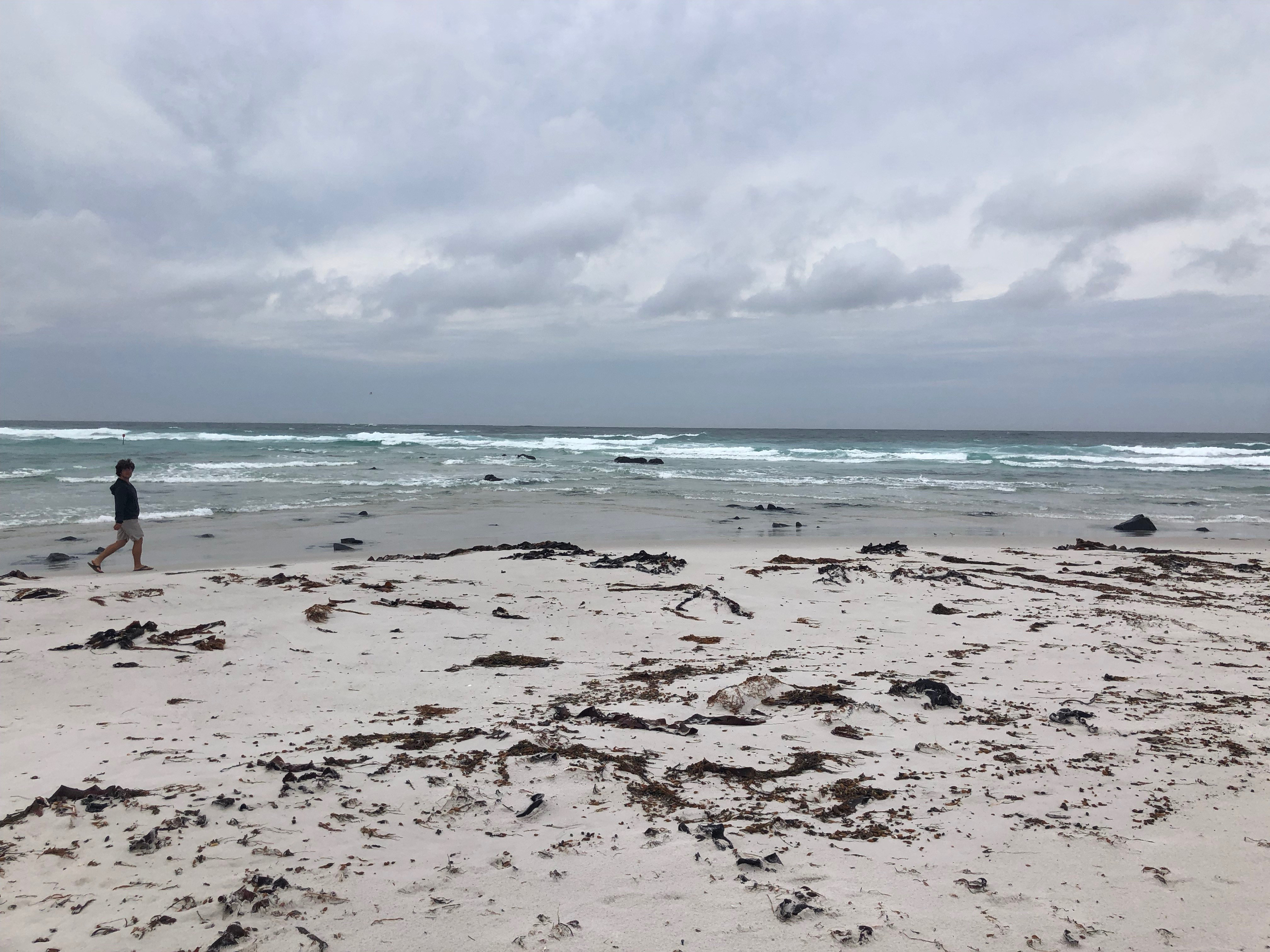
This downpour was super helpful to calm some of the raging fires around Tas, but the rain didn’t last too long and by the afternoon that day we were even able to go for a stroll along the still-stormy beach.
And then, by the next day, the sun was out again, the puddles drying up, and we were off once more to explore gorgeous Tasmania, starting with the Bay of Fires!