Flinders Ranges to Copley
Psst, have you seen our InReach map yet? If you’re ever curious to see where we are right now, our satellite communicator (InReach, by Garmin) auto-pings a map every 10 minutes when we’re on the move! Check it out at http://share.garmin.com/nickandpam (and you’ll notice we’re a liiiiitle behind in blog posts at the moment).
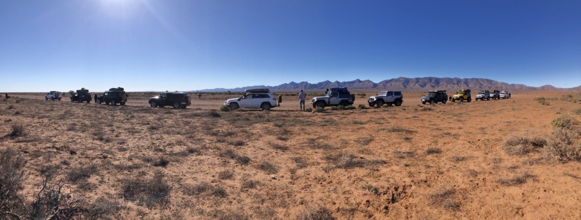
After a day of running errands in nearby Hawker, we returned to Wilpena Pound to meet up with the Sydney Jeep Club for the Simpson Desert crossing portion of our trip! It’s much safer to attempt crossing remote areas with a convoy of, I would say, at least 4 vehicles, preferably 6 to 7, and we had a convoy of wait for it…13 Jeeps!! (Well, 11 Jeeps and 2 Toyotas whose drivers couldn’t bring their Jeeps for whatever reason) Nick and I were super happy and thankful to the organiser (hi Dave!) for arranging the itinerary and herding all of the Jeeps and Jeep drivers well up to the day of the trip. And, we were sooo excited to see the familiar faces of our friends, and make new friends with the trip members we hadn’t met yet!

The first leg of the Jeep itinerary was to drive a short distance from Wilpena Pound to Copley – only 202km – but passing by a few points of interest along the way, like the Brachina Gorge drive I mentioned in the last post, where the Jeep club members were also fortunate enough to spot a few yellow-footed rock wallabies!
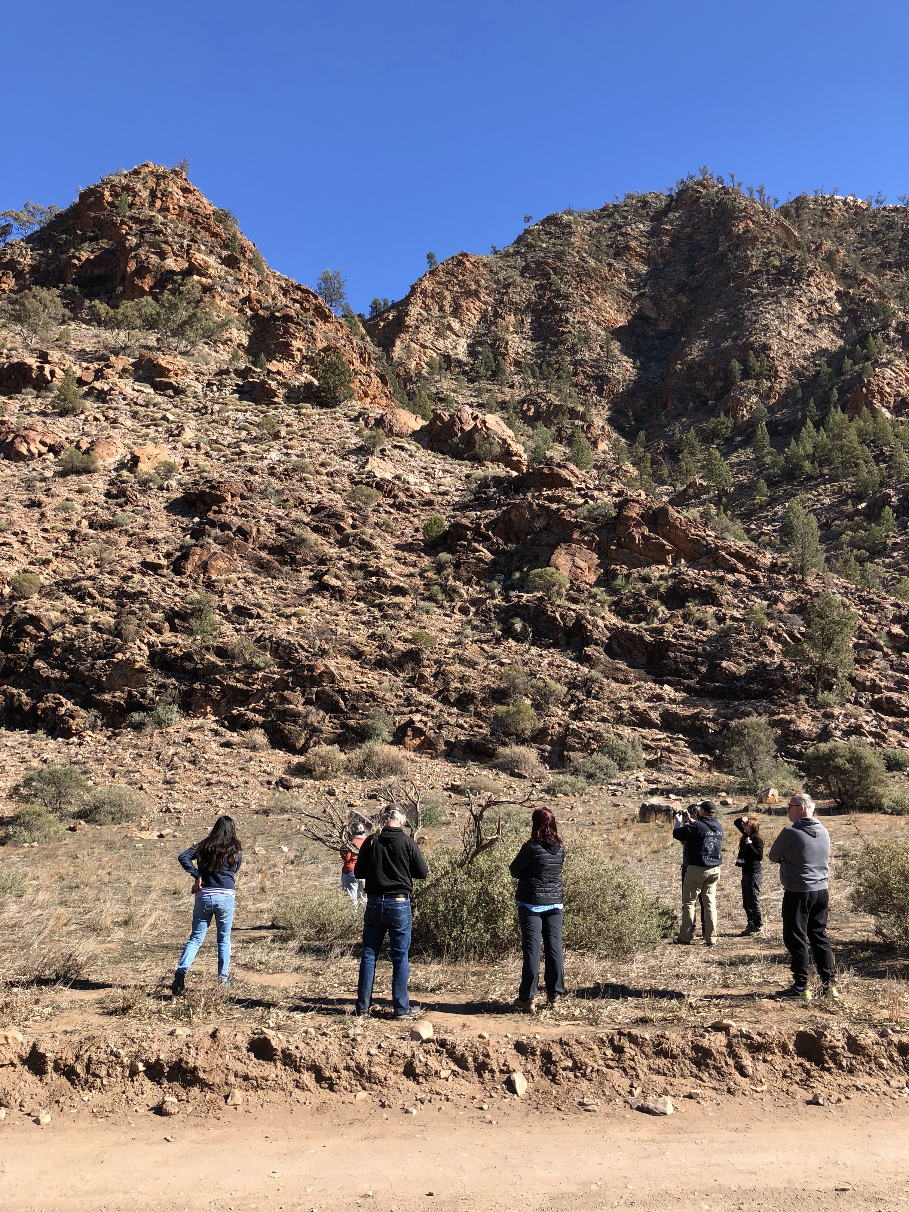
The yellow-footed rock wallaby only lives in a few small areas of Australia these days although it used to be found all over South Australia, New South Wales, and south-west Queensland. Population numbers were dramatically reduced following European settlement by a combination of factors such as livestock consuming the same food they do, the fur trade for their beautiful coats, and predation by introduced predators like foxes and cats. At one point they were nearly extinct – but thankfully conservation efforts have been working and they are now in “Near Threatened” status (the next one down from “No Concern”). It’s still quite rare to get a glimpse of them, though, and very exciting for Australians and non-Australians alike on our trip!
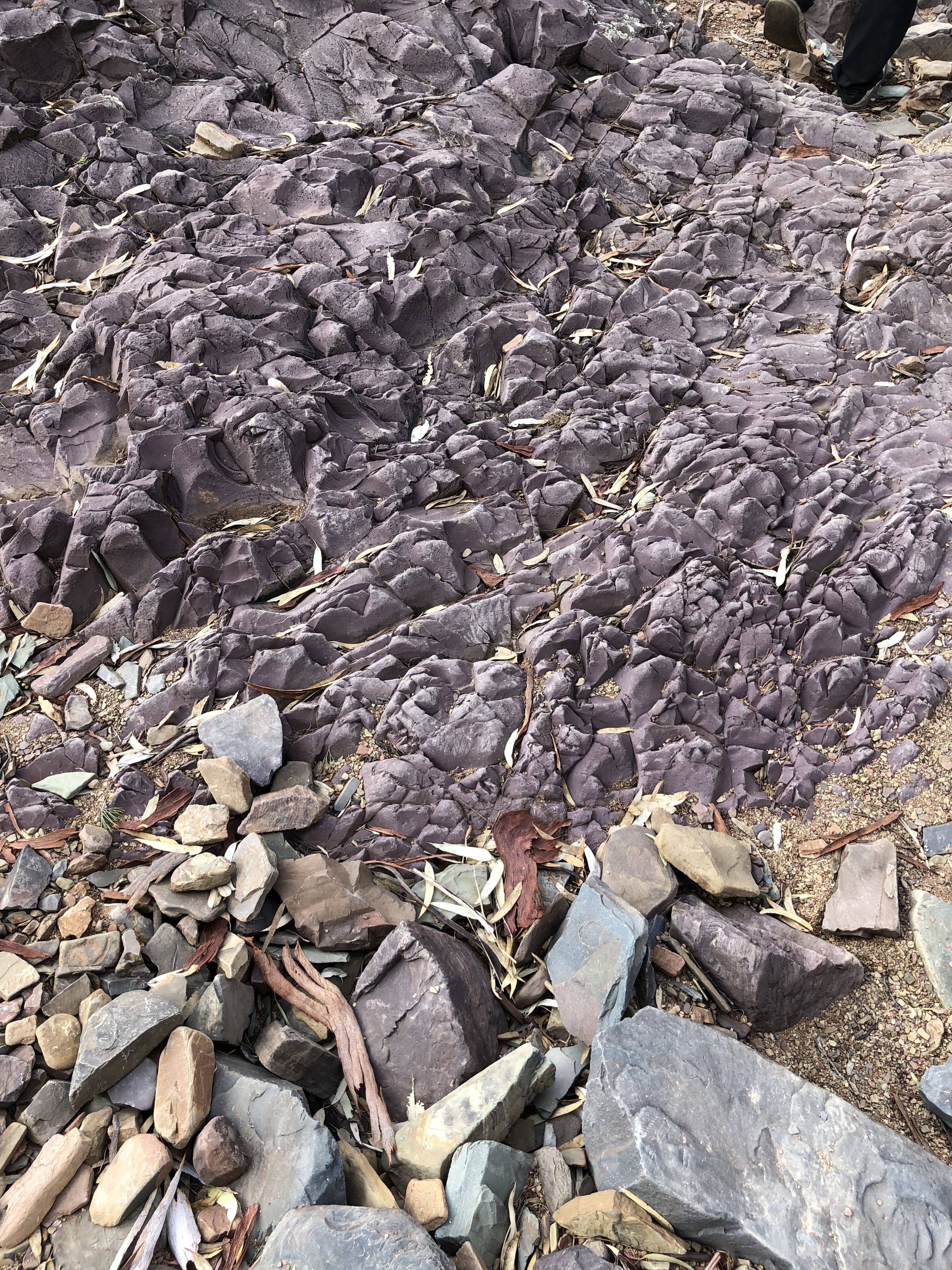
Also on our way to Copley were some very prominent aboriginal engravings, in an area of the national park called Sacred Canyon.

The engravings could be 30 to 40 thousand years old. The aboriginal history of Australia is mind-boggling when you think of the sheer length of time compared to the European/Greco-Roman history we’re used to thinking about.
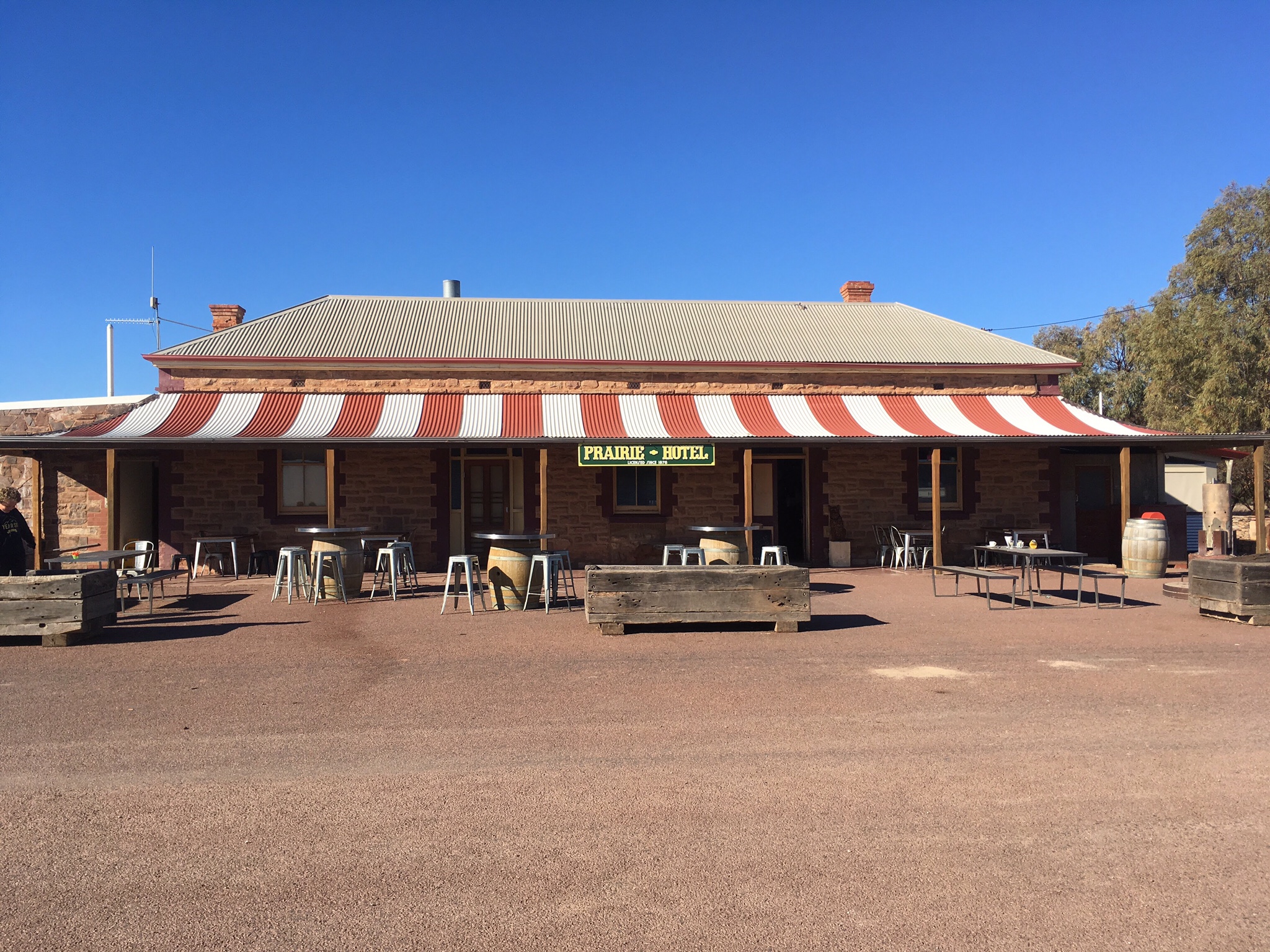
From Sacred Canyon it was on to Parachilna, population 4, for a stop at the Prairie Hotel. They’re renowned for their “feral mixed grill” (kangaroo, camel, and emu – we didn’t partake), but we loved them for the beautiful interior, and excellent ice cream! (Pretty funny to be eating ice cream mid-day when we were freezing cold in the morning, but hey – such is the weather)
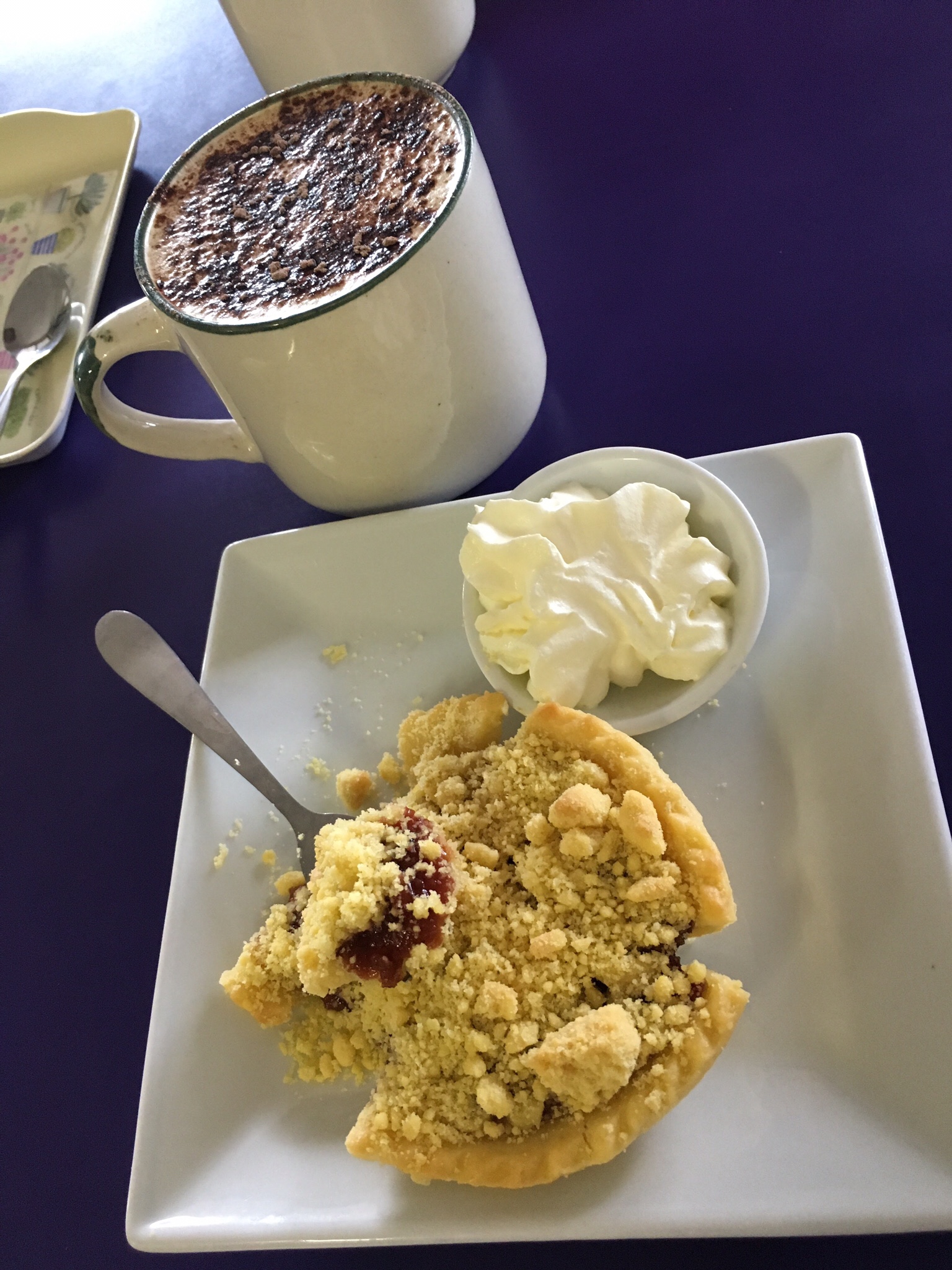
And from Parachilna, on we went to Copley, where we’d stopped last year on both the recommendation of our friend Dave (who organised this Simpson Desert crossing trip), and our Lonely Planet guidebook. Copley Caravan Park, in addition to having friendly staff, heaps of space, and a big fire pit for those cold cold nights, also serves up an absolutely amazing quandong pie! Quandong is a sort of ground cherry found in Australia – and they’re delicious in pies – or at least they are when made in Copley!
Yellow-footed rock wallabies, aboriginal engravings, ice cream, beautiful lookouts, and quandong pies – pretty good for one day – but by far, the best part of today was being with friends again. Nick and I really like hanging out with each other (you’d hope so!) but there’s just something about a big group of personalities that’s so refreshing and nice.

Especially when they all have such great taste in vehicles 😉
MVP: hands down (no pun intended) our handheld UHF radio! We have a great UHF radio and antenna hard wired in the Jeep, and had purchased the hand held just to have as a backup. Well, day one of convoying with the Jeep club and we discovered something wrong with our in-car radio (turning out to be something to do with the antenna we aren’t able to fix easily) – thank goodness for the hand-held! It’s incredibly important to remain in radio contact with others in a convoy for safety (calling out oncoming vehicles, letting others know when someone has a puncture, etc). And we were in remote areas where we wouldn’t have been able to buy one…so, in short, disaster averted – all because of our little hand held yellow radio.
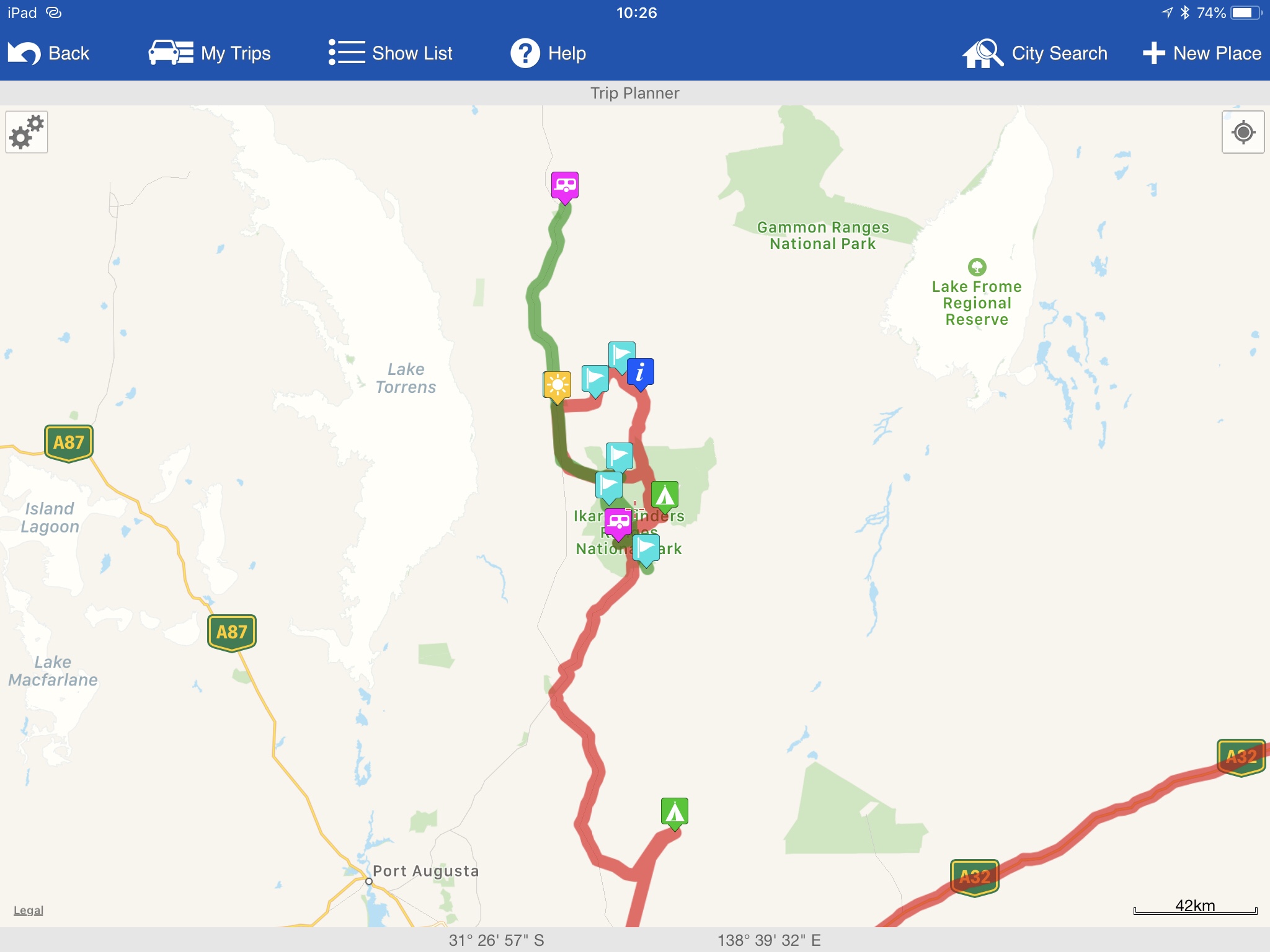
So, Where Exactly Is This?
Here’s a screenshot of this leg of the journey from WikiCamps! The red is what we’ve already covered, and the green is what was featured in the post you just read. You can also follow us live at this link – our satellite device pings our shared map frequently.


2 Comments
Ted
I love that your handheld matches your Jeep. And that your Jeep sticks out like a happy smile from all the other monochrome Jeeps 🙂
Pam Wright
Haha thanks Ted!! And almost all our accessories are yellow…? Nick has done a great job finding coordinated accessories for our Bumblebee Jeep!